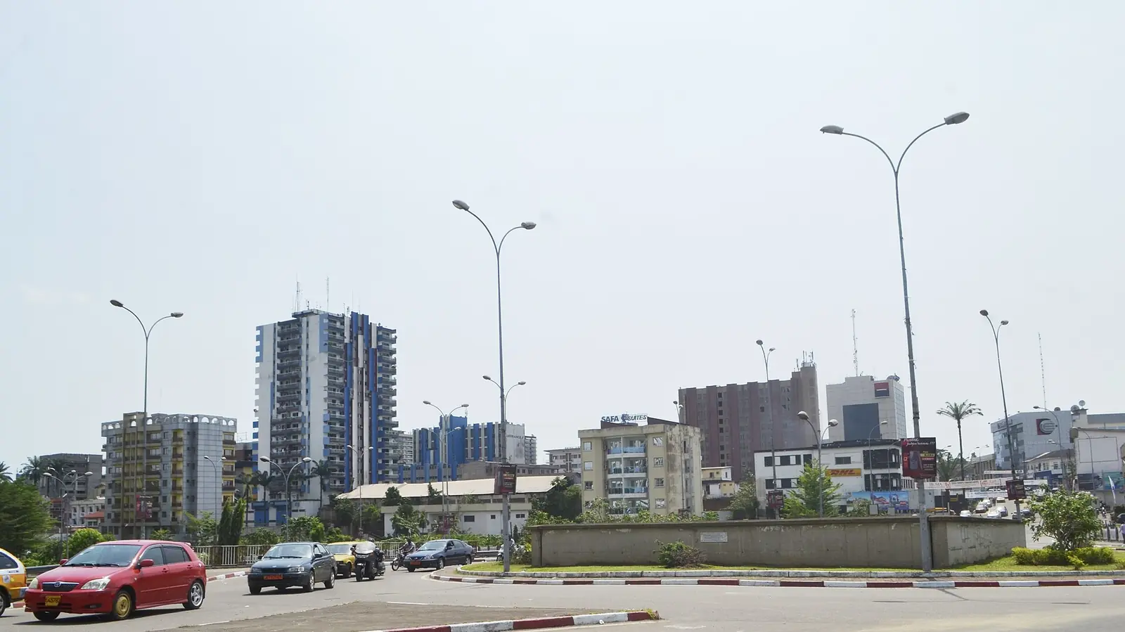
Douala, Cameroon's port city on the Wouri: Bonanjo's colonial quarter, the Ngondo festival, and public art from La Nouvelle Liberté to the SUD.
What to see
25 places in Douala, each with its sources.
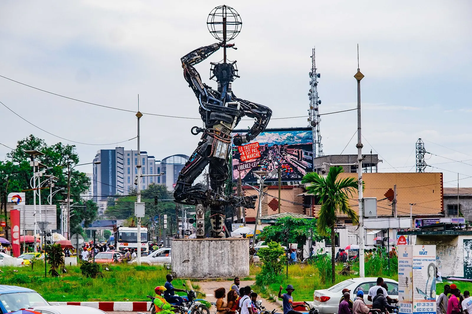
La Nouvelle Liberté
Deïdo, Douala I
Joseph-Francis Sumégné's 12-metre figure of salvaged metal, raised in 1996 on the Deïdo roundabout and now the best-known symbol of Douala.
Read the full guide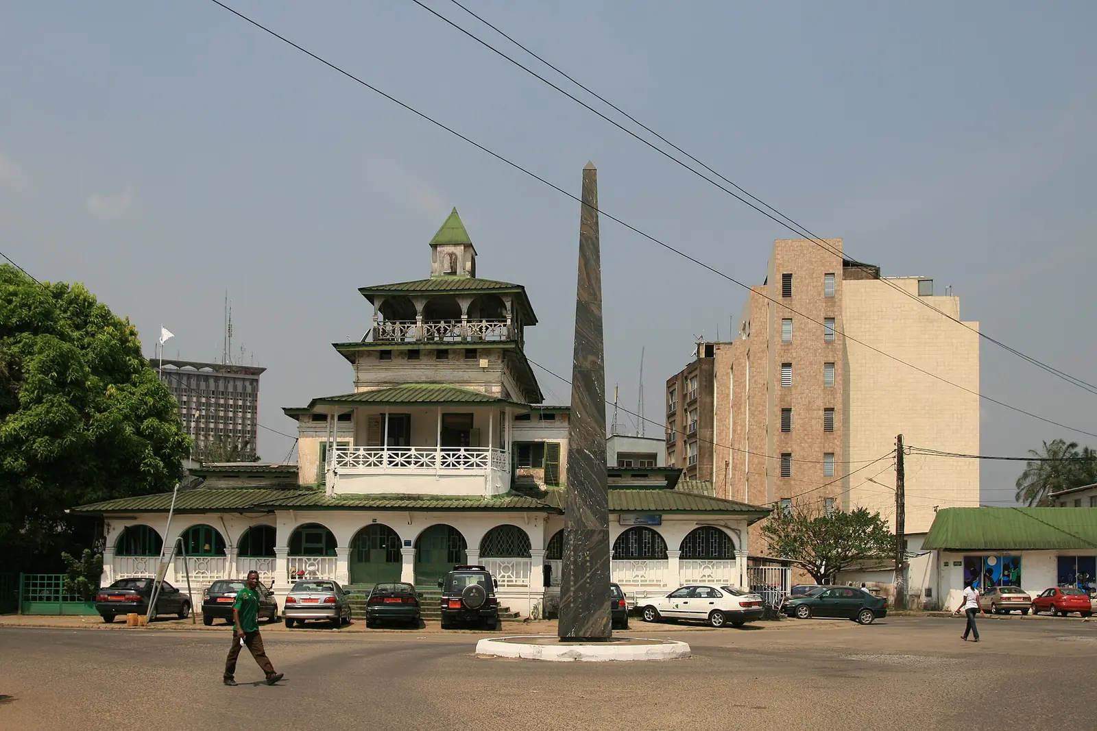
Sud-Obelisk
Bonanjo, Douala I
Faouzi Laatiris's black marble obelisk, made for SUD 2007, engraved in gold with the names of other cities with obelisks, in Bonanjo.
Read the full guide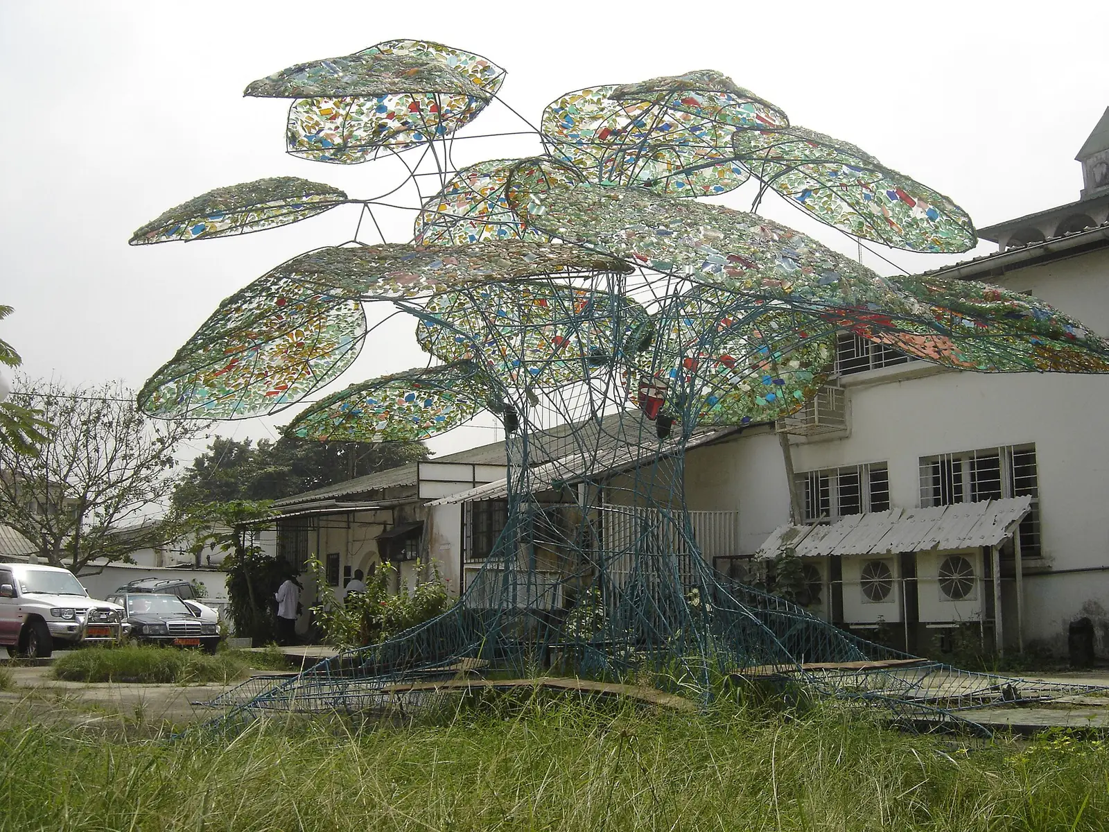
Palaver Tree of Bonambappe
Bonanjo, Douala I
Frédéric Keiff's palaver tree of painted steel bars, coloured glass leaves and wooden benches, set in a Bell family garden in Bonanjo in 2007.
Read the full guide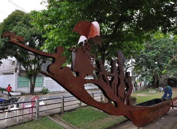
The Celestial Canoe
Bonapriso, Douala I
Hervé Youmbi's canoe with a figurehead cut from metal, made with young people of Bonapriso for SUD 2010 and set on the former airport esplanade.
Read the full guide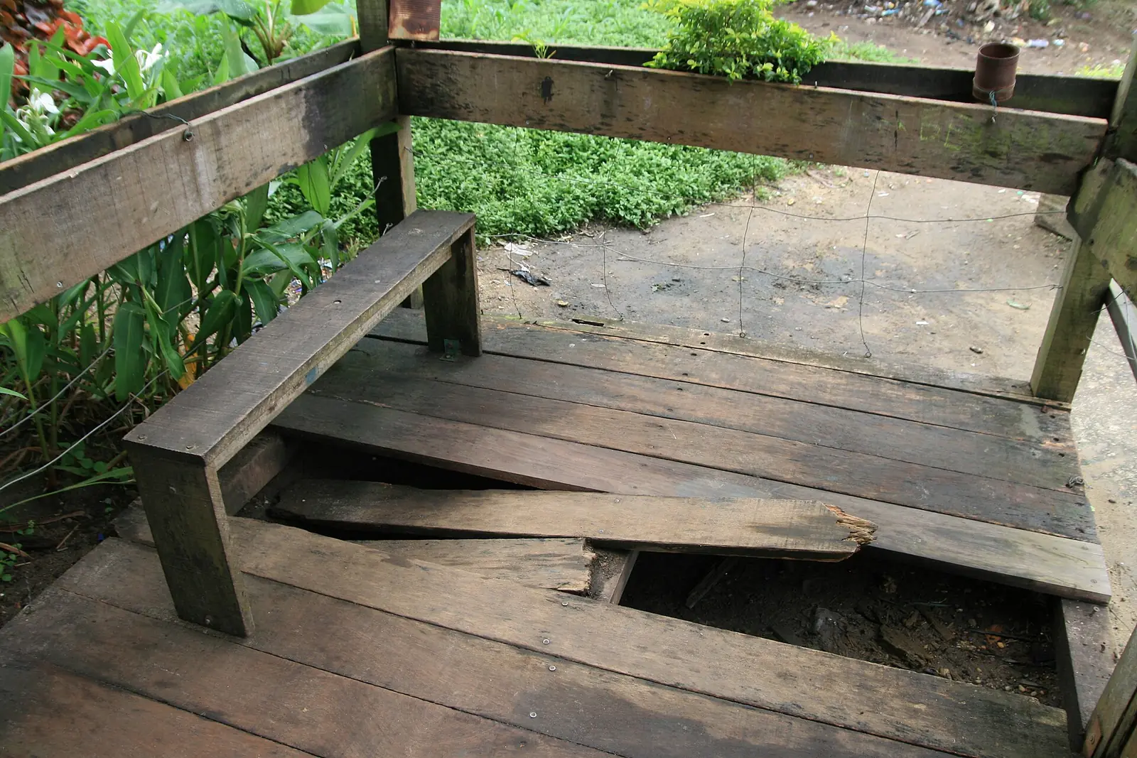
Sound garden of Bonamouti
Bonamouti, Deïdo, Douala I
Lucas Grandin's three-level wooden tower on the Wouri bank: a river viewpoint, a hanging garden and an organ played by drops of rainwater.
Read the full guide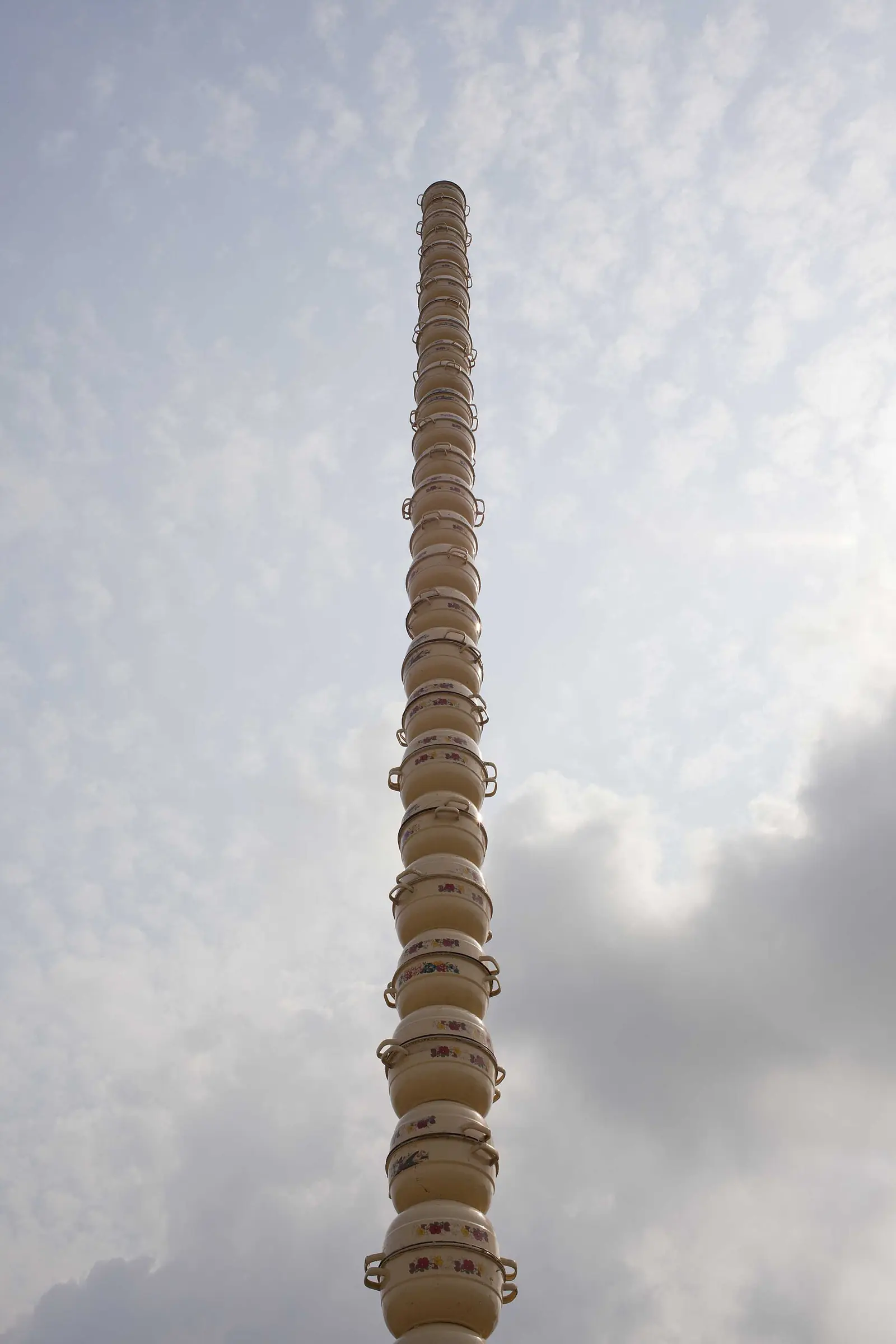
Colonne Pascale
New Bell, Douala II
Pascale Marthine Tayou's 12-metre column of stacked enamel cooking pots, raised in 2010 on the busy Shell roundabout in New Bell.
Read the full guide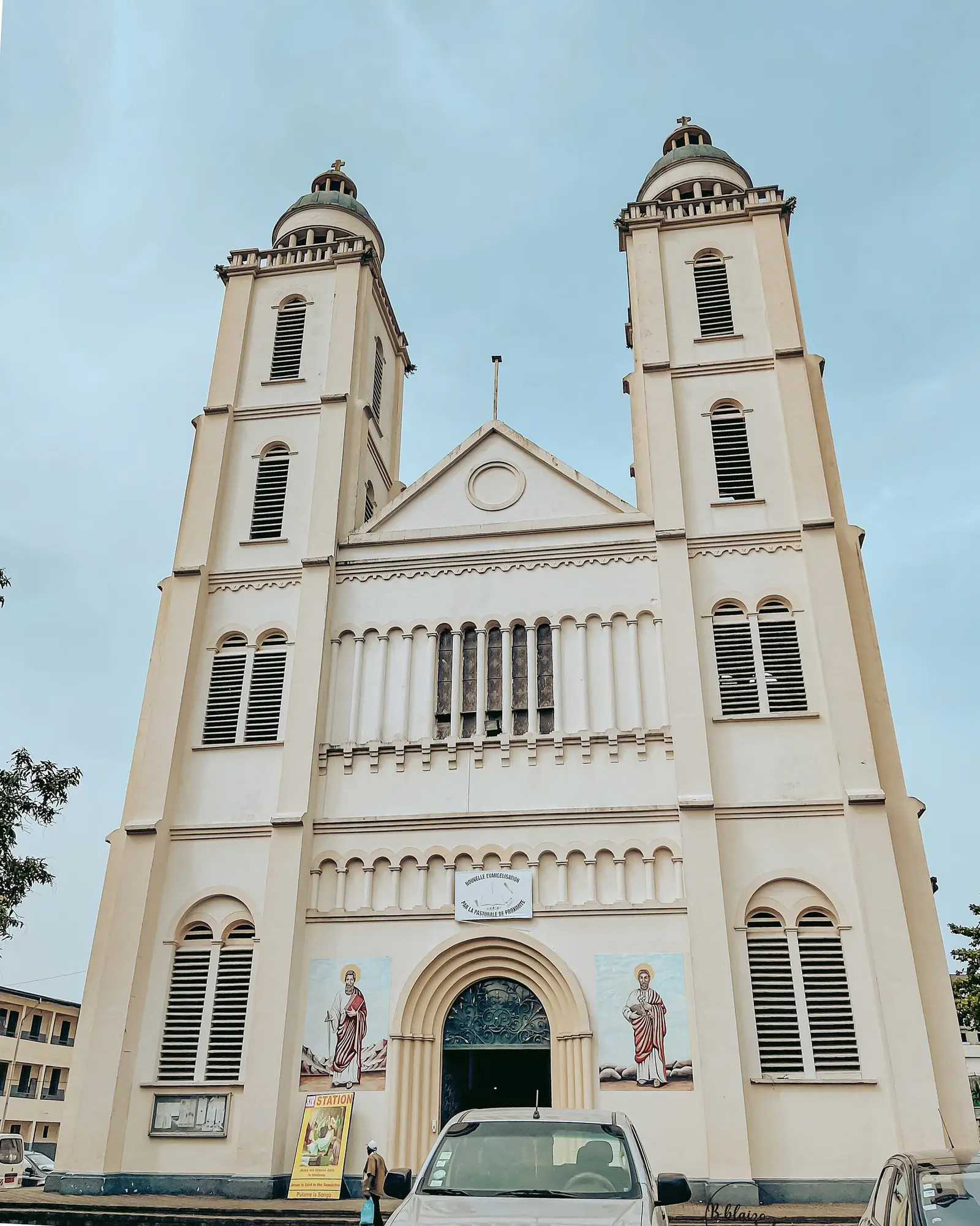
Saints Peter and Paul Cathedral
Akwa (Bonadibong), Douala I
Douala's Catholic cathedral, consecrated in 1936, with twin bell towers, domes and a Byzantine air, on rue Joss at Bonadibong in Akwa.
Read the full guide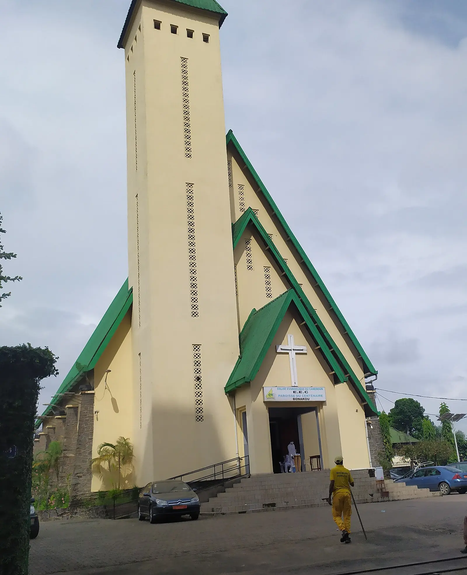
Centenary Temple
Akwa, Douala I
The Evangelical Church of Cameroon's mother church in Akwa, built in 1947 to mark a century since Bethel, Douala's first church.
Read the full guide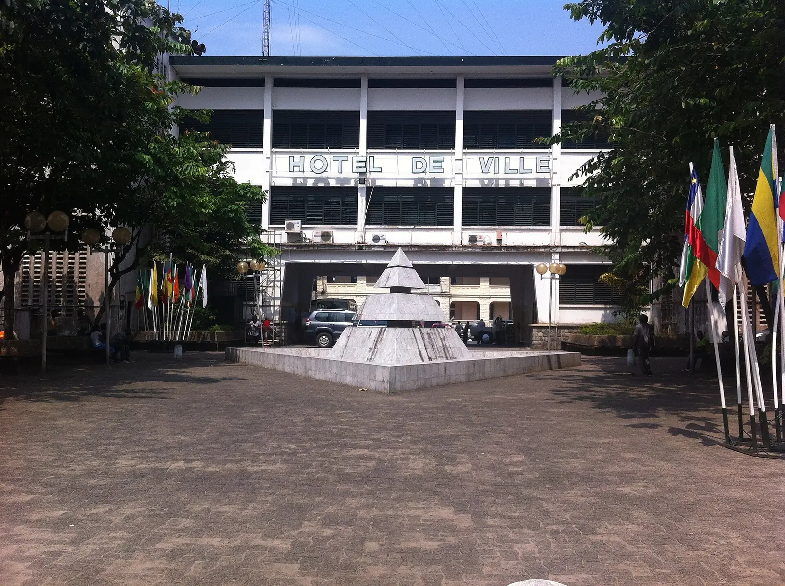
Bonanjo colonial quarter
Bonanjo, Douala I
Douala's administrative quarter on the Joss plateau, with German and French colonial buildings from 1891 to the 1930s around Place du Gouvernement.
Read the full guide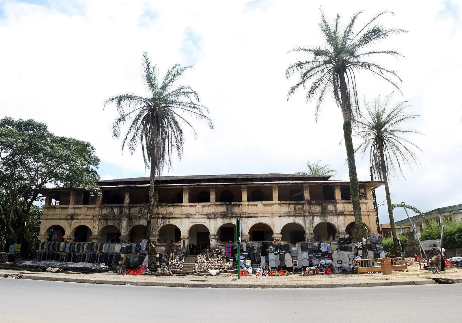
Villa Mandessi Bell
Bonanjo, Douala I
A brick house of the German period in Bonanjo, built from 1904 to 1910 for the planter David Mandessi Bell, and reported in ruins.
Read the full guide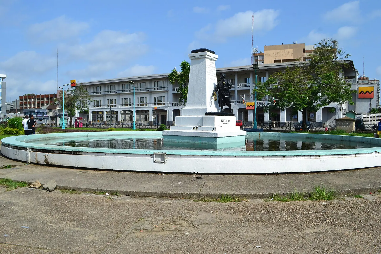
War memorial (Unknown Soldier)
Bonanjo, Douala I
A bronze French soldier in a fountain on Bonanjo's Place du Gouvernement, honouring those who died in the First World War Cameroon campaign.
Read the full guide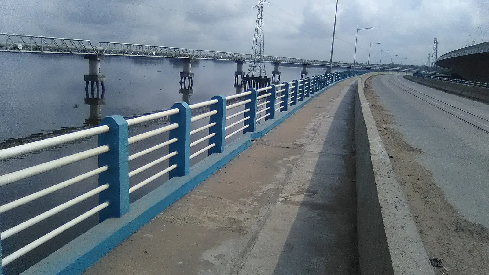
Wouri bridges
Deïdo to Bonabéri, Douala I and Douala IV
The 1,830 m concrete bridge of 1955 and the road and rail bridge of 2017 that link central Douala to Bonabéri across the Wouri.
Read the full guide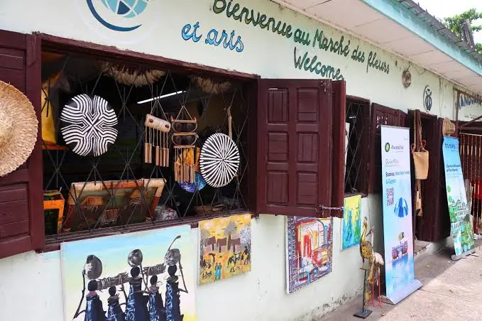
Marché des Fleurs
Bonapriso, Douala I
Florists' stalls by the Artisanat central in Bonapriso, selling bouquets, wedding flowers and funeral sprays, mostly grown in Cameroon.
Read the full guide- No openly licensed photo yet
Central Market
New Bell, Douala II
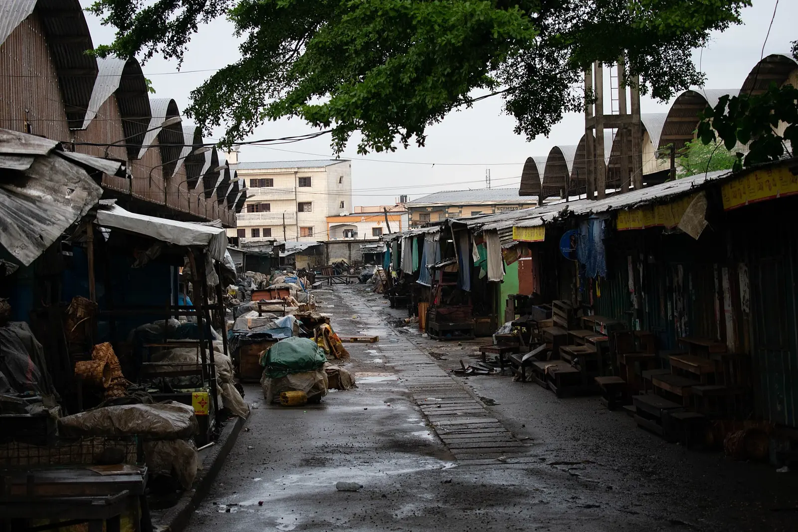
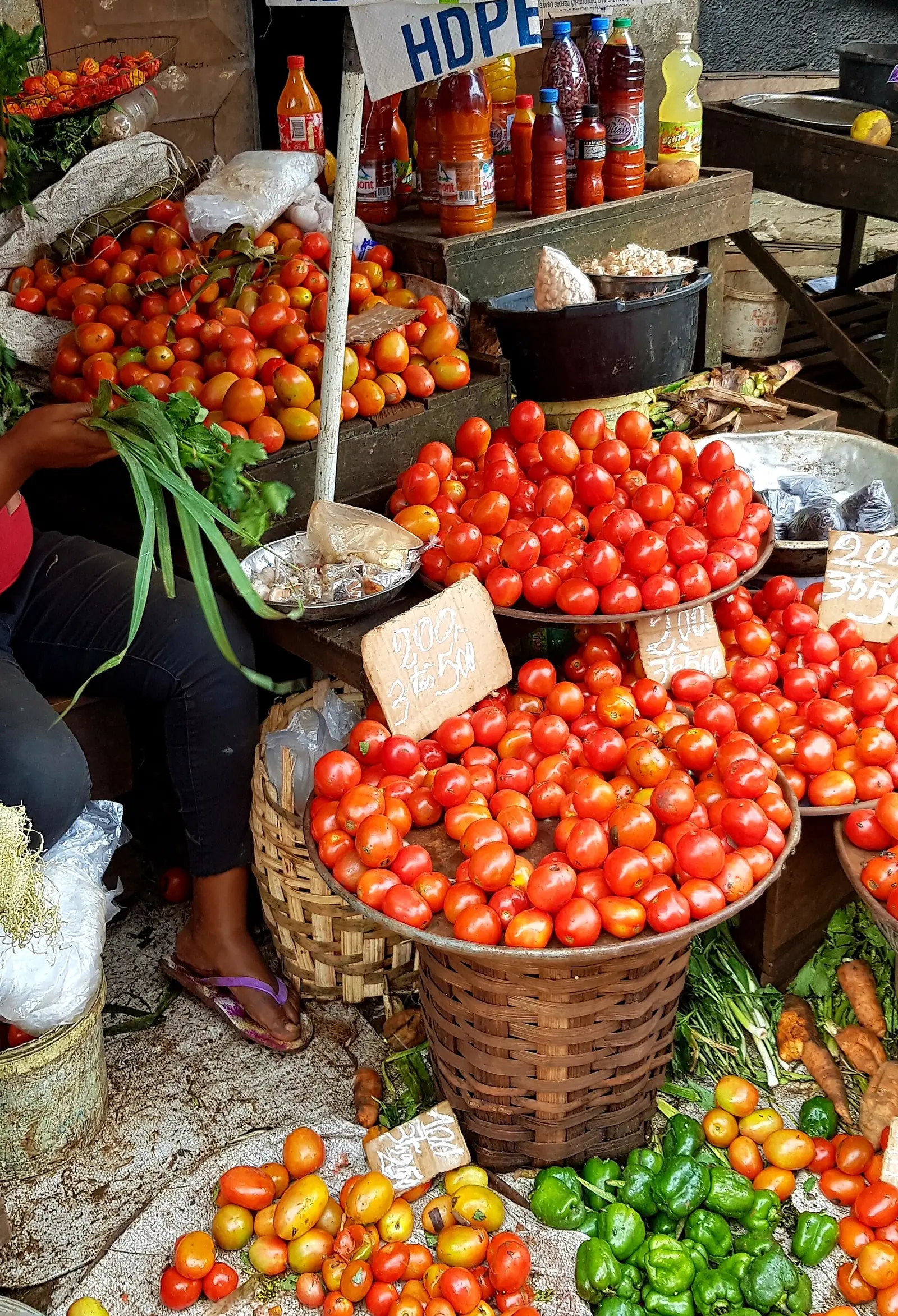
New Bell's sprawling central market, opened in 1982: one of Douala's two main markets, with food, fabric, meat and clothing stalls.
Read the full guide - No openly licensed photo yet
Galerie MAM
Bonanjo (or Bali, per OpenStreetMap), Douala I
A 300 m² contemporary art gallery opened in 1995 by Marème Malong, showing African artists in Douala and taking them to international fairs.
Read the full guide 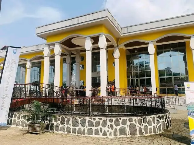
Maison des arts et de la culture Sawa
Besseké, Bonanjo (Bali, per OpenStreetMap), Douala I
The canoe-shaped museum and cultural centre of the coastal Sawa peoples and seat of the Ngondo, opened in the Bessèkè valley in December 2023.
Read the full guide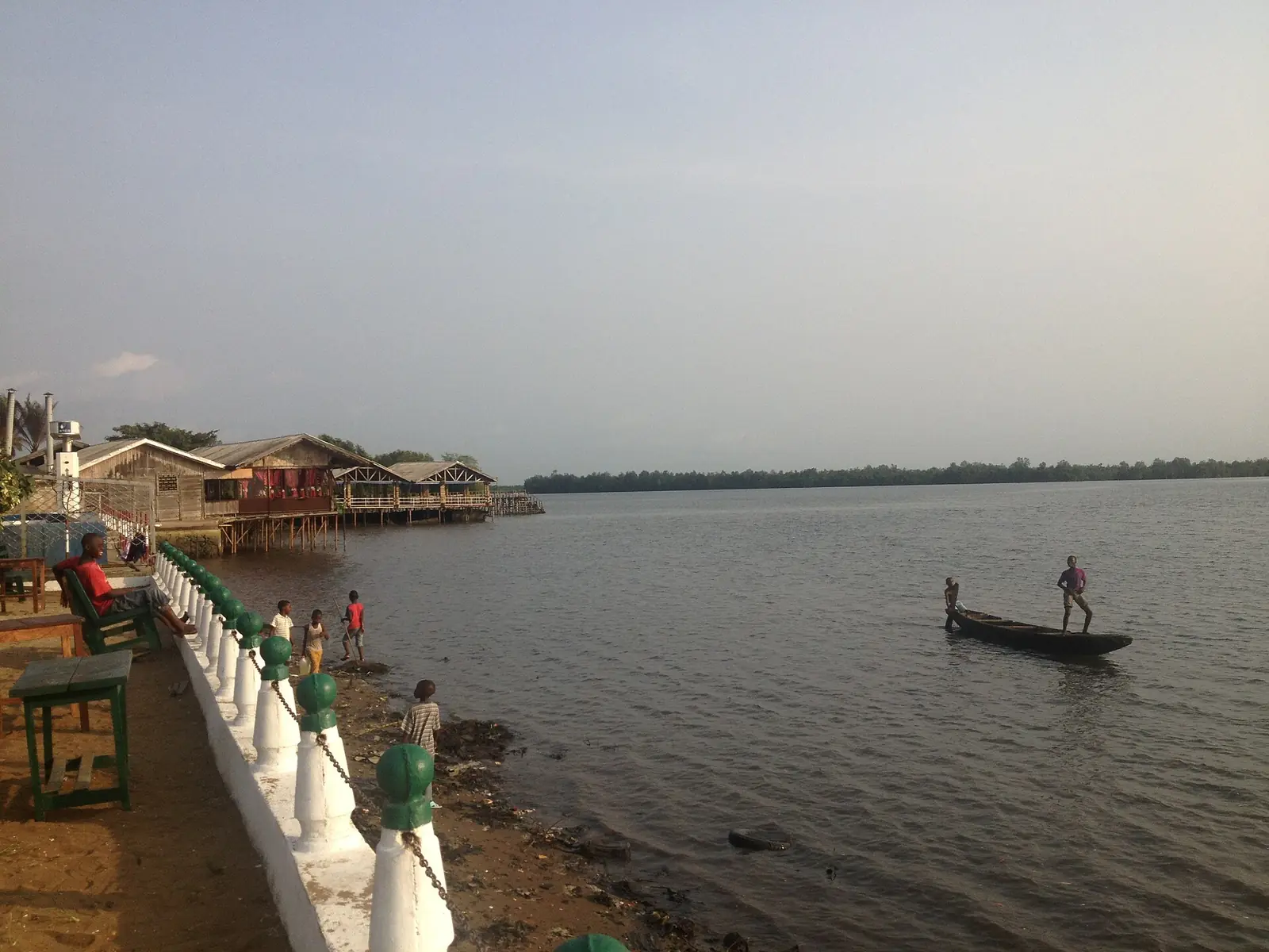
Youpwé fishing port
Youpwé, Douala II
Douala's main artisanal fishing port, on a creek of the Wouri estuary, with a new landing stage and fish market opened in December 2024.
Read the full guide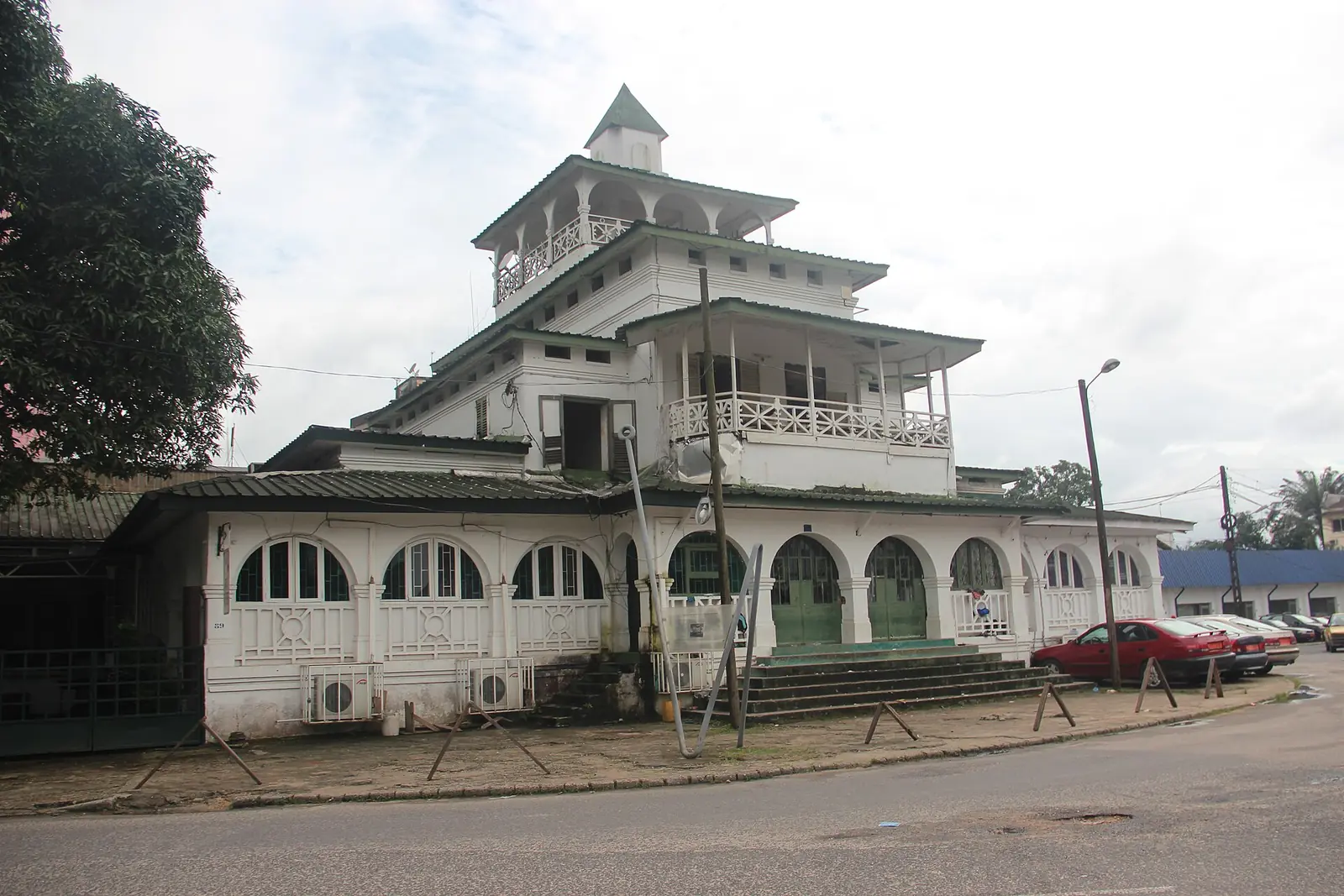
La Pagode (Palace of King Bell)
Bonanjo, Douala I
The former palace of the Bell kings in Bonanjo, Douala, built in 1905 and still owned by the Bell family. It was home to Rudolf Duala Manga Bell, hanged by the German authorities in 1914.
Read the full guide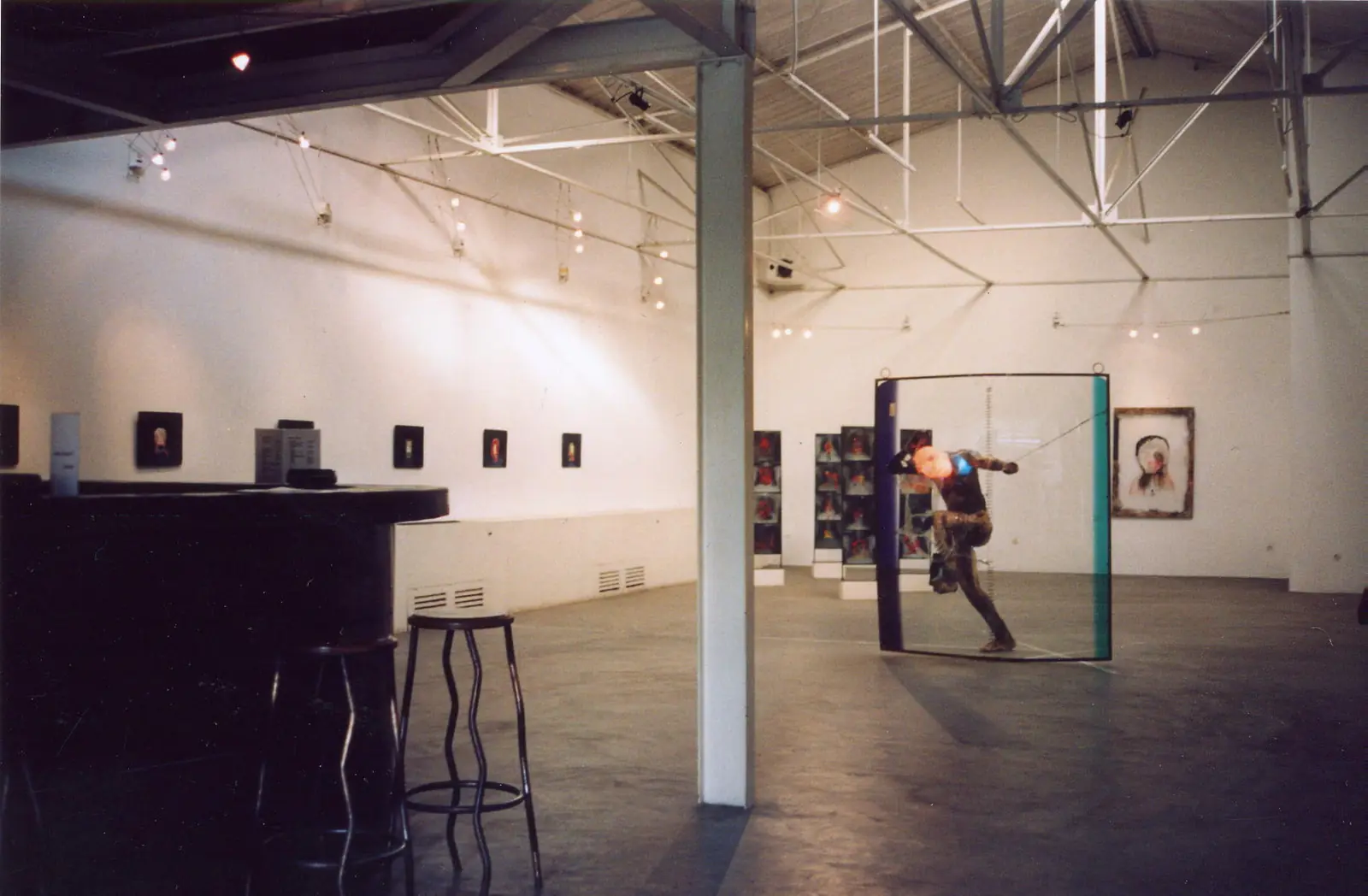
doual'art (Espace doual'art)
Bonanjo, Douala I
A non-profit contemporary art centre founded in Douala in 1991, with a gallery in Bonanjo and public artworks around the city. It organises SUD, the Salon Urbain de Douala.
Read the full guide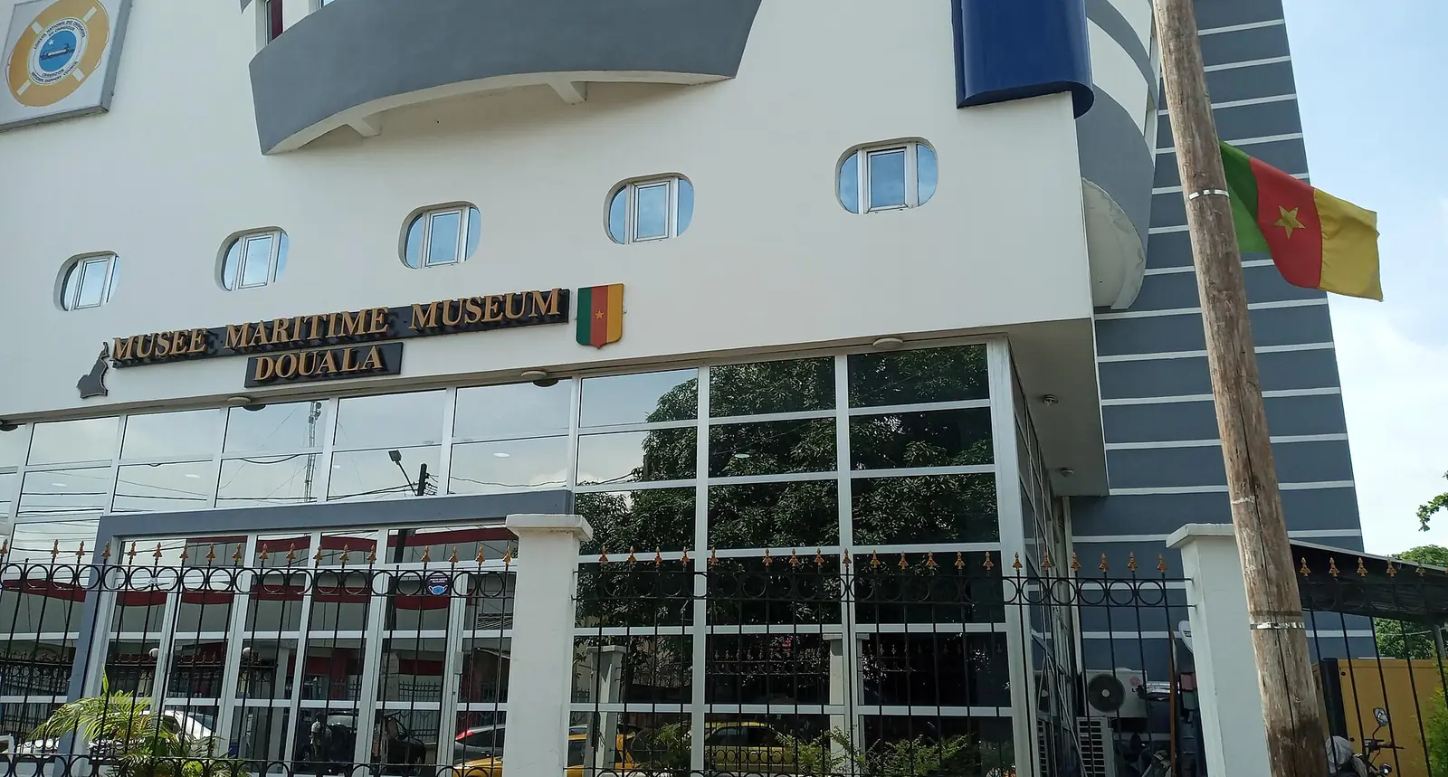
Douala Maritime Museum
Bonanjo, Douala I
A ship-shaped museum in Douala's Bonanjo district on Cameroon's coast, ports and ships, with a recreated ship's bridge and a navigation simulator.
Read the full guide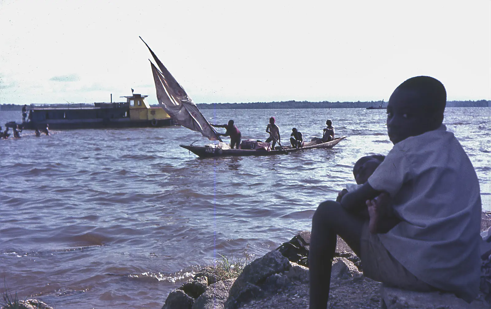
Wouri Estuary
Douala VI and beyond
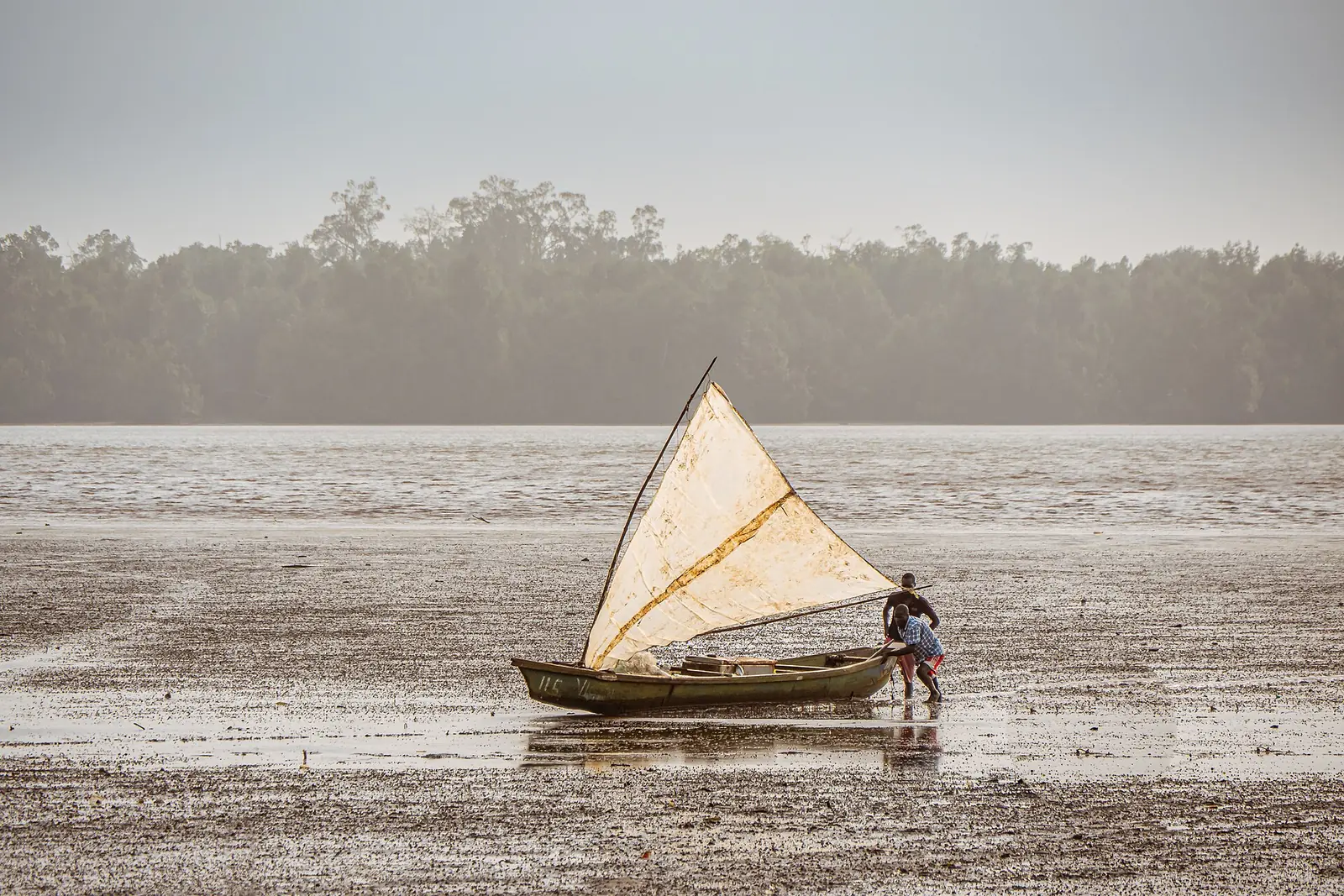
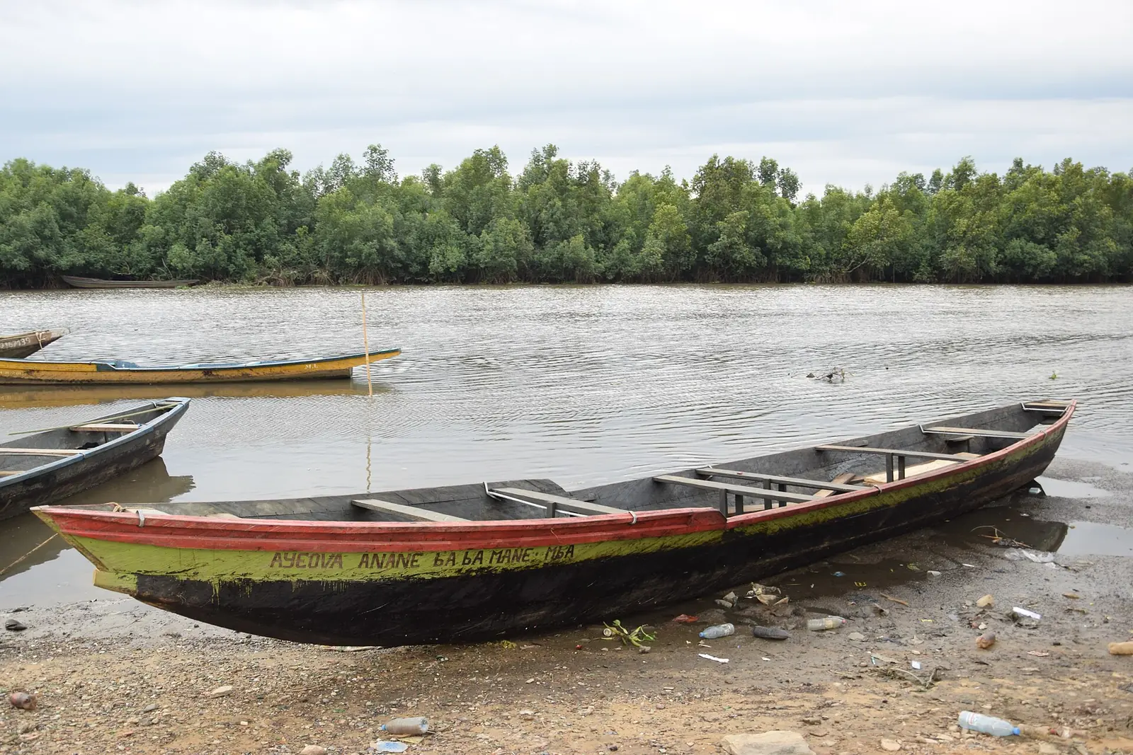
The tidal estuary where the Wouri, Mungo and Dibamba meet the Atlantic at Douala, lined with mangroves and fishing villages, and the source of Cameroon's name.
Read the full guide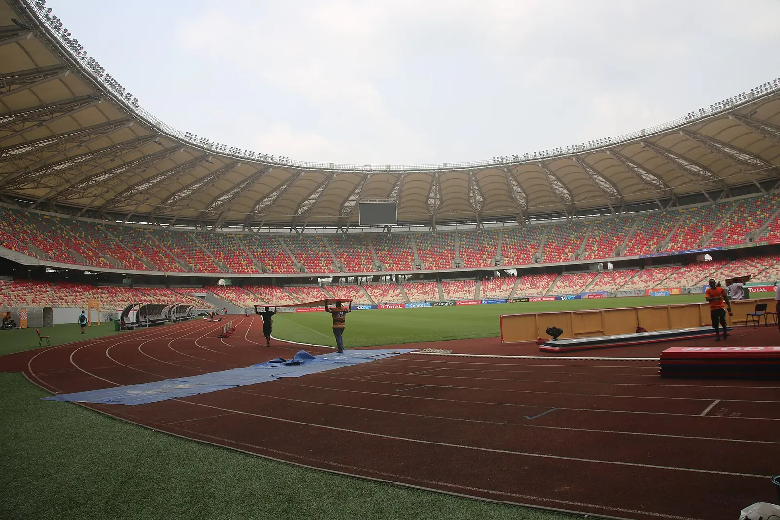
Japoma Sports Complex (Japoma Stadium)
Japoma, Douala III
Built around a 50,000-seat stadium whose form recalls Douala's woven baskets, this sports complex hosted the 2021 Africa Cup of Nations and the 2024 African Athletics Championships.
Read the full guide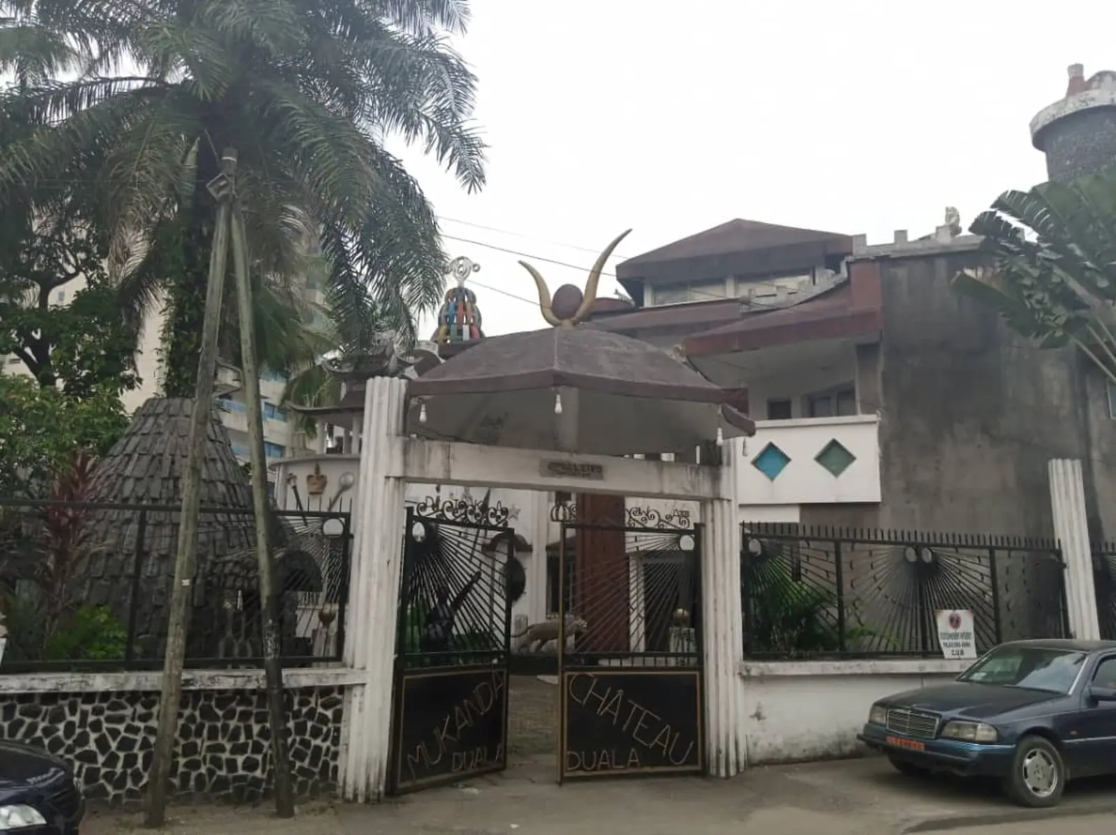
Dika Akwa palace
Akwa (Vallée Bessengué, per OpenStreetMap), douala-1
The white palace called Mukanda, built after independence by Prince Dika Akwa and long the seat of the Ngondo, the Sawa peoples' assembly.
Read the full guide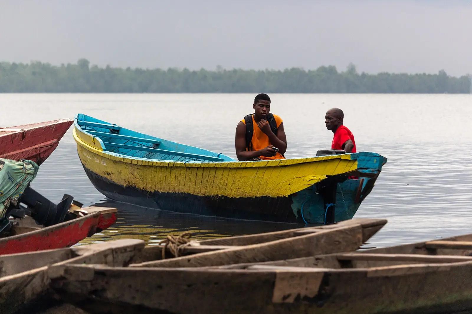
Djébalè island
Djébalè, Douala IV, douala-4
A quiet fishing island in the Wouri, reached by canoe from Bonassama, with an old church and a shrine of the jengu water-spirit initiates.
Read the full guide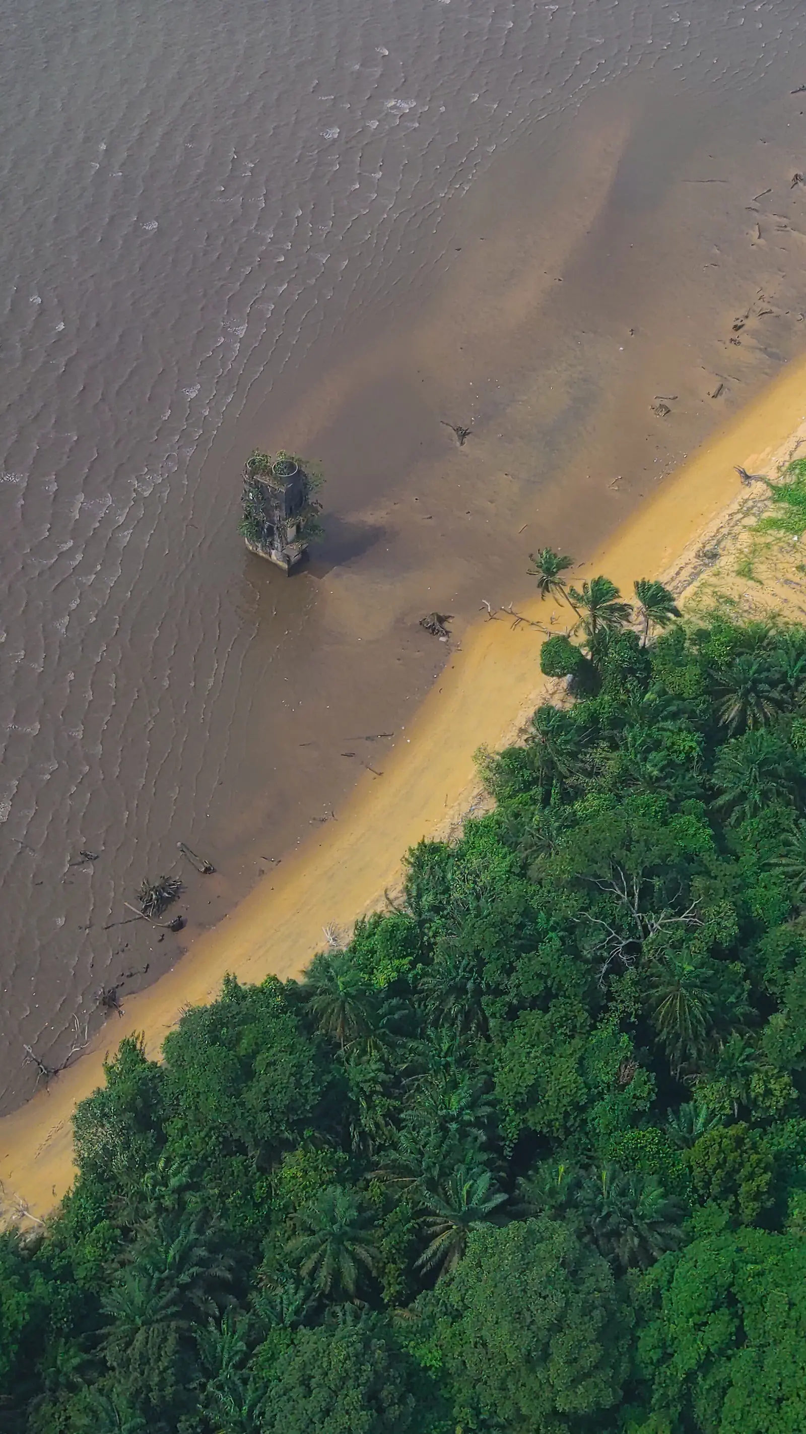
German-era ruins on Manoka
Manoka island, douala-6
The unrestored ruin of a German colonial building on Manoka's shore, called a prison by some sources and a lighthouse by others.
Read the full guide
- Region and division
- Littoral, Wouri2
- Subdivisions
- Six: Douala I to Douala VI6
- Population
- 1,906,962 (2005 census); 3,816,500 (official projection, 2025)4
- Area
- 923 km², of which about 210 km² built up6
- Rainfall
- About 3,570 mm a year; 28 mm in December, 703 mm in August (1981–2010)51
- Airport
- Douala International (DLA), about 8 km from the centre48
Where Douala is and what it's like
Douala is Cameroon's largest city and its economic capital, and the seat of the Littoral region and the Wouri division. It spreads over both banks of the Wouri estuary, which opens onto the Gulf of Guinea, about 210 km west of Yaoundé. Since 1987 it has been governed as an urban community, the Communauté urbaine de Douala, covering the same 923 km² as Wouri.1,2,6
Its 120 or so neighbourhoods often carry the Duala prefix bona, meaning family or descendants of. Akwa is the commercial centre. Bonanjo, on the old Joss plateau, is the administrative quarter of banks and head offices. Bonapriso is a well-off district of villas, Bali a grid of middle-class streets, and Deïdo a historic, crowded quarter. Across the river, Bonabéri mixes industry and housing.1,7,11,14,15,16,17,54
Six subdivisions
The urban community groups six borough councils. Douala I, run from Bonanjo, holds the historic centre: Akwa, Bonanjo, Deïdo, Bonapriso and Bali. Douala II, run from New Bell, has the central market, the airport and the fishing port of Youpwé. Douala III, run from Logbaba, reaches south-east to the Dibamba river and includes Japoma. Douala IV is Bonabéri, on the right bank; Douala V spreads north from Bonamoussadi; and Douala VI, run from Manoka, covers islands and mangrove at the river mouth.6,8,9,10,11,12,13
Population
The last census, in November 2005, counted 1,906,962 people in the city and 1,931,977 in Wouri, of whom 646,347 lived in Douala III and 544,919 in Douala V, the two largest subdivisions. Another source gives 1,907,479. Official projections put the city at 3,816,500 in January 2025, but other estimates range from 2.8 million for the metropolitan area in 2015 (English Wikivoyage) to 4.9 million (French Wikipedia).2,3,4,5,40
History
Portuguese sailors reached the estuary around 1472 and named it Rio dos Camarões, the river of prawns, which became the country's name. The Duala settled on the Wouri among the Bassa and Bakoko, in 1706 according to the historian Engelbert Mveng, or 1578 according to Ebélé Wei. By 1826 there were four villages: Deido, Akwa, Njo and Hickory Town, today's Bonabéri.1,2
In July 1884 the Duala kings signed a treaty with Germany, and the town, called Kamerunstadt, became the colony's capital; sources give dates between 1901 and 1907 for its renaming as Douala and the move of the capital to Buea. From 1910 the Germans expropriated the Joss plateau for a European quarter and pushed its people towards New Bell. King Rudolf Duala Manga Bell, who led the opposition, was hanged on 8 August 1914.1,2,5,14,18
French troops took the town in September 1914, and France governed it under a mandate from 1919. Douala was the capital again from 1940 to 1946, and the first Wouri bridge opened in 1955. The population grew from about 22,000 in 1910 to 124,703 in 1956 and, by one estimate, 1.4 million in 2000.1,2,5,42
The port and the economy
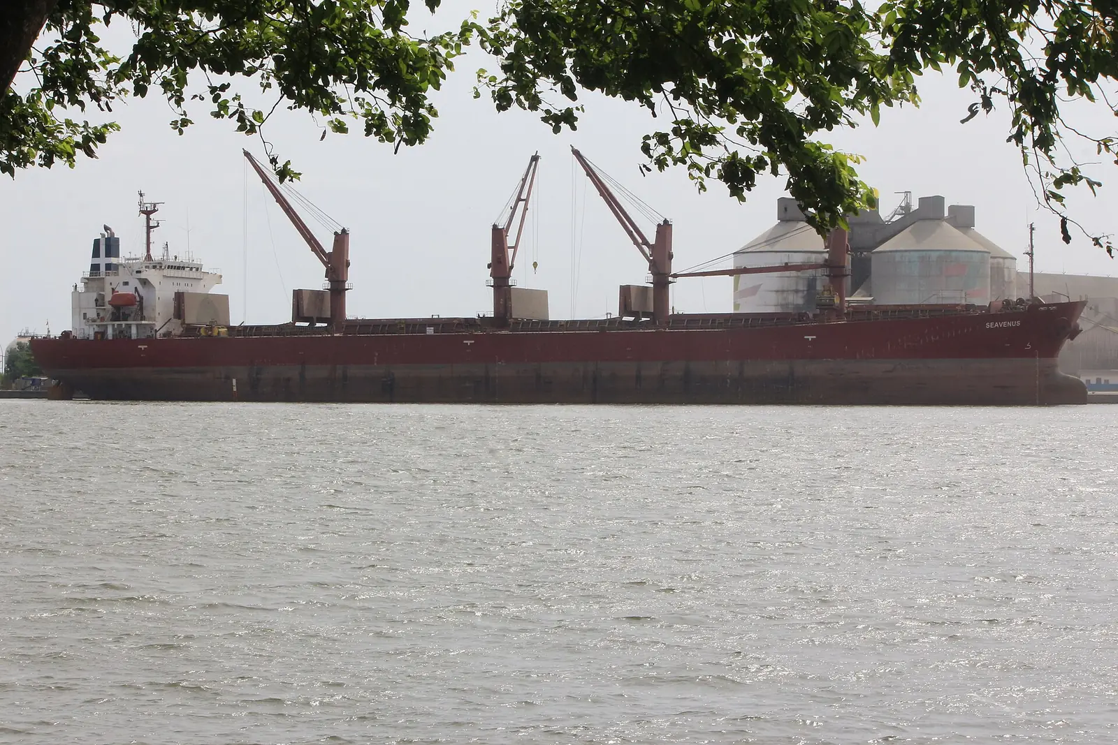
The city grew around its port, where the German firm Woermann-Linie began the first works in 1881. The Port autonome de Douala now handles 95% of Cameroon's port traffic and serves landlocked Chad and the Central African Republic, with 26 berths along 5.5 km of quays, though English Wikipedia notes that the newer port at Kribi is taking over part of its role. Industry is concentrated in the Bassa zone, in Douala III, and at Bonabéri, in Douala IV.1,2,10,11,19
Culture and the Ngondo
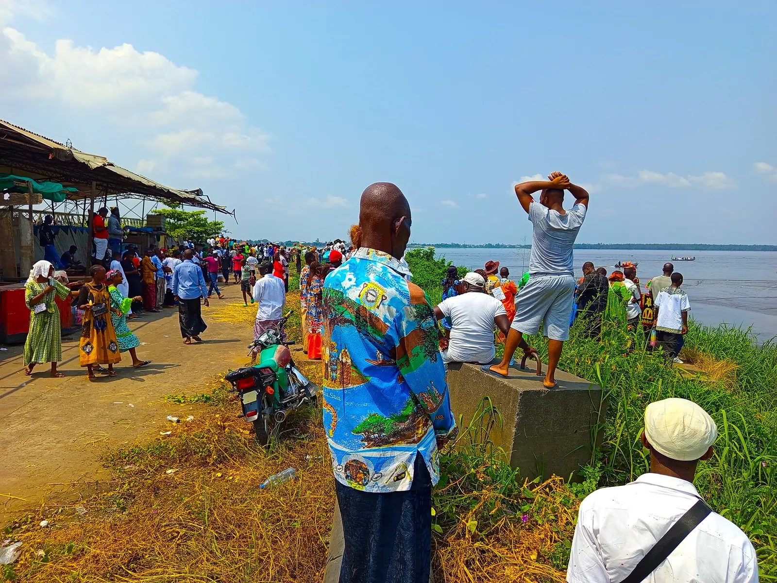
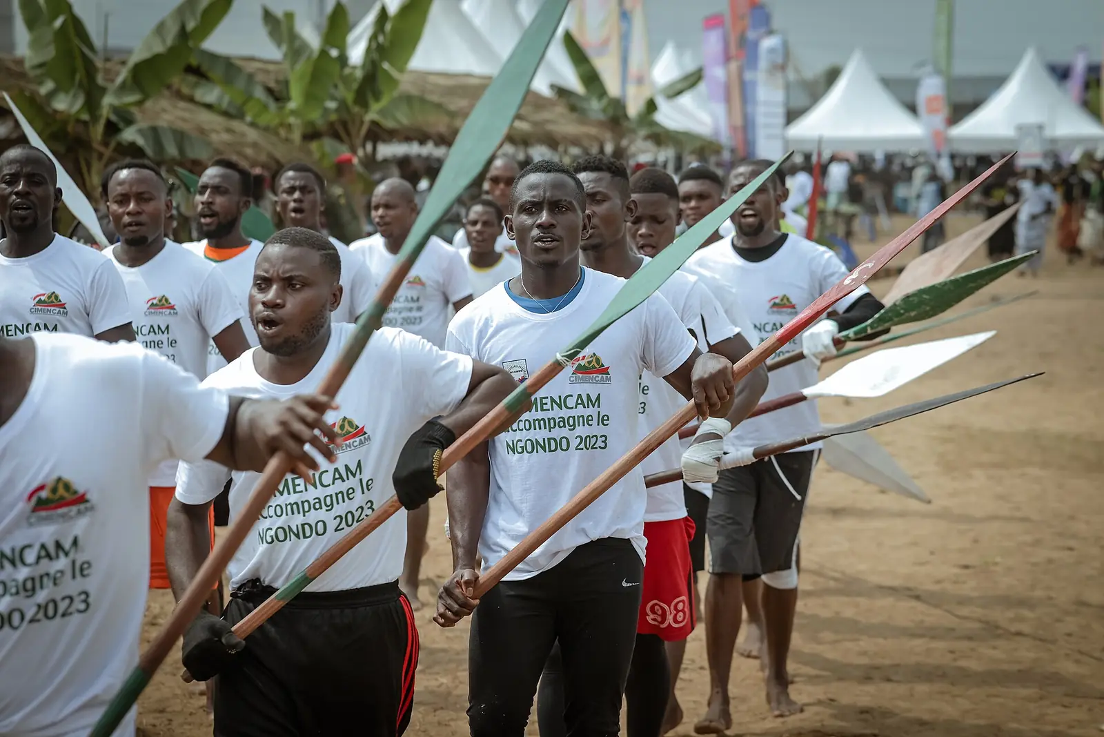
The Ngondo, festival of the coastal Sawa peoples, joined UNESCO's intangible heritage list in 2024. It runs from September to the first Sunday of December, when crowds gather on the Wouri and a priest dives from a sacred canoe with a vase of the community's wishes, returning with a message from the water spirits. Canoe races, wrestling and a crafts fair go with it. French Wikipedia says it was held each 12 July until 1972, then banned before its revival in December.20,21
Each December, Bali's streets also host the Bali Arts Market, or Balama.17
A city of public art
The art centre doual'art, founded in 1991 by Marilyn Douala Bell and Didier Schaub, has placed more than 80 permanent and temporary works and events in the city's neighbourhoods, starting with La Nouvelle Liberté in 1996. Since 2007 it has run the Salon urbain de Douala (SUD), a triennial public-art festival held in December; its 2007, 2010, 2013 and 2017 editions left works such as the Sud Obelisk and the Colonne Pascale. Guides show the art and history of the city by appointment.22,23,24,25,55
Getting there and around
Douala International Airport (DLA), the country's main airport, is about 8 km from the centre, in Douala II. English Wikivoyage lists flights by Camair-Co, Air France, Brussels Airlines, Turkish Airlines and Royal Air Maroc; not every airline flies daily.9,40,48
Trains leave from Bessengué station. In January 2026 Seat61 listed express, ordinary and stopping trains to Yaoundé, 263 km away, and a twice-weekly train to Kumba; check times with Camrail. By road, the N3 runs to Yaoundé and Limbe and the N5 to Bafoussam; westbound traffic crosses the Wouri from the Deïdo roundabout on the 1955 bridge or the second bridge, opened in 2017.40,42,43,49,50,53
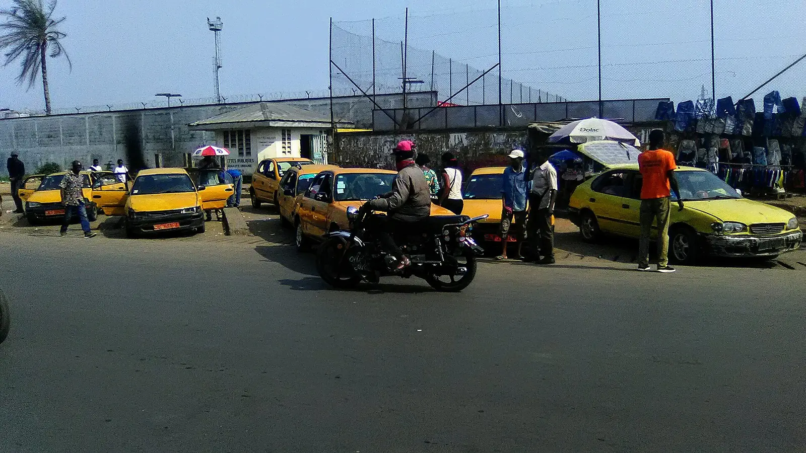
In town, most journeys are by motorbike taxi (bensikin), shared taxi or the minibuses called cargos. Socatur runs about ten bus lines, and the Yango ride-hailing app works. A bus rapid transit network has been planned, but we couldn't confirm that any line runs yet.1,2,40
When to go
The climate is tropical, hot and humid all year. Average monthly rainfall for 1981 to 2010, from Cameroon's weather service via the World Meteorological Organization: January 38 mm, February 52, March 156, April 243, May 279, June 384, July 620, August 703, September 549, October 383, November 138 and December 28, or about 3,570 mm a year (about 3,600 per English Wikipedia).1,51
Average highs run from about 27 °C in July and August to 32 °C from January to March. December to February is the driest stretch, with about three rainy days in December and January against 30 or more in July and August. December also brings the Ngondo's closing day and, in festival years, the SUD.20,22,51
In pictures
Map
What visitors say
We summarise accounts published elsewhere and link to the original. These aren't reviews collected by this site, and we don't show a rating.
We haven't yet found a published visitor account for this place.
Check before you go
Our sources can't yet confirm these points:
- A current official population figure: no census has been held since 2005, and estimates for today range from about 3 to nearly 5 million
- Current train times and fares from Bessengué (Camrail), and whether the Kumba service still runs
- The main intercity coach companies and where their Douala terminals are
- Whether any bus rapid transit line has opened
- Whether a SUD edition has been held since 2017, and the date of the next one
- Whether the SUD artworks of 2007 to 2013 (Arbre à palabres, Paï, Pirogue céleste, Jardin sonore, Face à l'eau, Colonne Pascale) are all still in place and in good condition
- Exact positions of the Arbre à palabres, Paï, the Pirogue céleste and the Colonne Pascale, which are not in OpenStreetMap; the Paï coordinates in particular look south of Bonanjo
- Whether doual'art still offers guided city visits, and on what terms
- The present condition of the Villa Mandessi Bell, and whether it can be visited
- Whether the war memorial stands in Parc Bonanjo or on Place du Gouvernement
- Whether the Marché des Fleurs today is mainly a flower market, a crafts market or both
- Opening hours and entry terms for the Galerie MAM and the Maison des arts et de la culture Sawa
- The year the Ngondo was banned and revived: French Wikipedia gives a ban after 1972, while other accounts differ
- The cathedral district: Wikivoyage places it at Bonadibong in Akwa, OpenStreetMap in Bali
Sources for this page
Information checked on 18 November 2026. It may have changed since.
- Douala, Wikipedia (English) (11 November 2026)
- Douala, Wikipedia (French) (2 November 2026)
- Cameroon: administrative division (2005 census by arrondissement, from BUCREP and INS), City Population (Thomas Brinkhoff) (undated)
- Cameroon: regions, major cities and towns (2005 census and 2025 projection, from BUCREP and INS), City Population (Thomas Brinkhoff) (undated)
- Timeline of Douala, Wikipedia (English) (29 August 2026)
- Communauté urbaine de Douala, Wikipedia (French) (6 June 2026)
- Quartiers de Douala, Wikipedia (French) (1 October 2026)
- Douala I, Wikipedia (French) (6 April 2026)
- Douala II, Wikipedia (French) (27 April 2026)
- Douala III, Wikipedia (French) (20 October 2025)
- Bonabéri (Douala IV), Wikipedia (French) (6 June 2026)
- Douala V, Wikipedia (French) (6 April 2026)
- Douala VI, Wikipedia (French) (6 June 2026)
- Bonanjo (Douala), Wikipedia (French) (14 October 2026)
- Deïdo, Wikipedia (French) (14 October 2026)
- Bonapriso, Wikipedia (French) (25 August 2022)
- Bali (Douala I), Wikipedia (French) (21 September 2026)
- New Bell, Wikipedia (French) (3 May 2026)
- Port autonome de Douala, Wikipedia (French) (14 September 2026)
- Ngondo, worship of water oracles and associated cultural traditions among the Sawa, UNESCO Intangible Cultural Heritage (4 December 2024)
- Ngondo (fête), Wikipedia (French) (25 April 2026)
- Doual'art, Wikipedia (English) (18 November 2026)
- SUD (Salon urbain de Douala), doual'art (undated)
- Salon urbain de Douala, Wikipedia (French) (20 July 2026)
- Art public : art dans l’espace urbain, doual'art (undated)
- Liste des œuvres publiques de Douala, Wikipedia (French) (15 September 2026)
- La Nouvelle Liberté de Sumegne, doual'art (undated)
- La Nouvelle Liberté, Wikipedia (French) (22 November 2025)
- Joseph-Francis Sumégné, Wikipedia (French) (30 July 2026)
- Sud-Obelisk, doual'art (undated)
- L’Arbre à Palabres, doual'art (undated)
- La Pirogue Céleste, doual'art (undated)
- Le Jardin Sonore, doual'art (undated)
- Face à l’eau, doual'art (undated)
- La Colonne Pascale, doual'art (undated)
- Colonne Pascale, Wikipedia (French) (29 March 2025)
- Cathedral of Saints Peter and Paul, Douala, Wikipedia (English) (30 July 2026)
- Temple du centenaire, Wikipedia (French) (5 July 2024)
- Douala, Wikivoyage (French) (8 March 2026)
- Douala, Wikivoyage (English) (24 October 2026)
- Villa Mandessi Bell, Wikipedia (French) (26 June 2025)
- Pont sur le Wouri, Wikipedia (French) (28 April 2026)
- Deuxième pont sur le Wouri, Wikipedia (French) (5 April 2026)
- Carnet du voyageur : un tour au marché des fleurs à Douala, Afrik.com (16 January 2022)
- Galerie MAM, Wikipedia (French) (24 February 2026)
- Maison des arts et de la culture Sawa, Wikipedia (French) (1 June 2026)
- Débarcadère et marché aux poissons de Youpwè, Wikipedia (French) (14 October 2026)
- Aéroport international de Douala, Wikipedia (French) (9 November 2026)
- Gare de Bessengué, Wikipedia (French) (31 August 2026)
- Train travel in Cameroon, Seat61 (Mark Smith) (1 January 2026)
- Douala: climatological information (normals 1981–2010, from the Direction de la Météorologie Nationale), World Meteorological Organization, World Weather Information Service (22 December 2010)
- Maritime Museum of Douala, Wikipedia (English) (12 October 2026)
- Rond-point Deïdo, Wikipedia (French) (18 September 2026)
- Akwa, Wikipedia (French) (11 November 2024)
- Guide et visites, doual'art (undated)
- Festival SUD 2007, doual'art (undated)
Planning a trip to Douala?
Tell us what you'd like to see, and Global Bush Travel will email you a quotation.