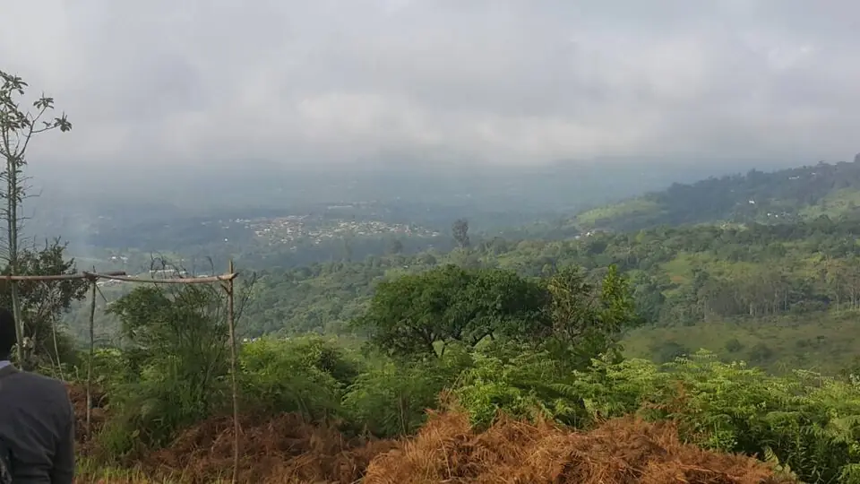
Ndé, the West's south-eastern Bamiléké division: Bangangté on the Yaoundé road, Medumba country, the Bangoua chiefdom and the Noun plain.
Subdivisions of Ndé Division
Ndé Division has 4 subdivisions.
Bangangté
Chief town: Bangangté
Bassamba
Chief town: Bassamba
Bazou
Chief town: Bazou
Tonga
Chief town: Tonga
Where it is and what it's like
Ndé covers 1,524 km² in the south-east of the Bamiléké country. It borders the Haut-Nkam, Hauts-Plateaux, Koung-Khi and Noun divisions, the Littoral's Nkam and the Centre's Mbam-et-Inoubou. The statistics office counts it among the high plateaux, places the Noun plain astride Ndé and Noun, and lists the Ndé among the region's rivers. Bangangté, the chief town, stands at about 1,340 m on the right bank of the Noun, drained by the Ngam, one of its tributaries.4,1,5
People
The 2005 census counted 94,849 people, against 83,588 in 1987, or about 62 per km², one of the lowest densities in the region with Noun. The 2010 projection was 98,446. Bangangté subdivision had 63,595 people, 28,011 of them in the town, Bazou 14,912, Tonga 13,528 and Bassamba 2,814. Medumba is the main language, spoken in Bangangté, Bakong, Bangoulap, Bahouoc, Bagnoun and Tonga; French Wikipedia also names Nda'nda'. The Bangangté chiefdom is a first-degree chiefdom.1,2,5,6,4
History
An administrative post opened at Bangangté on 14 June 1930, and the Bangangté subdivision was created on 5 May 1931 within the Dschang circonscription. It became a department in 1960 and was renamed Ndé by decree 61-8 of 3 February 1961. Bazou and Tonga, created as districts on 31 December 1960, later became subdivisions; Bassamba commune followed. English Wikipedia notes that the Medumba area, like the rest of the Bamiléké highlands, went through a period of unrest from 1956 to the late 1960s.4,5,6
What it's known for
None of the site's places is in Ndé yet. French Wikipedia highlights the Bangoua chiefdom, 13 km north-west of Bangangté near National Road 4, with its royal museum of traditional art, and the sacred site of Ntagni at Bangoulap. The Medumba-speaking area is known for its Medumba arts and culture festival. The Université des Montagnes, a private non-profit university, opened in Bangangté in 2000.4,7,6,8
Main towns and getting there
Map
Still to confirm
Our sources can't yet confirm these points:
- The creation date of Bassamba commune and arrondissement
- Dates and programme of the next Medumba arts and culture festival
- Opening hours and fees of the Bangoua royal museum
Sources for this page
Information checked on 19 November 2026. It may have changed since.
- Annuaire statistique de la région de l'Ouest, édition 2024: chapter 1 (relief, soils, rivers), Tableaux 1.1, 1.4, 2.1, 2.2 and 4.2 (sources: Governor's office, DR-MINTP, DR-ELECAM, BUCREP), Institut national de la statistique, Agence régionale de l'Ouest (undated)
- Cameroon: administrative division, census counts of 1987 and 2005 by division and arrondissement, City Population (Thomas Brinkhoff), citing BUCREP (19 November 2026)
- OpenStreetMap Nominatim: boundary relations of Ndé and its subdivisions (lookup), OpenStreetMap contributors / Nominatim (19 November 2026)
- Ndé, Wikipédia (19 November 2026)
- Bangangté, Wikipédia (19 November 2026)
- Medumba language, Wikipedia (19 November 2026)
- Bangoua (Cameroun), Wikipédia (19 November 2026)
- Université des Montagnes, Wikipédia (19 November 2026)