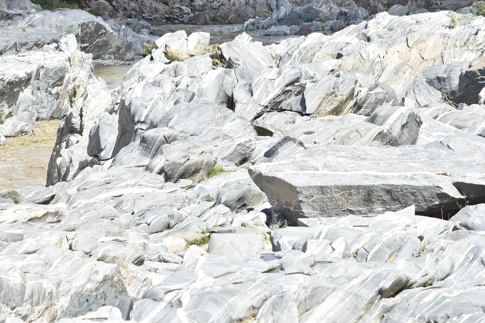
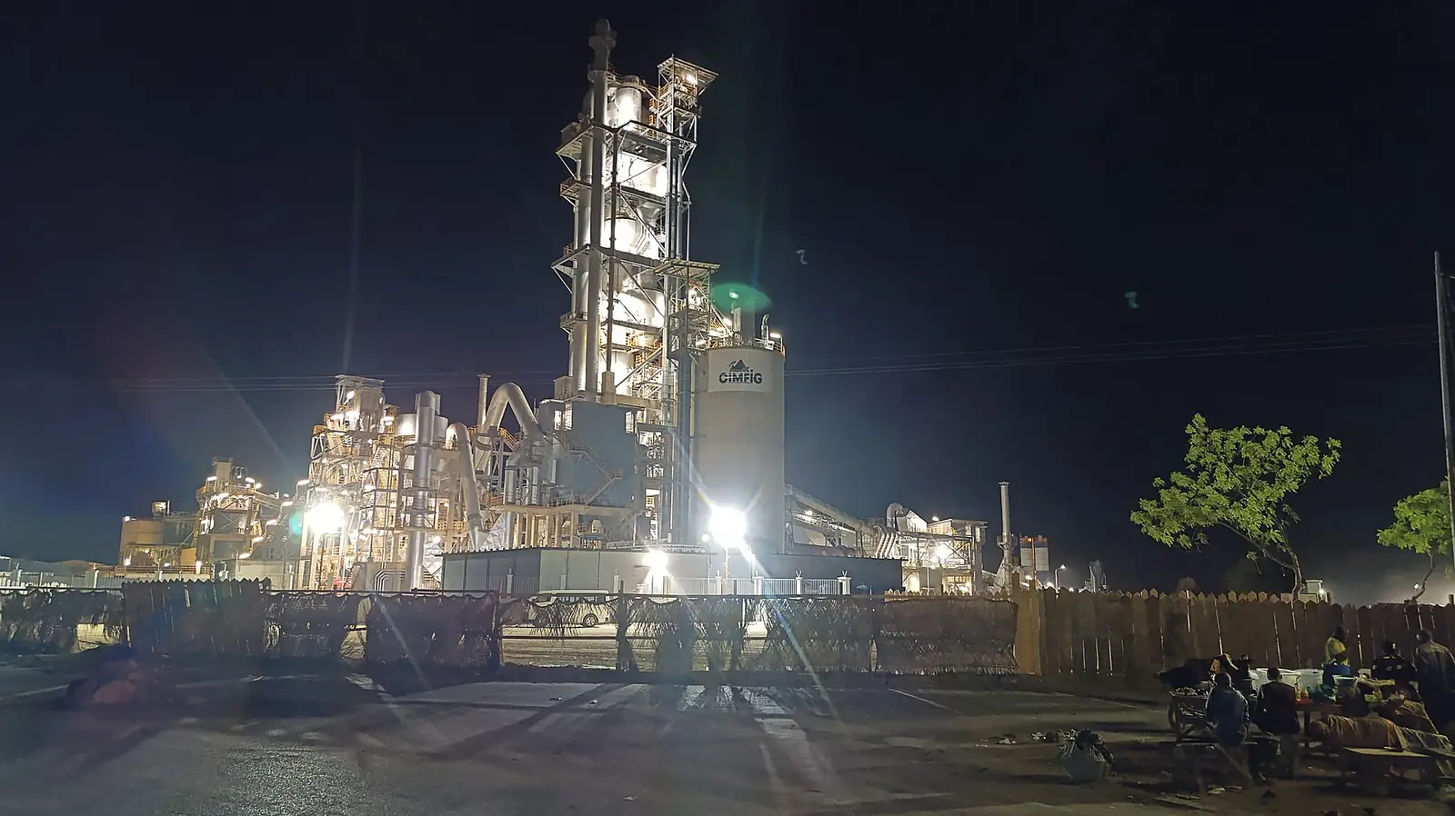
Mayo-Louti, the North region's smallest and most densely settled division: Guider and the Kola gorge, Figuil's cement works and Mayo-Oulo.
Subdivisions of Mayo-Louti Division
Mayo-Louti Division has 3 subdivisions.
Guider
Chief town: Guider
Figuil
Chief town: Figuil
Mayo-Oulo
Chief town: Mayo-Oulo
Where it is and what it's like
Mayo-Louti is the North region's smallest division, at 4,162 km², and its most densely settled, with an estimated 147 people per km² in 2018. Osidimbea says it borders the Far North's Mayo-Tsanaga, Diamaré and Mayo-Kani divisions to the north, Chad to the east, and Nigeria and Bénoué to the west. Maayo means watercourse in Fulfulde, French Wikipedia notes. The statistics office describes the Mayo-Louti plain, the Doumo and Guiriza plateaux at 500 to 1,000 m, and the Mousgoy-Douroum and Peske-Bori mountains.1,2,5
Its mayos are seasonal streams, dry in the dry season and overflowing in the rains, and their fertile banks are farmed for dry-season sorghum. The Chidifi dam, astride the boundary between Mayo-Oulo and Mayo-Tsanaga, supplies water to the division's households, according to the statistics office. Figuil has a semi-arid climate with 600 to 800 mm of rain a year, says French Wikipedia.1,4
People
The statistics office estimates 613,826 people for 2018, of whom 347,503 live in Guider subdivision. At the 2005 census Guider commune had 223,503 people, 52,316 of them in the town. French Wikipedia says the town takes its name from the Guidar, its majority people, and that Daba and Fali, culturally close to them, live there with Tupuri, Fulbe, Mundang and Giziga. Around Figuil it lists Guidar, Bororo, Mambay, Mundang, Sara, Tupuri, Giziga and Massa. Osidimbea names Lam and Mayo-Oulo as first-class chiefdoms.1,3,4,2
History
Osidimbea says Mayo-Louti came out of the break-up of the old Bénoué division in 1983. It dates Guider commune to 1962, Mayo-Oulo subdivision to 1969, and the Figuil and Mayo-Oulo communes to 1982.2
What it's known for
The site has no place page here yet. French Wikipedia calls the Kola gorge one of Guider's main attractions, and Guider's tourism office, created in 2013, features it. Figuil is one of the most industrialised places in the region, where Cimencam and Roccaglia make cement, lime and tiles, and marble, sand and gravel are quarried, says French Wikipedia.3,6,7,4
Main towns and getting there
In pictures
Map
Still to confirm
Our sources can't yet confirm these points:
- A census count of the division's population (the INS gives only a 2018 projection)
- Figuil subdivision's area (627 km² from the INS against 2,535 km² from French Wikipedia)
- The distance from Guider to the Kola gorge, and how the gorge is managed and reached
- The history of the Guider lamidate
Sources for this page
Information checked on 19 November 2026. It may have changed since.
- Annuaire statistique de la région du Nord, édition 2019: chapitre 1 and Tableau 1-2 (areas, MINEPAT 2017 estimate), Tableau 2-1 (administrative map, source INS/MINAT), Tableau 4-1 (2018 population estimate, MINEPAT), Institut national de la statistique, Agence régionale du Nord (undated)
- Département du Mayo-Louti, Osidimbea, la mémoire du Cameroun (undated)
- Guider, Wikipédia (19 November 2026)
- Figuil, Wikipédia (19 November 2026)
- Mayo-Louti, Wikipédia (19 November 2026)
- Mayo-Louti, Wikipedia (19 November 2026)
- Office communal du tourisme de Guider, Osidimbea, la mémoire du Cameroun (undated)
- Road route from Garoua to Guider, computed by us on 19 November 2026, Project OSRM, OpenStreetMap data (19 November 2026)
- Road route from Garoua to Figuil, computed by us on 19 November 2026, Project OSRM, OpenStreetMap data (19 November 2026)