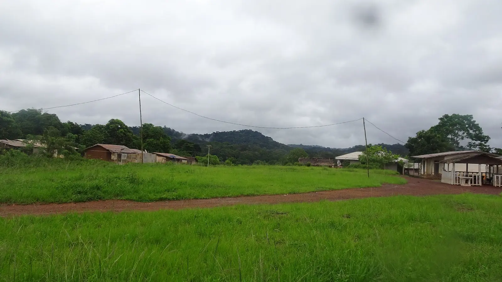
Haut-Nyong, the East's largest division: rainforest where the Nyong rises, Maka country around Abong-Mbang, and the Dja Faunal Reserve.
Subdivisions of Haut-Nyong Division
Haut-Nyong Division has 14 subdivisions.
Abong-Mbang
Chief town: Abong-Mbang
Bebend
Chief town: Atok
Dimako
Chief town: Dimako
Doumaintang
Chief town: Doumaintang
Doumé
Chief town: Doumé
Lomié
Chief town: Lomié
Mboanz
Chief town: Angossas
Mboma
Chief town: Mboma
Messamena
Chief town: Messamena
Messok
Chief town: Messok
Dja
Chief town: Mindourou
Ngoyla
Chief town: Ngoyla
Nguelemendouka
Chief town: Nguelemendouka
Somalomo
Chief town: Somalomo
Places in Haut-Nyong Division
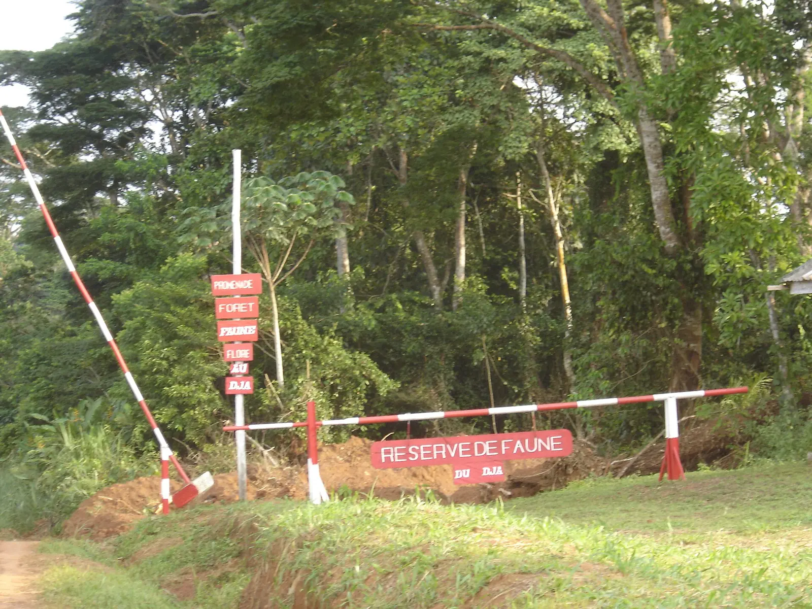
Where it is and what it's like
Haut-Nyong, the upper Nyong, is the largest of the East's divisions at 36,384 km², though French Wikipedia's commune areas add up to 36,051 km². It covers the south-west of the region, on the South Cameroon Plateau at around 700 m, under rainforest. The Nyong rises about 40 km east of Abong-Mbang and flows 690 km west to the sea south of Edéa; between April and November small boats can use it from Abong-Mbang to Mbalmayo. In the south, the Dja almost encircles the Dja Faunal Reserve.1,2,5,6,7,8
People
The 2005 census counted 196,519 people, about five per km². The Maka live around Abong-Mbang, Nguelemendouka and Doumé, the Bajwe around Messamena, the Nzime around Mindourou and the Njem around Lomié and Ngoyla; Baka hunter-gatherers live in the surrounding forests. The Maka language is Bantu, like those of their neighbours.4,7,5
History
Germans came up the Nyong in the late 19th century in search of wild rubber and built a fort at Abong-Mbang, now the prefectural prison. At Doumé they built a hilltop fort in 1909–1910, which French troops took on 25 July 1915. Under French rule an order of 5 March 1920 grouped Doumé, Lomié and Yokadouma into an East Cameroon region with Abong-Mbang as its seat; it was named Haut-Nyong in 1935 and became a division by decree 59-138 of 8 August 1959. According to Osidimbea, seven of the fourteen subdivisions became arrondissements in 2010, among them Dja, a district since 1992.5,9,1,10
What it's known for
The Dja Faunal Reserve, a World Heritage site since 1987, covers about 5,260 km²; its eastern part is in Haut-Nyong and its western part in Dja-et-Lobo, in the South region. OpenStreetMap places the site's map point for the reserve in the Lomié subdivision and the reserve's northern buffer zone in Somalomo. To the south-east, Nki National Park, created in 2005, straddles Ngoyla in Haut-Nyong and Moloundou in Boumba-et-Ngoko. Timber is processed at Dimako and Mindourou, and cocoa and coffee are grown around Abong-Mbang. Doumé's best-known sights are the former German fort and the Saints Peter and Paul cathedral.8,11,12,7,5,9
Main towns and getting there
Abong-Mbang, the chief town, had an estimated 18,700 people in 2001. It lies 178 km east of Yaoundé and 108 km west of Bertoua, where National Road 10 meets the road south through Mindourou to Lomié. Doumé, Nguelemendouka, Messamena and Lomié are the other main centres. The Ayos–Abong-Mbang–Bertoua stretch of National Road 10 carries heavy lorry traffic to the Central African Republic, and pothole repairs on the Ayos–Abong-Mbang section were under way in mid-2022.5,7,13,14
Map
Still to confirm
Our sources can't yet confirm these points:
- The division's area: 36,384 km² (Osidimbea, INS 2006 yearbook) against 36,051 km² from the sum of the commune areas
- Population of the division and its subdivisions after the 2005 census
- The decree that raised the former districts (Bebend, Doumaintang, Mboanz, Mboma, Messok, Dja, Ngoyla) to arrondissements in 2010, and the creation dates of Lomié and Somalomo
- OpenStreetMap coordinates for the Messok subdivision
Also nearby
Sources for this page
Information checked on 19 November 2026. It may have changed since.
- Département du Haut-Nyong, Osidimbea, la mémoire du Cameroun (undated)
- Haut-Nyong, Wikipédia (19 November 2026)
- Departments of Cameroon: areas from the Annuaire statistique du Cameroun 2006 and earlier census figures, Statoids (Gwillim Law), page updated 2009-01-24 (24 January 2009)
- Cameroon: departments and arrondissements, 2005 census (11 November 2005), from BUCREP and INS data, City Population (Thomas Brinkhoff) (19 November 2026)
- Abong-Mbang, Wikipedia (19 November 2026)
- Nyong River, Wikipedia (19 November 2026)
- East Region (Cameroon), Wikipedia (19 November 2026)
- Réserve de faune du Dja, Wikipédia (19 November 2026)
- Doumé, Wikipédia (19 November 2026)
- Arrondissement de Dja (Mindourou), Osidimbea, la mémoire du Cameroun (undated)
- OpenStreetMap Nominatim: boundary relations of the East's divisions and subdivisions (search), and reverse lookups of the site's place coordinates, OpenStreetMap contributors / Nominatim (19 November 2026)
- Nki National Park, Wikipedia (19 November 2026)
- Cameroon plans 28 km bypass to ease congestion on key Douala-Bangui corridor, Business in Cameroon (28 April 2026)
- Routes : ça circule mieux à l'Est, Cameroon Tribune (6 June 2022)