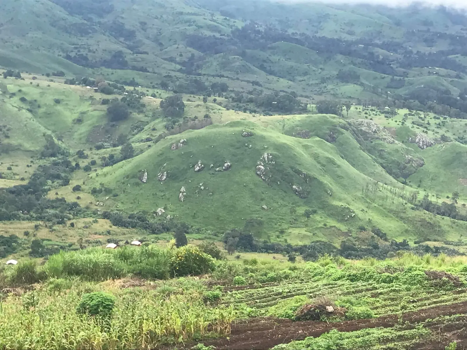
Donga-Mantung, the Northwest division of the Wimbum and the Nkambe plateau, near Nigeria: Nkambe, Ndu, Nwa, Ako and Misaje.
Subdivisions of Donga-Mantung Division
Donga-Mantung Division has 5 subdivisions.
Ako
Chief town: Ako
Misaje
Chief town: Misaje
Ndu
Chief town: Ndu
Nkambe
Chief town: Nkambe
Nwa
Chief town: Nwa
Where it is and what it's like
Donga-Mantung covers 4,279 km², the region's second-largest division after Menchum. Nkambe stands at the northern edge of the Bamenda Grassfields, 25 to 40 km from the Nigerian border. The land runs from highlands such as Mount Binka, at 2,200 m, down to about 1,500 m at Chup. The division is named after two rivers, the Donga in Ako subdivision and the Mantung in Nwa.1,2,4
Kaberry noted in 1952 that the Donga flows west to the Benue, that Mbem and Mbaw lie below the escarpment in the east, and that the forested lowlands of Mbembe, on the plateau's northern edge, were the only place where bulrush millet was grown.7
Peoples and languages
The 2005 census counted 269,931 people, up from 226,916 in 1987; English Wikipedia gives 520,401 for 2021, a figure we could not trace to an official source, and French Wikipedia 337,533 for 2001. Ndu was the most populous subdivision, with 73,955. The Governor's office counts thirty second-class chiefdoms and no first-class ones.1,2,3
Most people around Nkambe are Wimbum, whose three clans each have a seat: War at Mbot, Tang at Tallah and Wiya at Ndu. They speak Limbum, an Eastern Grassfields language with about 130,000 native speakers (Ethnologue, 2005 figure), also used for trade. Yamba, with about 80,000 speakers, has its largest community at Mbem.4,5,6
History
The Wimbum probably arrived between the 1700s and the mid-1800s. German administration of the Grassfields began around 1901, Fulani herders came around 1910, and Britain took over in 1916. Nkambe Division was created in 1949 within Bamenda Province, renamed Donga and Mantung Division in 1968, and lost the "and" in 1972. Its subdivisions date from 1963 (Nwa), 1966 (Nkambe), 1977 (Ako) and 1992 (Ndu and Misaje).2,4
What it's known for
The site has no place page in Donga-Mantung yet. Wikipedia mentions the Chua Chua botanical gardens at Nkambe, created by the farmer Tantoh, and the Fulani cattle herders scattered across the plateau.4
Main towns
Nkambe, the long-standing administrative centre, has a daily market, a hospital and a mixed population that includes Hausa traders. Figures for it differ: the census gave 63,032 for Nkambe subdivision in 2005, while Wikipedia estimates about 170,000 for the Nkambe Central commune in 2011. The other seats are Ndu, Nwa, Ako and Misaje.1,4,8
Map
Still to confirm
Our sources can't yet confirm these points:
- A current official population for Donga-Mantung (Wikipedia's 520,401 for 2021 is unsourced)
- The origin of the name: Wikipedia links it to the two rivers and also to a German named Donga at Mbem in 1911
- The creation date of the division in its current form
Sources for this page
Information checked on 19 November 2026. It may have changed since.
- Statistical Yearbook for the North West Region, 2023 edition: Tables 2.1 and 2.3 (Governor's office), 2.9 (FEICOM), 4.3 and 4.4 (1987 and 2005 censuses), Institut national de la statistique (INS) (undated)
- Donga-Mantung, Wikipedia (19 November 2026)
- Donga-Mantung, Wikipédia (19 November 2026)
- Nkambé, Wikipedia (19 November 2026)
- Limbum language, Wikipedia (19 November 2026)
- Yamba language, Wikipedia (19 November 2026)
- Women of the Grassfields (1952), chapter II: Ecology (P. M. Kaberry), Colonial Research Publication No. 14, online at era.anthropology.ac.uk (undated)
- OpenStreetMap Nominatim: boundary relations of the Northwest's divisions and subdivisions (search), and reverse lookups of the site's place coordinates, OpenStreetMap contributors / Nominatim (19 November 2026)