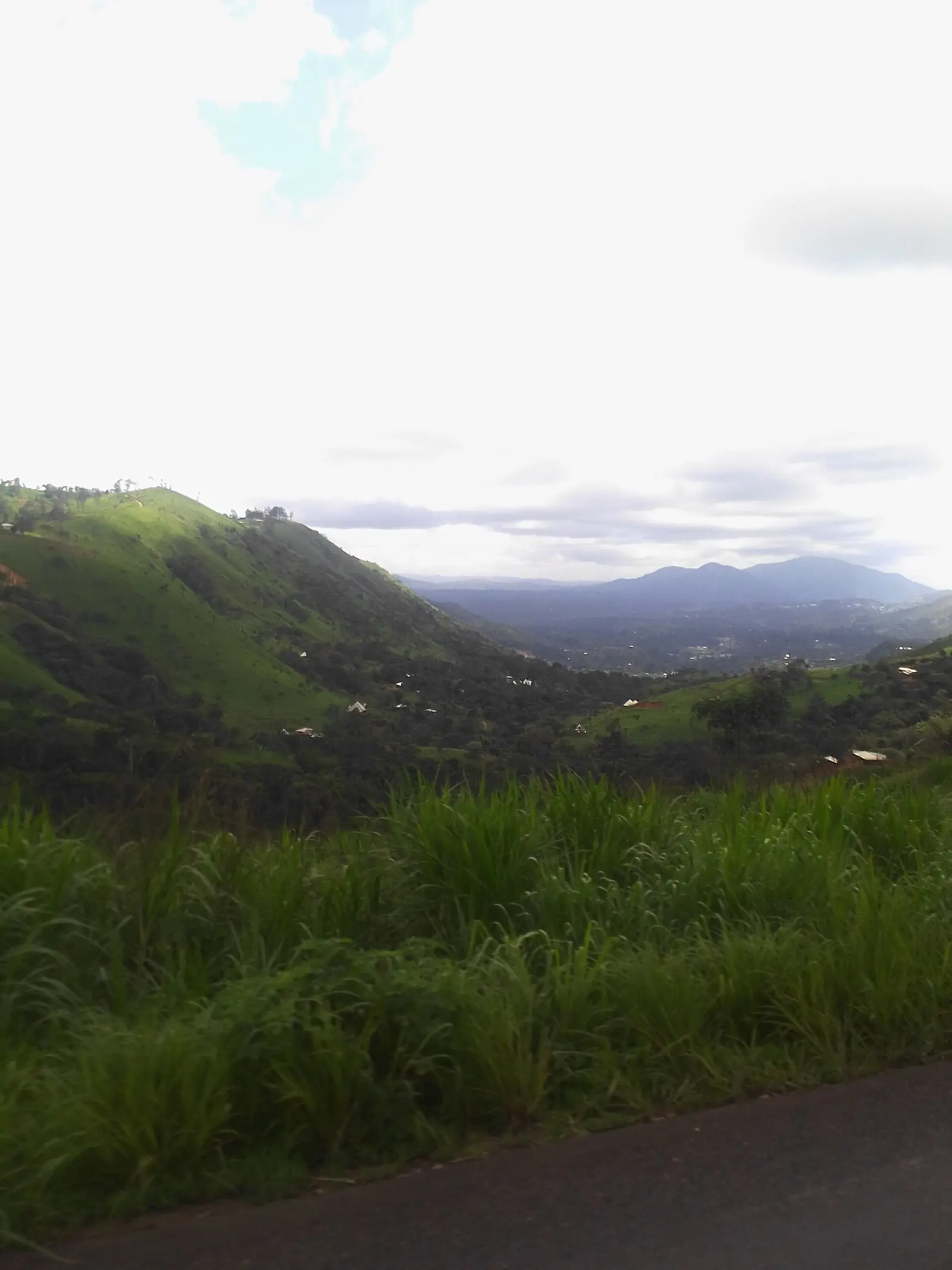
Hauts-Plateaux, a small West division of Bamiléké chiefdoms around Baham, Bamendjou, Bangou and Batié, known for its crafts and the Bapa chiefdom.
Subdivisions of Hauts-Plateaux Division
Hauts-Plateaux Division has 4 subdivisions.
Baham
Chief town: Baham
Bamendjou
Chief town: Bamendjou
Bangou
Chief town: Bangou
Batié
Chief town: Batié
Places in Hauts-Plateaux Division
Where it is and what it's like
The Hauts-Plateaux is one of the West's smallest divisions, covering 415 km² south-west of Bafoussam. Its four subdivision seats lie close to the regional capital: the statistics office measures 15 km by road to Bamendjou, 20 km to Baham, 25 km to Bangou and 26 km to Batié. French Wikipedia describes Bapa, in Bangou commune, as built on a hilly volcanic base, with a landscape mostly of rocks and caves.1,3,5
People
The 2005 census counted 80,678 people, against 76,704 in 1987; the 2010 projection was 83,738. Bamendjou subdivision had 34,269 people in 2005, Baham 19,680, Bangou 15,787 and Batié 10,942. Ghomala', the Bamiléké language of most of Mifi and Koung-Khi, is also spoken across most of the division. French Wikipedia lists second-degree chiefdoms at Baham, Bangou, Bandenkop, Bapa, Bamendjou, Bameka, Bahouan, Bangam, Batié and Baloumgou; the division has no first-degree chiefdom.1,2,6,7
History
The division was created in October 1992, when the old Mifi was split in three; French Wikipedia cites decree 92/207 of 5 October 1992, whose text we have not seen. It began with three subdivisions, Baham, Bamendjou and Bangou, and a district at Batié, with Baham as chief town. Oral tradition dates the Bapa chiefdom to the 1600s, founded by a hunter from Bamendou.7,5
What it's known for
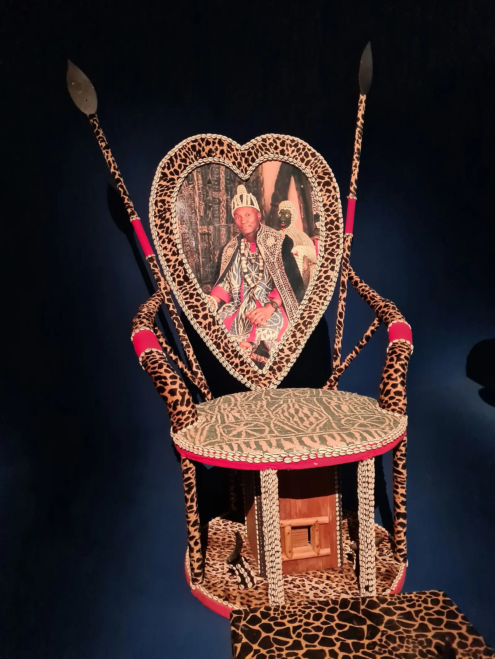
The site lists the Bapa chiefdom, which OpenStreetMap and French Wikipedia place in Bangou commune. Its heritage house opened on 3 March 2018, at the close of the first Pa'a Ngouo'ok festival, and holds more than 500 objects, mostly in wood, including masks and a throne. French Wikipedia also says the division is known for its traditional crafts, bamboo work and beaded objects, at the Bangou chiefdom and along the road between Baham and Batié.4,5,7
Main towns and getting there
Map
Still to confirm
Our sources can't yet confirm these points:
- Which national roads cross the Hauts-Plateaux, and travel times from Bafoussam
- The text of decree 92/207 of 5 October 1992 creating the division
- A current official population for the Hauts-Plateaux
Sources for this page
Information checked on 19 November 2026. It may have changed since.
- Annuaire statistique de la région de l'Ouest, édition 2024: chapter 1 (relief, soils, rivers), Tableaux 1.1, 1.4, 2.1, 2.2 and 4.2 (sources: Governor's office, DR-MINTP, DR-ELECAM, BUCREP), Institut national de la statistique, Agence régionale de l'Ouest (undated)
- Cameroon: administrative division, census counts of 1987 and 2005 by division and arrondissement, City Population (Thomas Brinkhoff), citing BUCREP (19 November 2026)
- OpenStreetMap Nominatim: boundary relations of Hauts-Plateaux and its subdivisions (lookup), OpenStreetMap contributors / Nominatim (19 November 2026)
- OpenStreetMap: boundary of Bangou commune, which contains the site's place coordinates (Overpass is_in query), OpenStreetMap contributors (19 November 2026)
- Bapa, Wikipédia (19 November 2026)
- Ghomala language, Wikipedia (19 November 2026)
- Hauts-Plateaux (Cameroun), Wikipédia (19 November 2026)