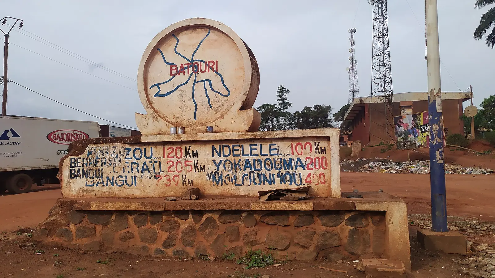
Kadey, the East division around Batouri on the Kadéï river: forest and savanna, gold workings and roads towards the Central African Republic.
Subdivisions of Kadey Division
Kadey Division has 7 subdivisions.
Batouri
Chief town: Batouri
Bombé
Chief town: Kentzou
Kette
Chief town: Kette
Mbang
Chief town: Mbang
Mbotoro
Chief town: Ouli
Ndélélé
Chief town: Ndélélé
Ndem-Nam
Chief town: Nguélébok
- Population
- 184,098 (2005 census)4
Where it is and what it's like
Kadey, the smallest of the East's four divisions at 15,884 km², lies in the centre-east of the region and borders the Central African Republic. It is named after the Kadéï, which rises on the eastern Adamawa Plateau south-east of Garoua-Boulaï, passes just west of Batouri, follows the border for 12 km and joins the Mambéré at Nola, in the Central African Republic, to form the Sangha, part of the Congo basin. A granite outcrop, Mount Pandi, rises about 25 km north of Batouri.2,3,6,7
People
The 2005 census counted 184,098 people. The Kako (Kaka) live south and west of the Kadéï, with Batouri and Ndélélé as their main centres, while the Gbaya occupy the northern third of the division along the river. Batouri also has a large Fulbe community, for whom Fulfulde is a common language, and the Yangélé and Mézimé are native to the area.4,8,7
History
The Kako lost a profitable trade under German rule, which led to a revolt. Under French rule the seat of the Bertoua circumscription moved to Batouri in 1929, and the circumscription took the town's name; in 1935 it became the Lom-et-Kadéï region. That division was split in 1965 into Kadey and Lom-et-Djérem. Batouri's arrondissement dates from 1955, Ndélélé's from 1962 and those of Kette and Mbang from 1981; Bombé, Mbotoro and Ndem-Nam were districts raised to arrondissements in 2010.8,9,10,1,11,12,13
What it's known for
Gold is the division's best-known resource. Kambélé III, near Batouri, is one of its artisanal mining sites, and a 2022 study reported by Mongabay found mercury above the World Health Organization's limit in most of the 60 miners tested in Batouri, Kette, Ngoura and Bétaré-Oya. Tobacco is grown on the plains north of Batouri, and plantains are the main crop further south. None of the site's places is in Kadey yet.14,8
Main towns and getting there
Batouri, the chief town, had an estimated 75,000 people in 2023 and is the second town of the East after Bertoua. It lies on the road from Bertoua towards the Central African Republic and on the road south to Yokadouma. The 90 km from Mandjou, near Bertoua, to Batouri were almost fully paved by June 2022. Kentzou, the chief town of the Bombé subdivision, is a border town; Kette, Mbang, Ndélélé, Ouli and Nguélébok are the other subdivision centres.7,15,11,16,12,13,17
Map
Still to confirm
Our sources can't yet confirm these points:
- Population of the division and its subdivisions after the 2005 census; Batouri's 75,000 for 2023 is an estimate
- The year Kadey was created: Osidimbea gives 1920 on the Kadey page and 1965 on its regional page
- The decree that raised Bombé, Mbotoro and Ndem-Nam to arrondissements in 2010
- The division's area: 15,884 km² (INS 2006 yearbook) or 15,910 km² (1987 table)
Sources for this page
Information checked on 19 November 2026. It may have changed since.
- Département de la Kadey, Osidimbea, la mémoire du Cameroun (undated)
- Kadey, Wikipédia (19 November 2026)
- Departments of Cameroon: areas from the Annuaire statistique du Cameroun 2006 and earlier census figures, Statoids (Gwillim Law), page updated 2009-01-24 (24 January 2009)
- Cameroon: departments and arrondissements, 2005 census (11 November 2005), from BUCREP and INS data, City Population (Thomas Brinkhoff) (19 November 2026)
- Decree of July 2022 to appoint Subdivisional Officers (East Region: Yokadouma, Kette, Ndem-Nam and Ngoura subdivisions), Presidency of the Republic of Cameroon (undated)
- Kadéï River, Wikipedia (19 November 2026)
- Batouri, Wikipedia (19 November 2026)
- East Region (Cameroon), Wikipedia (19 November 2026)
- Département du Lom et Djerem, Osidimbea, la mémoire du Cameroun (undated)
- Région de l'Est: départements and former departments, Osidimbea, la mémoire du Cameroun (undated)
- Arrondissement de Bombé, Osidimbea, la mémoire du Cameroun (undated)
- Arrondissement de Mbotoro, Osidimbea, la mémoire du Cameroun (undated)
- Arrondissement de Ndem-Nam, Osidimbea, la mémoire du Cameroun (undated)
- About 72% of gold miners poisoned with mercury at artisanal mining sites in Cameroon, Mongabay (Yannick Kenné) (29 November 2022)
- Bitumage de l'axe Bertoua-Batouri : les retombées du Plan d'urgence, Cameroon Tribune (16 June 2022)
- Garoua-Boulaï, Wikipedia (19 November 2026)
- Commune de Nguelebock, Osidimbea, la mémoire du Cameroun (undated)