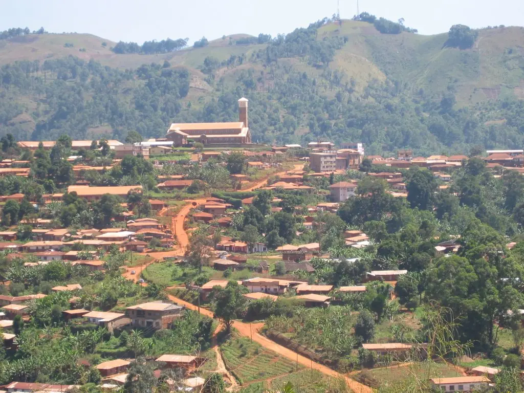
Bui, the Northwest division of the Nso and Oku peoples: Kumbo, seat of the Fon of Nso, and Mount Oku, in six subdivisions.
Subdivisions of Bui Division
Bui Division has 6 subdivisions.
Jakiri
Chief town: Jakiri
Kumbo
Chief town: Kumbo
Mbven
Chief town: Mbiame
Nkum
Chief town: Tatum
Noni
Chief town: Nkor
Oku
Chief town: Elak
Places in Bui Division
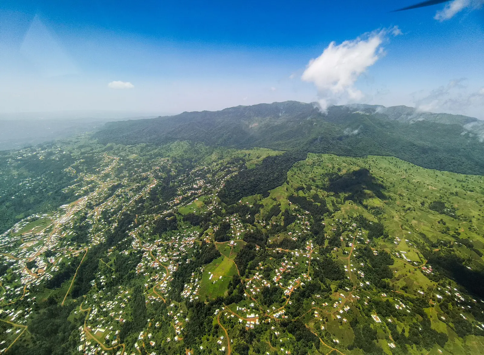
Where it is and what it's like
Bui covers 2,297 km² of high plateau. Within it rises Mount Oku, which the Key Biodiversity Areas Partnership puts at 3,011 m, the highest mountain in West Africa after Mount Cameroon, ringed by the Kilum-Ijim montane forest. OpenStreetMap places the summit in Oku subdivision. Kumbo itself stands high: English Wikipedia gives 1,800 m in its summary box and about 2,000 m in its text.1,3,4,8,10
Kaberry, writing in 1952, described the escarpment at Nsaw and Oke rising from the Ndop Plain, and recorded the lowest rainfall of the old Bamenda Province here, some 65 inches (about 1,650 mm) a year. Finger millet was then grown only in Nsaw and a few nearby villages, and Oku was known for its blacksmiths.9
Peoples and languages
The 2005 census counted 321,969 people, up from 217,064 in 1987, making Bui the second most populous division of the region after Mezam. Oku subdivision had 87,720 people and Kumbo 83,479. The Governor's office counts one first-class and eleven second-class chiefdoms.1
Kumbo is the capital of the Nso kingdom, and Lamnso is its common language. English Wikipedia gives about 240,000 Lamnso speakers in Cameroon (Ethnologue, 2005), while its text says more than 100,000. Oku, the language of the Oku fondom, has about 87,000 speakers.4,6,7
History
Nso tradition traces the dynasty to the Tikar at Kimi, today Bankim, and to its founder Ngonnso', from whom the Nso take their name; her brother Nchare Yen founded the Bamum kingdom. German troops of Lieutenant Colonel von Pavel's expedition reached Nso in 1901–1902; after an attack by about 1,200 Nso men they burned the palace. A wooden figure of Ngonnso taken to Berlin in 1903 was approved for return in June 2022, and the Fon saw it at the Humboldt Forum that November.5
Missionaries of the Sacred Heart arrived in 1912 and set up their mission in 1913. Kumbo's stone cathedral dates from the 1950s and has been a bishop's seat since 1983. The Ngonnso cultural festival grew out of an annual cultural week in the 1950s and was formally recognised in 1976.4,5
What it's known for
The site's page on Oku white honey covers the honey of the Kilum forest on Mount Oku, whose summit OpenStreetMap places in Oku subdivision. In Kumbo, Wikipedia names the Nso palace, the heart of the town's social and cultural life, and the Musa Heritage Gallery, opened in 1996 with more than 400 objects.4,10
Main towns
Map
Still to confirm
Our sources can't yet confirm these points:
- Kumbo's altitude (Wikipedia gives both 1,800 m and about 2,000 m)
- The number of Lamnso speakers (sources give about 240,000 and more than 100,000)
- The creation date of the Bui division (Osidimbea only gives the 1970s)
- Whether the Ngonnso figure has physically returned to Kumbo
Sources for this page
Information checked on 19 November 2026. It may have changed since.
- Statistical Yearbook for the North West Region, 2023 edition: Tables 2.1 and 2.3 (Governor's office), 2.9 (FEICOM), 4.3 and 4.4 (1987 and 2005 censuses), Institut national de la statistique (INS) (undated)
- Département du Bui, Osidimbea (19 November 2026)
- Bui (département), Wikipédia (19 November 2026)
- Kumbo, Wikipedia (19 November 2026)
- Nso people, Wikipedia (19 November 2026)
- Nso language, Wikipedia (19 November 2026)
- Oku language, Wikipedia (19 November 2026)
- Mount Oku (6115), Key Biodiversity Areas Partnership (19 November 2026)
- Women of the Grassfields (1952), chapter II: Ecology (P. M. Kaberry), Colonial Research Publication No. 14, online at era.anthropology.ac.uk (undated)
- OpenStreetMap Nominatim: boundary relations of the Northwest's divisions and subdivisions (search), and reverse lookups of the site's place coordinates, OpenStreetMap contributors / Nominatim (19 November 2026)