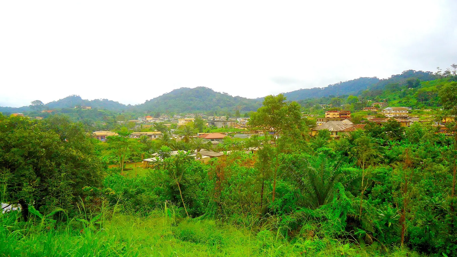
Nyong-et-Kéllé, the Centre's Bassa country: Éséka and its hills, forest, the falls of the Nyong, and the railway between Yaoundé and Douala.
Subdivisions of Nyong-et-Kéllé Division
Nyong-et-Kéllé Division has 10 subdivisions.
Biyouha
Chief town: Biyouha
Bondjock
Chief town: Bondjock
Bot-Makak
Chief town: Bot-Makak
Dibang
Chief town: Dibang
Éséka
Chief town: Éséka
Makak
Chief town: Makak
Matomb
Chief town: Matomb
Messondo
Chief town: Messondo
Ngog-Mapubi
Chief town: Ngog-Mapubi
Nguibassal
Chief town: Nguibassal
Where it is and what it's like
Nyong-et-Kéllé is the south-western division of the Centre region, on the road and railway between Yaoundé and Douala. It is named after the confluence of the Nyong and the Kéllé. It covers 6,362 km² of dense, humid evergreen forest, and the statistics office notes that the Nyong drops towards the sea through a series of falls, the largest at Makak and Njok. Hills ring the chief town, Éséka.4,1,5
People
The 2005 census counted 129,819 people, and the statistics office projects 245,868 for 2023. This is Bassa country: the statistics office lists the Bassa as the division's people. French Wikipedia associates Éséka with assiko music and the musician Jean Bikoko, and Osidimbea lists a Mbog Liaa festival in the division.1,5,2
History
Under French rule, Éséka belonged to the Edéa-Éséka circonscription created in 1916, later the Sanaga-Maritime. A law of 30 June 1958 cut the Nyong-et-Kéllé region out of the Sanaga-Maritime, and a decree of 8 August 1959 made it a division. Éséka hosted the second congress of the Union des populations du Cameroun (UPC) in 1952. Ruben Um Nyobe, the UPC's leader, came from this area: French Wikipedia places his birthplace south of Boumnyébel in one article and near Éséka in another. He lived in hiding in the forest around Boumnyébel until he was killed in 1958.2,5,6
What it's known for
The regional tourism office's 2017 inventory counted eight sites in the division, including three waterfalls and three historic monuments. French Wikipedia links Éséka with the Dipipii and Ngo Njock Lipo falls and an Um Nyobe monument, and notes forests with valuable timber such as bubinga, and fishing on the Nyong and the Kéllé. None of the site's places is in this division yet.7,5,4
Main towns and getting there
Éséka has a station on the Douala–Yaoundé railway; the line from Douala ended here from 1914 until it reached Yaoundé in 1927. Boumnyébel lies on the N3 between Yaoundé and Douala, at the junction with the road to Bafia. The statistics office projects about 53,000 people for Makak subdivision in 2023 and 44,000 for Éséka.5,6,1
Map
Still to confirm
Our sources can't yet confirm these points:
- Where the Dipipii and Ngo Njock Lipo falls are, and how they are reached
- Ruben Um Nyobe's exact birthplace (Song-Mpeck near Boumnyébel, or Eog Makon near Éséka)
- Current Camrail passenger services stopping at Éséka
- Official current population (the 2023 figures are INS projections from the 2005 census)
Sources for this page
Information checked on 19 November 2026. It may have changed since.
- Annuaire statistique de la région du Centre, édition 2025: chapter 1 (relief, rivers, vegetation, protected areas; Tableau 1-2, ethnolinguistic groups), Tableaux 2-2 and 2-3 (administrative map at 31 December 2024, source MINAT), Tableau 4-6 (area and population by division, 2005 census and 2023 projection), Institut national de la statistique, Agence régionale du Centre (undated)
- Département du Nyong et Kellé, Osidimbea, la mémoire du Cameroun (undated)
- OpenStreetMap Nominatim: boundary relations of the Centre's divisions and subdivisions (search), and reverse lookups of the site's place coordinates, OpenStreetMap contributors / Nominatim (19 November 2026)
- Nyong-et-Kéllé, Wikipédia (19 November 2026)
- Éséka, Wikipédia (19 November 2026)
- Boumnyébel, Wikipédia (19 November 2026)
- Annuaire statistique de la région du Centre, édition 2020: Tableau 21-1, tourist sites by division and type in 2017 (source MINTOUL, Centre regional delegation), Institut national de la statistique, Agence régionale du Centre (undated)