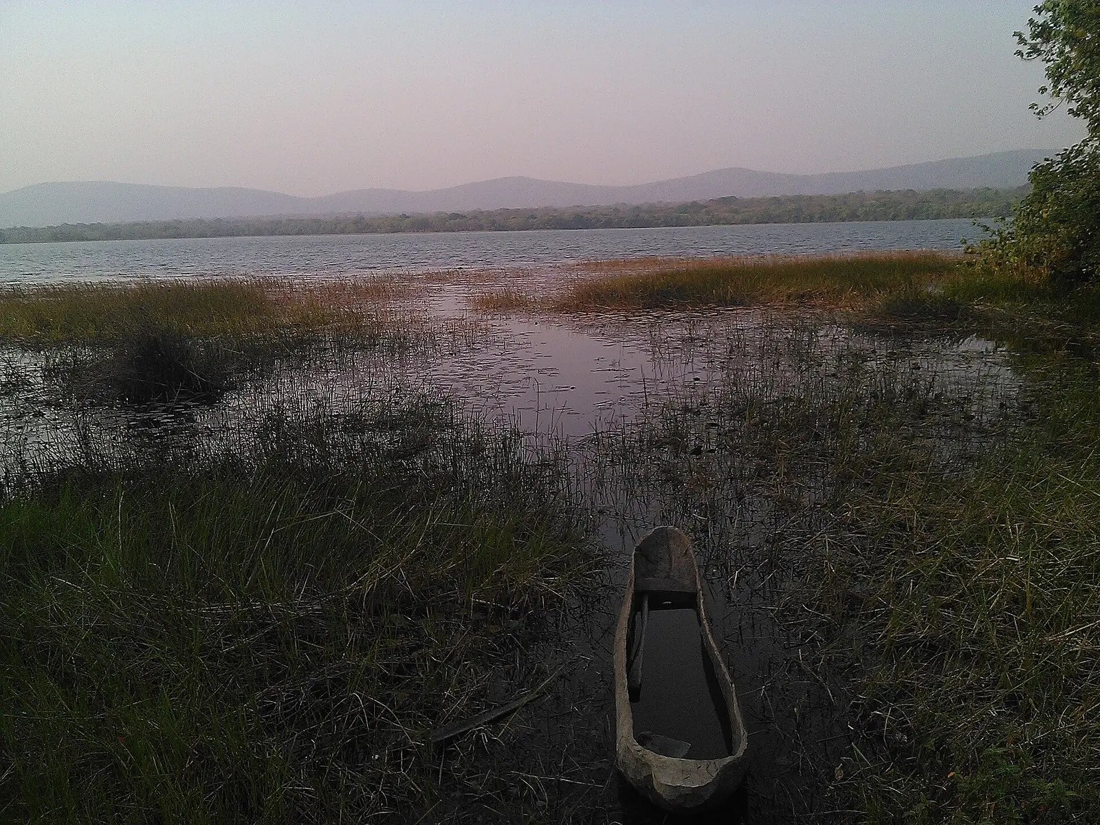
Djérem, Adamawa's southern division: Tibati and its lamidate, Lake Mbakaou, the railway town of Ngaoundal and the Djérem river.
Subdivisions of Djérem Division
Djérem Division has 2 subdivisions.
Ngaoundal
Chief town: Ngaoundal
Tibati
Chief town: Tibati
- Population
- 124,948 (2005 census)1
Where it is and what it's like
Djérem is the southern division of the Adamawa region: Tibati borders Yoko in the Centre region, and Ngaoundal borders Bétaré-Oya in the East. The statistics office gives it 13,283 km², about a fifth of the region. It takes its name from the Djérem river, a tributary of the Sanaga, and the office describes the Martap peneplain running on beyond the Djérem in the south of the region.1,4,5,7
Water shapes the division. Tibati sits beside Lake Mbakaou, a reservoir behind a dam built at the village of Mbakaou in 1969, and the statistics office reports that the dam is silting up. Mbam and Djerem National Park, created in 2000, straddles the Adamawa, Centre and East regions: the office gives it 4,165 km², while English Wikipedia gives about 4,235 km².1,3,6
People and how it's organised
The 2005 census counted 124,948 people. The division has two subdivisions, each with a council of the same name: Tibati, with 72,081 people in 2005 (22,869 in the town), and Ngaoundal, with 52,867 (25,853 in the town).1,4,5
English Wikipedia names the Vute and the Mbum as the first inhabitants of the Tibati area. French Wikipedia describes a mixed town where Kanuri, Hausa and Fulani are the largest groups, alongside Mbum, Gbaya, Vute, Tikar and Mbororo, and lists the Gbaya, Fulani and Mbum as the main groups around Ngaoundal.3,4,5
History
Tibati was founded in the 1820s by Hamman Sambo, a flag-bearer of Modibo Adama, and became the southernmost lamidate of the Adamawa emirate, within the Sokoto caliphate. German troops took the town in March 1899: English Wikipedia says forces under Hans Dominik sacked it on 10 March, while French Wikipedia says Captain von Kamptz conquered the area on 9 March. Some German colonial buildings remain, among them the prefecture. The division was created in 1983 on the territory of the former Tibati subdivision.2,3,4
What it's known for
Lakes, above all. The statistics office's 2020 inventory of tourist sites counts nine lakes in Djérem, more than in any other Adamawa division, and English Wikipedia describes the Lake Mbakaou fishery, whose fish is sold across Cameroon, mainly in Yaoundé. The Lamidat of Tibati is the division's first-degree traditional chiefdom. Around Ngaoundal, the office records bauxite reserves estimated at 120 million tonnes. None of the site's current Adamawa places are in Djérem.1,2,3
Main towns and getting there
Map
Still to confirm
Our sources can't yet confirm these points:
- Which river the Mbakaou dam stands on: English Wikipedia's Tibati article names the Meng
- The current population of the division and of its two subdivisions (latest census figures are from 2005)
- The creating decree of the division (Osidimbea gives 1983 without a reference) and of the Tibati subdivision
- Whether the airport at Ngaoundal mentioned by English Wikipedia has any scheduled service
Sources for this page
Information checked on 19 November 2026. It may have changed since.
- Annuaire statistique de la région de l'Adamaoua, édition 2024: chapitre 1 (relief, hydrographie, mines, faune), Tableau 2.2 and Graphique 2.1 (administrative map and areas, source Services du Gouverneur), Tableau 3.1 (2005 census by division), Tableau 10.10 (tourist sites by division, 2020), Institut national de la statistique, Agence régionale de l'Adamaoua (undated)
- Département du Djérem, Osidimbea, la mémoire du Cameroun (undated)
- Tibati, Wikipedia (19 November 2026)
- Tibati, Wikipédia (19 November 2026)
- Ngaoundal, Wikipédia (19 November 2026)
- Mbam Djerem National Park, Wikipedia (19 November 2026)
- Djérem (department), Wikipedia (19 November 2026)
- Ngaoundal, Wikipedia (19 November 2026)