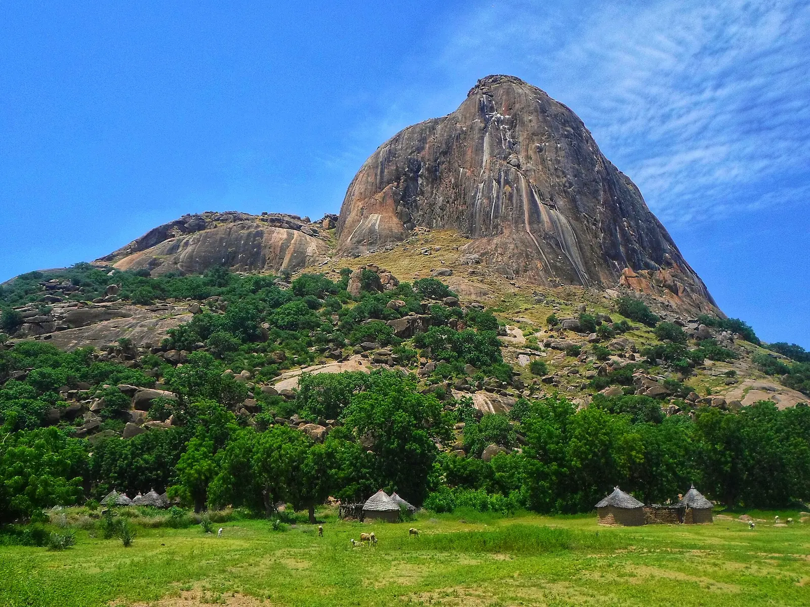
Mayo-Kani, the Far North division around Kaélé: Moundang, Guiziga and Tupuri country, the Mindif peak and the plains towards Chad.
Subdivisions of Mayo-Kani Division
Mayo-Kani Division has 7 subdivisions.
Kaélé
Chief town: Kaélé
Guidiguis
Chief town: Guidiguis
Mindif
Chief town: Mindif
Moulvoudaye
Chief town: Moulvoudaye
Moutourwa
Chief town: Moutourwa
Porhi
Chief town: Touloum
Taibong
Chief town: Dziguilao
Where it is and what it's like
Mayo-Kani lies in the south of the Far North, towards the Chadian border. Kaélé, its chief town, is on the Diamaré plain about 104 km south of Maroua. In the east, Moulvoudaye lies in the yaéré, a broad plain used as pasture once the floodwater has gone. The division covers 5,033 km².6,10,1
Isolated rocky hills rise from the plain. The best known is the Mindif peak, or 'tooth of Mindif', a sugar-loaf rock of 729 m, shaped like an upturned molar and visible from far away.7
People
The 2005 census counted 404,646 people, and the INS projects 544,442 for 2017, or 108 per km². The INS names the Moundang, the Guiziga and the Tupuri as the main groups; English Wikipedia places the Tupuri east of Kaélé. Kaélé and Moutourwa are both first-degree traditional chiefdoms, according to French Wikipedia.1,2,8,9,11
The seven subdivisions are Kaélé, Guidiguis, Mindif, Moulvoudaye, Moutourwa, Porhi and Taibong. The councils for Porhi and Taibong are named after their seats, Touloum and Dziguilao.1,5,12,13
History
The division was carved out of Diamaré as the Kaélé division by decree 81/521 of 11 December 1981, according to Osidimbea's Mayo-Kani page, and later took the name Mayo-Kani. Osidimbea's pages disagree on the dates: its Mayo-Kani page gives 1983 for the new name, and its Diamaré page dates the split to 1984 and the renaming to 1995.3,4
French Wikipedia says the Mindif peak was mentioned by Western travellers from 1823, appears in Jules Verne's Five Weeks in a Balloon (1863), and served as a backdrop for films including John Huston's The Roots of Heaven (1958) and Claire Denis's Chocolat (1988).7
What it's known for
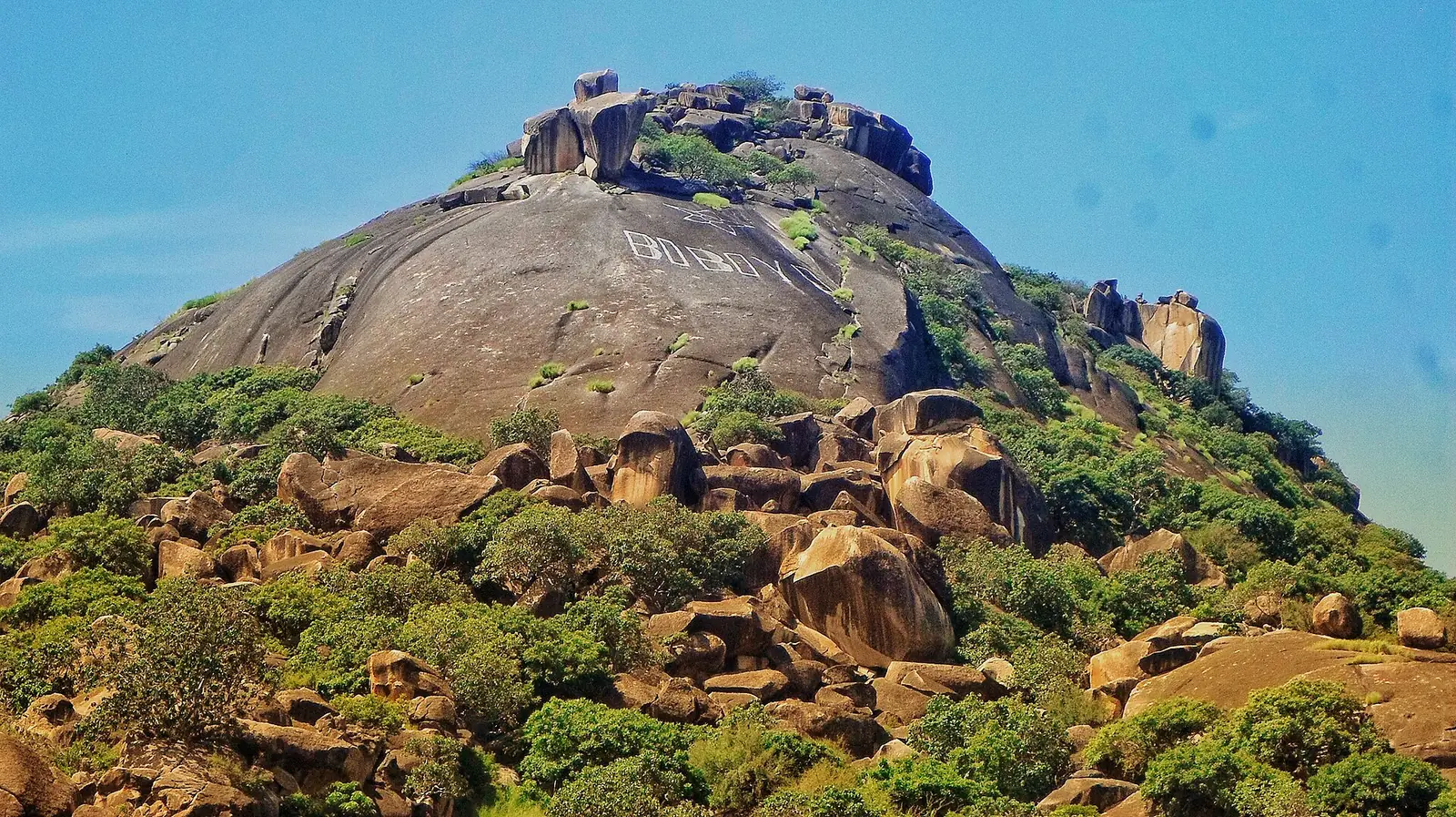
None of the site's places is in Mayo-Kani yet. The regional tourism delegation's list, published by the INS, names the Mindif peak, the megalithic rock of Missinguel, the Diguing cave, a passage of about 205 m between the villages of Bololo and Diguing, the palaces of the lamidos of Kaélé, Mindif, Guidiguis, Moutourwa, Moulvoudaye, Lara and Midjiving, the Tupuri chief's palace at Dziguilao, Mount Boboyo and the crocodile-filled quarry lake of Boboyo near Kaélé, and the Doumrou cattle market.1
Main towns
In pictures
Map
Still to confirm
Our sources can't yet confirm these points:
- An official current population for Mayo-Kani and its subdivisions (the latest INS figures are 2017 projections)
- When the Kaélé division was created and renamed Mayo-Kani: Osidimbea gives 1981 or 1984, and 1983 or 1995
- Kaélé's town population: 15,810 in 2005 (French Wikipedia) or about 30,600 (English Wikipedia, undated)
Sources for this page
Information checked on 19 November 2026. It may have changed since.
- Annuaire statistique 2018 de la région de l'Extrême-Nord, édition 2019: Tableau 1-1 (areas, source DREPAT), Tableau 2-1 (administrative map, source MINATD), main ethnic groups, Tableau 3-1 (2017 projections), Tableau 3-4 (2005 census by subdivision), Tableau 21-1 (heritage sites, source DR-MINTOUL), Institut national de la statistique, Agence régionale de l'Extrême-Nord (undated)
- Mayo-Kani: department, census counts 1987 and 2005 by subdivision, City Population (Thomas Brinkhoff), citing BUCREP and INS (19 November 2026)
- Département du Mayo-Kani: administrative history, Osidimbea (19 November 2026)
- Département du Diamaré: administrative history, Osidimbea (19 November 2026)
- Mayo-Kani, Wikipédia (19 November 2026)
- Kaélé, Wikipedia (19 November 2026)
- Mindif, Wikipédia (19 November 2026)
- Tupuri people, Wikipedia (19 November 2026)
- Kaélé, Wikipédia (19 November 2026)
- Moulvoudaye, Wikipédia (19 November 2026)
- Moutourwa, Wikipédia (19 November 2026)
- Touloum, Wikipédia (19 November 2026)
- Dziguilao, Wikipédia (19 November 2026)
- Guidiguis, Wikipédia (19 November 2026)