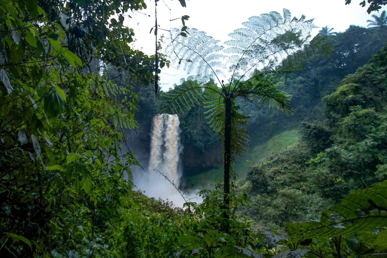
Haut-Nkam, the West's south-western division: Bafang on the Douala road, the Mouankeu falls and the chiefdoms of Bana, Banka and Bandja.
Subdivisions of Haut-Nkam Division
Haut-Nkam Division has 7 subdivisions.
Bafang
Chief town: Bafang
Bakou
Chief town: Bakou
Bana
Chief town: Bana
Bandja
Chief town: Bandja
Banka
Chief town: Banka
Banwa
Chief town: Banwa
Kékem
Chief town: Kékem
Places in Haut-Nkam Division
Where it is and what it's like
Haut-Nkam covers 958 km² in the south-west of the region. It borders Menoua, the Hauts-Plateaux and Ndé within the West, and the Littoral's Nkam and Moungo divisions. The statistics office counts it among the region's high plateaux, at around 1,500 m. Bafang lies in a valley ringed by hills and mountains, drained by the Mouankeu, a tributary of the Matchingo in the basin of the Nkam.5,1,6
People
The statistics office and City Population give 144,786 people at the 2005 census, against 137,386 in 1987; French Wikipedia gives 144,285, 44.6% of them urban. The 2010 projection was 150,278. Kékem (31,542), Bandja (30,931) and Bafang (29,821) were the most populous subdivisions in 2005. Fe'fe', also called Nufi, is the Bamiléké language spoken around Bafang. French Wikipedia lists Bana, Banka and Bandja as first-degree chiefdoms; the statistics office's 2023 list names Bana and Banka.1,2,5,7
History
What it's known for
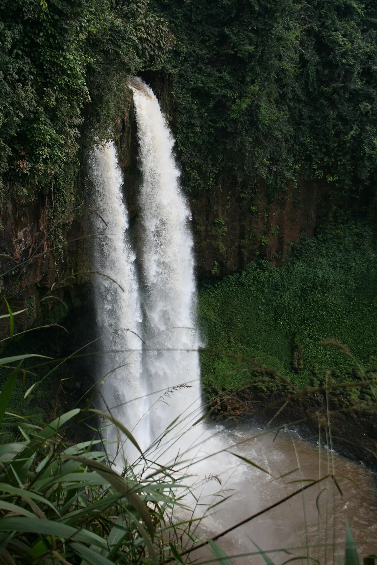
The site lists the Mouankeu falls at the entrance to Bafang, which OpenStreetMap places in Bafang commune. Their height differs between two French Wikipedia pages: about 40 m on the Haut-Nkam page and about 20 m on the page about the falls. The Haut-Nkam page also lists the Bakassa falls near Bana, the Tūwū falls at Banka and the Ekom falls, about 80 m high, used as a setting for the film Greystoke. The site lists Ekom-Nkam under the Littoral's Moungo division, because sources disagree on which bank of the Nkam they belong to.4,5,8
Main towns and getting there
Bafang, which French Wikipedia calls the southern gateway to Bamiléké country, forms one built-up area with Banka on National Road 5 between Douala and Bafoussam. It lies 63 km south-west of Bafoussam according to French Wikipedia, and 60 km according to the statistics office. By road from Bafoussam, Bandja is 43 km, Banka 58 km, Bakou 70 km, Bana 71 km, Kékem 86 km and Banwa 88 km.6,1
Map
Still to confirm
Our sources can't yet confirm these points:
- The height of the Mouankeu falls (about 20 m or about 40 m on French Wikipedia; the site's place page gives 20 to 60 m)
- Whether Bandja is a first-degree chiefdom
- Which bank of the Nkam, and so which division, the Ekom-Nkam falls officially belong to
Sources for this page
Information checked on 19 November 2026. It may have changed since.
- Annuaire statistique de la région de l'Ouest, édition 2024: chapter 1 (relief, soils, rivers), Tableaux 1.1, 1.4, 2.1, 2.2 and 4.2 (sources: Governor's office, DR-MINTP, DR-ELECAM, BUCREP), Institut national de la statistique, Agence régionale de l'Ouest (undated)
- Cameroon: administrative division, census counts of 1987 and 2005 by division and arrondissement, City Population (Thomas Brinkhoff), citing BUCREP (19 November 2026)
- OpenStreetMap Nominatim: boundary relations of Haut-Nkam and its subdivisions (lookup), OpenStreetMap contributors / Nominatim (19 November 2026)
- OpenStreetMap: boundary of Bafang commune, which contains the site's place coordinates (Overpass is_in query), OpenStreetMap contributors (19 November 2026)
- Haut-Nkam, Wikipédia (19 November 2026)
- Bafang, Wikipédia (19 November 2026)
- Fe'fe' language, Wikipedia (19 November 2026)
- Chutes de la Moakeu, Wikipédia (19 November 2026)