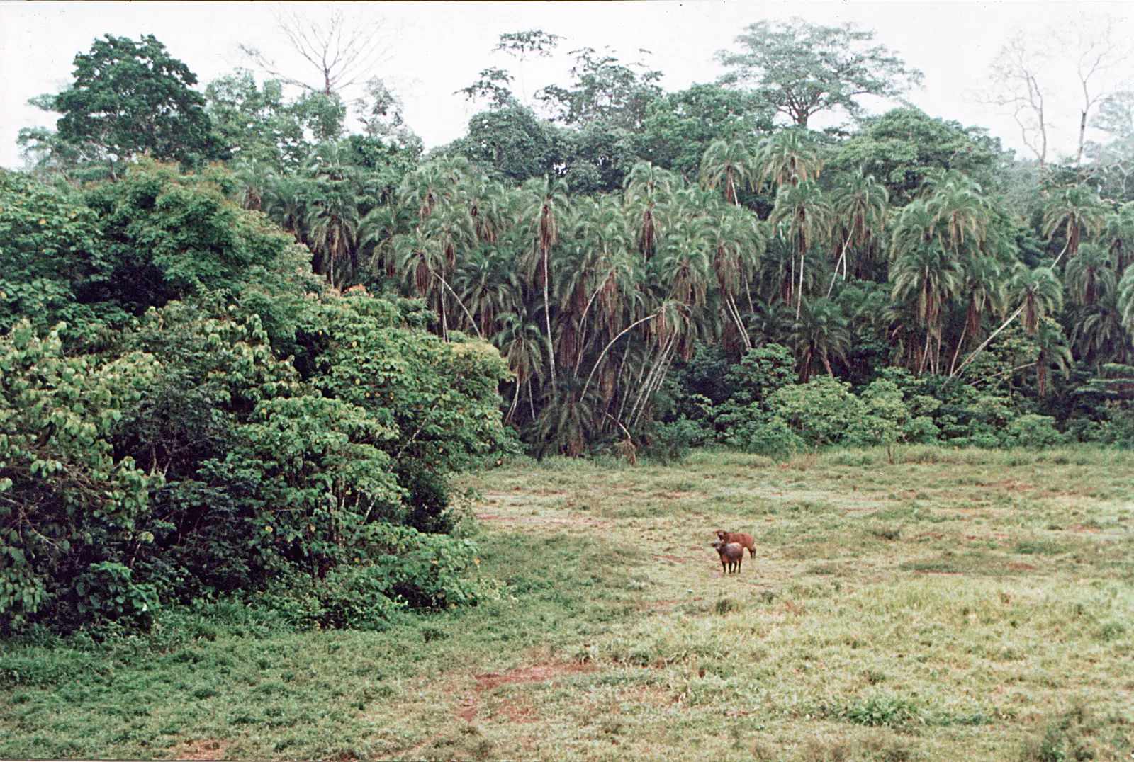
- Forest clearings
- About 73 recorded2
A hilly forest on the Dja
Nki covers 309,362 ha of rainforest in south-eastern Cameroon, on the border with Congo. It spans two administrative units of the East region, Ngoyla in Haut-Nyong and Moloundou in Boumba-et-Ngoko. The Dja River runs along its southern and south-western edge. The Nki Falls, around 14°30'E, mark the point beyond which the river can't be navigated, and Cameroon's 2018 heritage submission also names the Chollé rapids.1,2,3
The ground is hillier than in neighbouring Boumba-Bek, and WWF describes the park as largely inaccessible, which has kept most of its forest intact. It has never been logged.2,3
How the park came about
Boumba-Bek and Nki were first set aside as protection zones in 1995. They became national parks by decrees of October 2005: Cameroon's submission dates the decrees to 6 October, and a WWF release of 11 October announced them. Together they form what the submission calls Cameroon's largest protected area, and in 2018 Cameroon placed them on its tentative list for World Heritage status.1,8,6
Wildlife
WWF counted about 73 bais, of which six are monitored, including Ikwa. Elephants, gorillas, sitatunga and buffalo are the animals seen most often there. A 20-day bird survey recorded about 265 species, including the Dja River scrub warbler.2,3
Older figures are hopeful, newer ones less so. WWF reported elephants rising to about 3,000 by 2006. The IUCN ape portal, updated in 2025, estimates about 3,421 gorillas and chimpanzees in 2015, down from 11,417 in 2012, and rates poaching for bushmeat and ivory as the main threat. That contrasts with a 2001 factsheet which said poachers rarely reached the site.2,3,4
People
About 22,900 people live around the park, mostly Baka and Bantu peoples including the Djem, Bangando, Bakwele and Zime, in villages some 40 km from Yokadouma, Moloundou and Lomié.2
Access
There is no visitor infrastructure that we could find. The main way in is the Dja, and a 2001 factsheet says arranging a boat trip upriver from Moloundou is very difficult. A travel blog puts the boat journey from Moloundou to the Nki Falls at about five hours. A 2024 USAID tourism assessment left Nki out of its priority sites because stakeholders judged tourism there hard to develop in the near term.3,5,7
Map
What visitors say
We summarise accounts published elsewhere and link to the original. These aren't reviews collected by this site, and we don't show a rating.
We haven't yet found a published visitor account for this place.
Check before you go
Our sources can't yet confirm these points:
- Whether the park accepts visitors, and how to arrange a trip
- Any entry fee or guide charges
- A contact for the park conservation service
- Whether boats to the Nki Falls can be hired in Moloundou, and the journey time
- Current wildlife estimates for elephants
Also nearby
Sources for this page
Information checked on 9 November 2026. It may have changed since.
- Le Complexe des Parcs Nationaux de Boumba Bek et de Nki (tentative list), UNESCO World Heritage Centre, submitted by Cameroon's Ministry of Arts and Culture (2 February 2018)
- Three National Parks of Southeast Cameroon, WWF Jengi Southeast Forests Programme (2007 (file date))
- Nki (KBA 6135), Key Biodiversity Areas / BirdLife International (last assessed 2001)
- Nki National Park, IUCN SSC A.P.E.S. Portal (3 November 2025)
- Congo Basin Nature-Based Tourism Assessment: Cameroon, USAID FABS (report by Lillian Herbert) (2024-03)
- Cameroon decrees two new national parks (WWF news release, republished), WWF International, via Agência Ecologia (11 October 2005)
- Parc national de Lobéké (Cameroun) : activités variées, Bouger & Voyager (travel blog) (undated)
- Case study 7, Cameroon - Boumba Bek: protected areas and indigenous peoples, Benoît Ndameu, Forest Peoples Programme (2001-07)
Enquire about Nki National Park
Visit Nki National Park
Plan your trip to Nki National Park in the East Region. Send us an enquiry about guided tours, accommodation and transport, and we'll reply by email.
Send an enquiryEast Region
Capital: Bertoua
Cameroon's largest and most sparsely populated region, the East runs from wooded savanna around Bertoua to rainforest on the borders with the Central African Republic and Congo. It includes the Dja and Lobéké World Heritage areas.
More places in the East Region
Lobéké National Park
A rainforest park on the Sangha River and part of the Sangha Trinational World Heritage Site, where forest elephants, gorillas and bongo come out into open clearings called bais.
Dja Faunal Reserve
A World Heritage rainforest of about 5,260 km² in southern and eastern Cameroon, almost encircled by the Dja River. It is home to western lowland gorillas, chimpanzees and forest elephants, and is explored on foot from Somalomo.
Boumba Bek National Park
A lowland rainforest park enclosed by the Boumba and Bek rivers, where forest buffalo graze in rocky clearings and gorillas and chimpanzees live in forest that has never been logged.
Bélabo Railway Station
A railway town on the Sanaga, where the Transcamerounais arrived in 1969 and which served as the line's end until it reached Ngaoundéré in 1974. Timber from the east has long been loaded here.