- World Heritage
- Since 2012, as part of the Sangha Trinational1
- Altitude
- 300 to 750 m3
- Entry fee
- 5,000 FCFA for foreigners (2024 report)6
A rainforest park on the Sangha
Lobéké lies in the far south-east of Cameroon, in the Moloundou subdivision of Boumba-et-Ngoko. Its eastern edge is the wide, sandy Sangha River, which forms the border with the Central African Republic and Congo. Most of its semi-evergreen forest has never been logged.2,3
Since 2012 the park has been part of the Sangha Trinational World Heritage Site, with Dzanga-Ndoki in the Central African Republic and Nouabalé-Ndoki in Congo, 746,309 ha in all. UNESCO notes that, unlike its neighbours, Lobéké has zones within the park where local people may use resources.1
Sources differ on its size and age. WWF gives 217,854 ha, the IUCN ape portal 2,153 km² and the bird-area factsheet about 1,839 km². WWF and BirdLife date its creation to March 2001, while Wikipedia gives October 1999.2,3,4,8
Forest clearings and wildlife
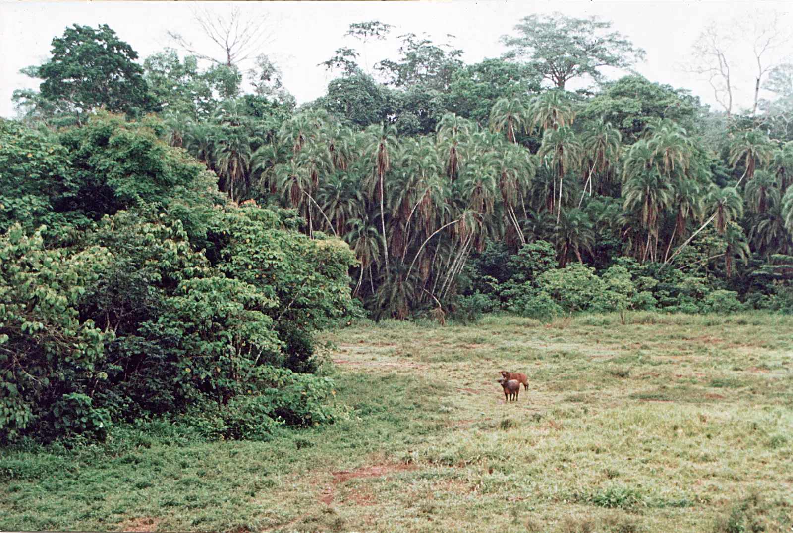
The park is known for its bais, open clearings with mineral-rich soils that draw animals out of the forest. WWF counted more than 14, and park teams monitor seven of them: Bolo, Djaloumbe, Djangui, Ndangaye, Ngoa, Petite Savane and Samba.2
Forest elephants, western lowland gorillas, chimpanzees, sitatunga and bongo live here. Between 305 and 335 bird species have been recorded, depending on the source, and the sedge marshes hold the Dja River scrub warbler. Numbers are under pressure: the IUCN portal shows great ape estimates falling from 6,360 in 2002 to 2,658 in 2015, and grey parrots are trapped in thousands for trade.1,2,3,4
People
Visiting the clearings
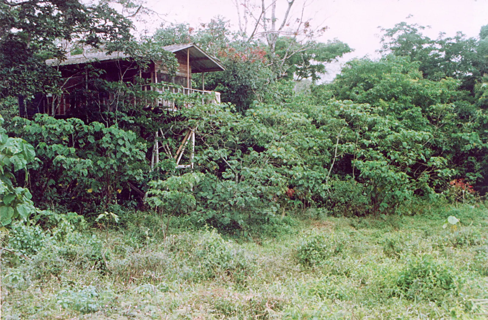
Visits are on foot with guides and porters. A 2024 assessment for USAID says three or four bais have wooden viewing platforms where visitors can camp overnight. The Petite Savane is about three hours' walk from the drop-off point, and the larger Grand Savane, or Djangui, three to four hours further. Ndangaye is harder to reach. Campsites are basic, with no built facilities.6,7
Few people make the trip: 96 visitors in 2016 and slightly over 100 in 2024. Gorilla habituation for visits is still at an early stage.5,6
How to get there
All visitors check in at the park headquarters in Mambélé. From Yaoundé, the USAID assessment describes about 340 km of tarred road to Bertoua, then about 300 km of maintained dirt road to Yokadouma, before the final stretch south. Allow about two days. Mongabay's reporters needed two days by road (2025 article), and the park's conservator calls poor roads the main barrier to visits.5,6
International flights arrive at Yaoundé-Nsimalen. The park can also be combined with Dzanga-Sangha in the Central African Republic: in 2023 the road from Mambélé to the Libongo border post was passable again after years without a working bridge.6,7
When to go
Where to stay
In pictures
Map
What visitors say
We summarise accounts published elsewhere and link to the original. These aren't reviews collected by this site, and we don't show a rating.
Found the wildlife viewing better than expected, with a bongo seen on the drive in and thousands of green pigeons at the Grand Savane each evening, but warns that the campsites are very basic, the walking is hard and the two-day drive from Yaoundé is long.
Tom Clode, Pictus Safaris (tour operator), April 2023
Check before you go
Our sources can't yet confirm these points:
- The current entry fee and any guide, porter or camping charges
- How to arrange a visit, and a contact at the park headquarters in Mambélé
- Whether Kombo Camp and the riverside Djembe camp are open to visitors
- The state of the viewing platforms
- Road conditions from Yokadouma, by season
Also nearby
Sources for this page
Information checked on 9 November 2026. It may have changed since.
- Sangha Trinational, UNESCO World Heritage Centre (undated)
- Three National Parks of Southeast Cameroon, WWF Jengi Southeast Forests Programme (2007 (file date))
- Lobéké National Park (KBA 6136), Key Biodiversity Areas / BirdLife International (last assessed 2001)
- Lobéké National Park, IUCN SSC A.P.E.S. Portal (22 July 2025)
- From porter to conservation leader: the inspiring journey of Marlyse Bebeguewa in Cameroon, Mongabay (23 June 2025)
- Congo Basin Nature-Based Tourism Assessment: Cameroon, USAID FABS (report by Lillian Herbert) (2024-03)
- Pictus Safaris trip report: Cameroon and Central African Republic, April 2023, Pictus Safaris (tour operator), on Mammalwatching.com (2023-07)
- Lobéké National Park, Wikipedia (undated)
East Region
Capital: Bertoua
Cameroon's largest and most sparsely populated region, the East runs from wooded savanna around Bertoua to rainforest on the borders with the Central African Republic and Congo. It includes the Dja and Lobéké World Heritage areas.
More places in the East Region
Dja Faunal Reserve
A World Heritage rainforest of about 5,260 km² in southern and eastern Cameroon, almost encircled by the Dja River. It is home to western lowland gorillas, chimpanzees and forest elephants, and is explored on foot from Somalomo.
Nki National Park
A remote, hilly rainforest park on the Dja River, where the Nki Falls mark the limit of navigation and elephants, gorillas and sitatunga gather in forest clearings.
Boumba Bek National Park
A lowland rainforest park enclosed by the Boumba and Bek rivers, where forest buffalo graze in rocky clearings and gorillas and chimpanzees live in forest that has never been logged.
Bélabo Railway Station
A railway town on the Sanaga, where the Transcamerounais arrived in 1969 and which served as the line's end until it reached Ngaoundéré in 1974. Timber from the east has long been loaded here.