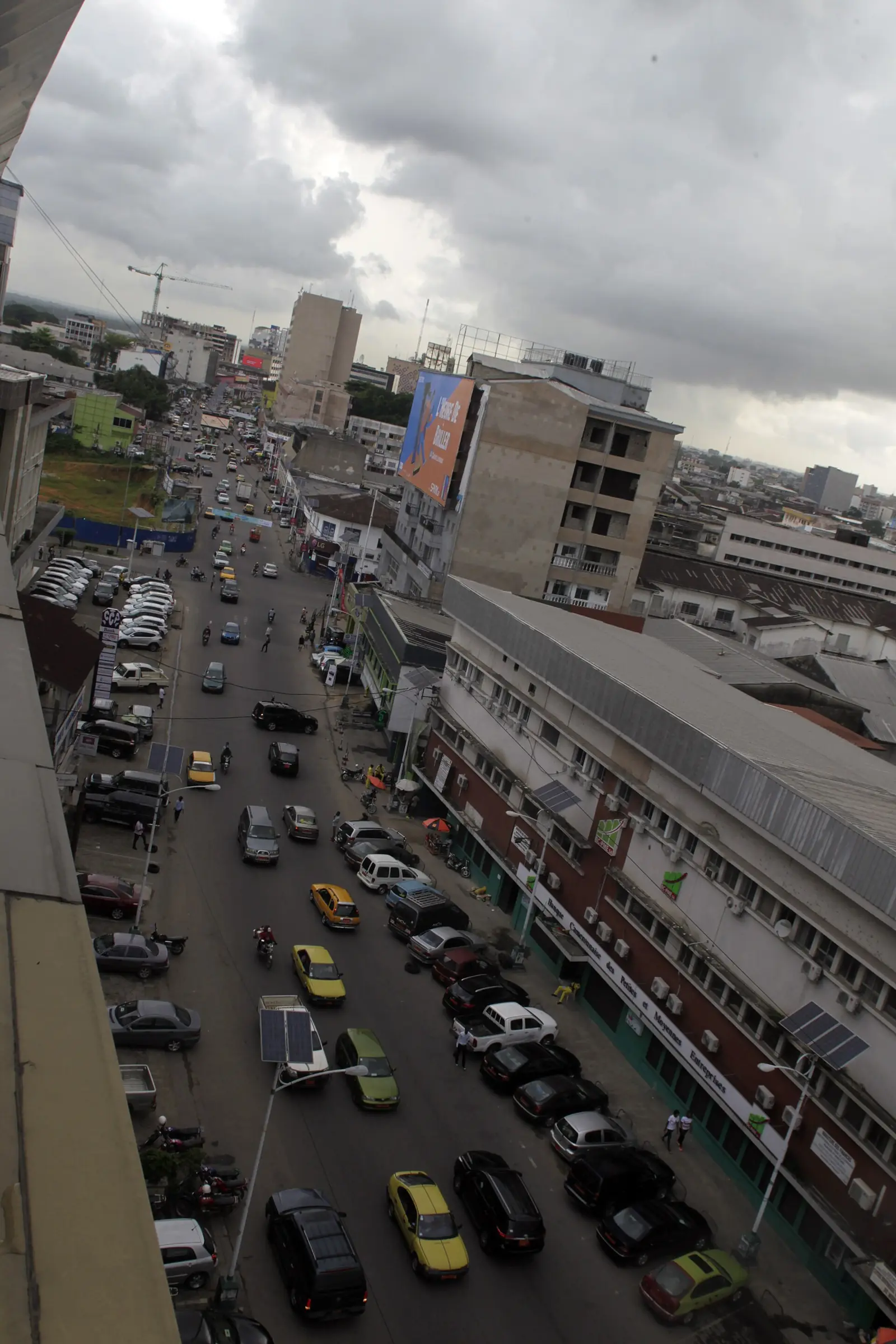
Douala I, the historic heart of Douala: Akwa, Bonanjo, Deïdo, Bali and Bonapriso, home to the Akwa, Bell and Deïdo chiefdoms and the port.
What to see
18 places in Douala I, each with its sources.
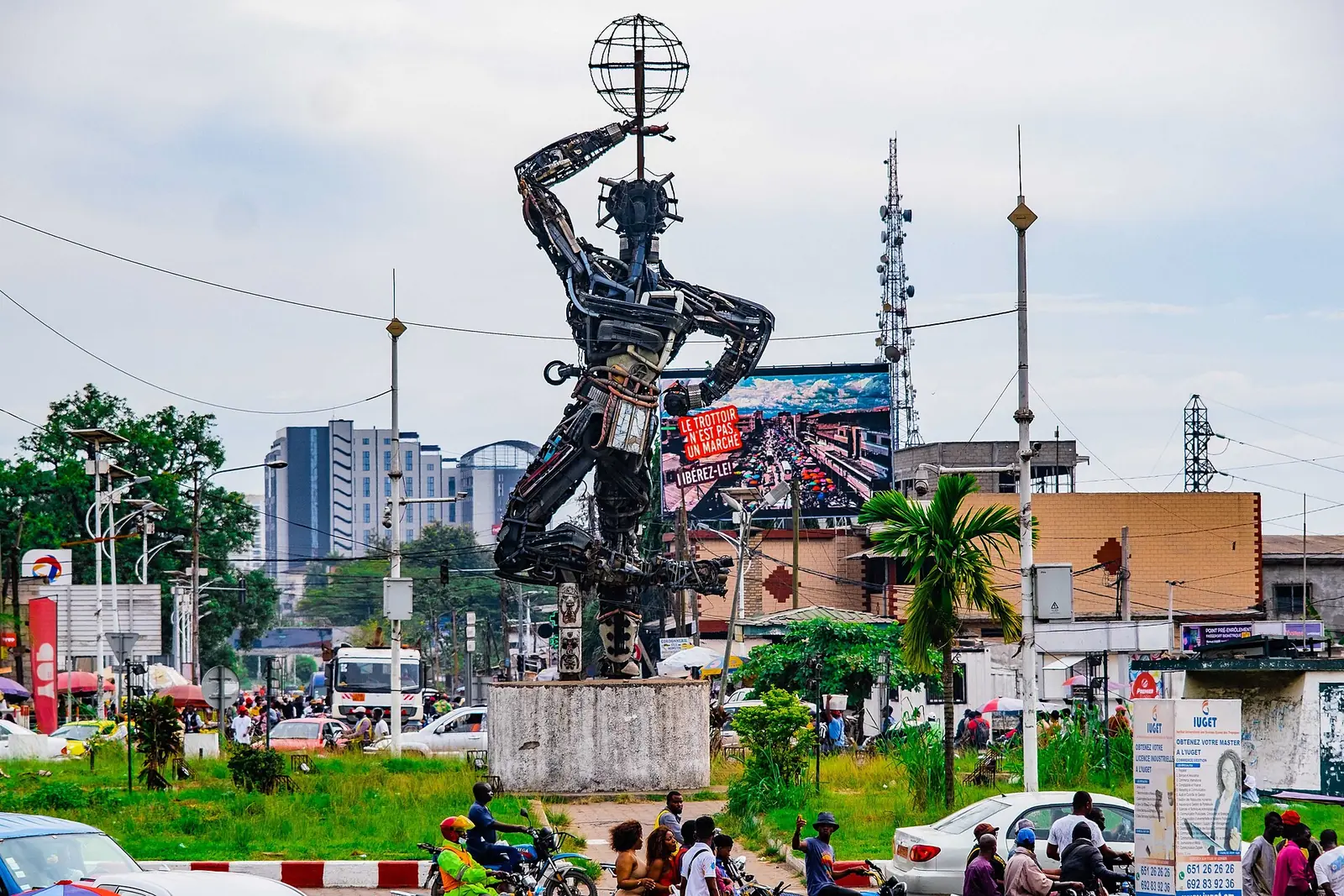
La Nouvelle Liberté
Deïdo, Douala I
Joseph-Francis Sumégné's 12-metre figure of salvaged metal, raised in 1996 on the Deïdo roundabout and now the best-known symbol of Douala.
Read the full guide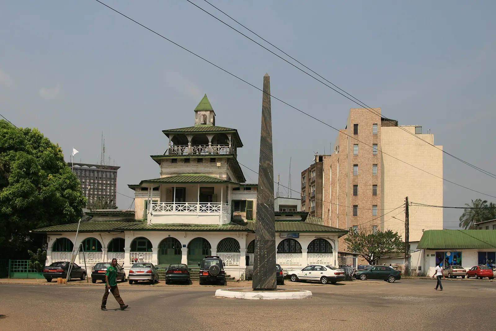
Sud-Obelisk
Bonanjo, Douala I
Faouzi Laatiris's black marble obelisk, made for SUD 2007, engraved in gold with the names of other cities with obelisks, in Bonanjo.
Read the full guide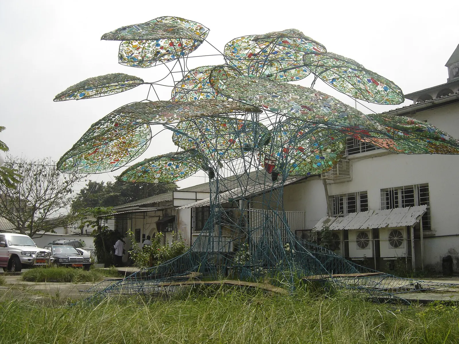
Palaver Tree of Bonambappe
Bonanjo, Douala I
Frédéric Keiff's palaver tree of painted steel bars, coloured glass leaves and wooden benches, set in a Bell family garden in Bonanjo in 2007.
Read the full guide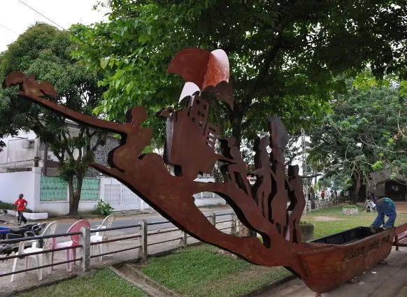
The Celestial Canoe
Bonapriso, Douala I
Hervé Youmbi's canoe with a figurehead cut from metal, made with young people of Bonapriso for SUD 2010 and set on the former airport esplanade.
Read the full guide
Sound garden of Bonamouti
Bonamouti, Deïdo, Douala I
Lucas Grandin's three-level wooden tower on the Wouri bank: a river viewpoint, a hanging garden and an organ played by drops of rainwater.
Read the full guide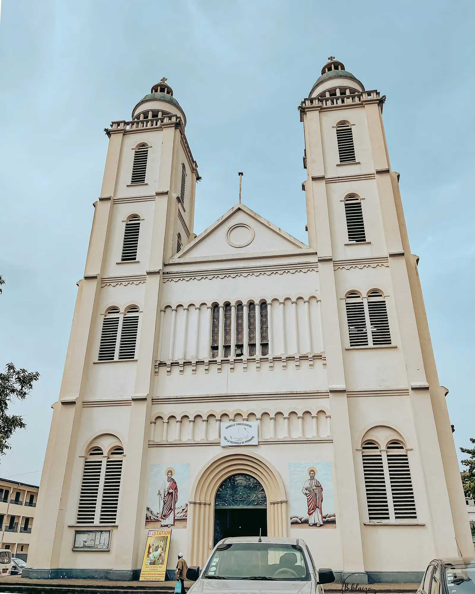
Saints Peter and Paul Cathedral
Akwa (Bonadibong), Douala I
Douala's Catholic cathedral, consecrated in 1936, with twin bell towers, domes and a Byzantine air, on rue Joss at Bonadibong in Akwa.
Read the full guide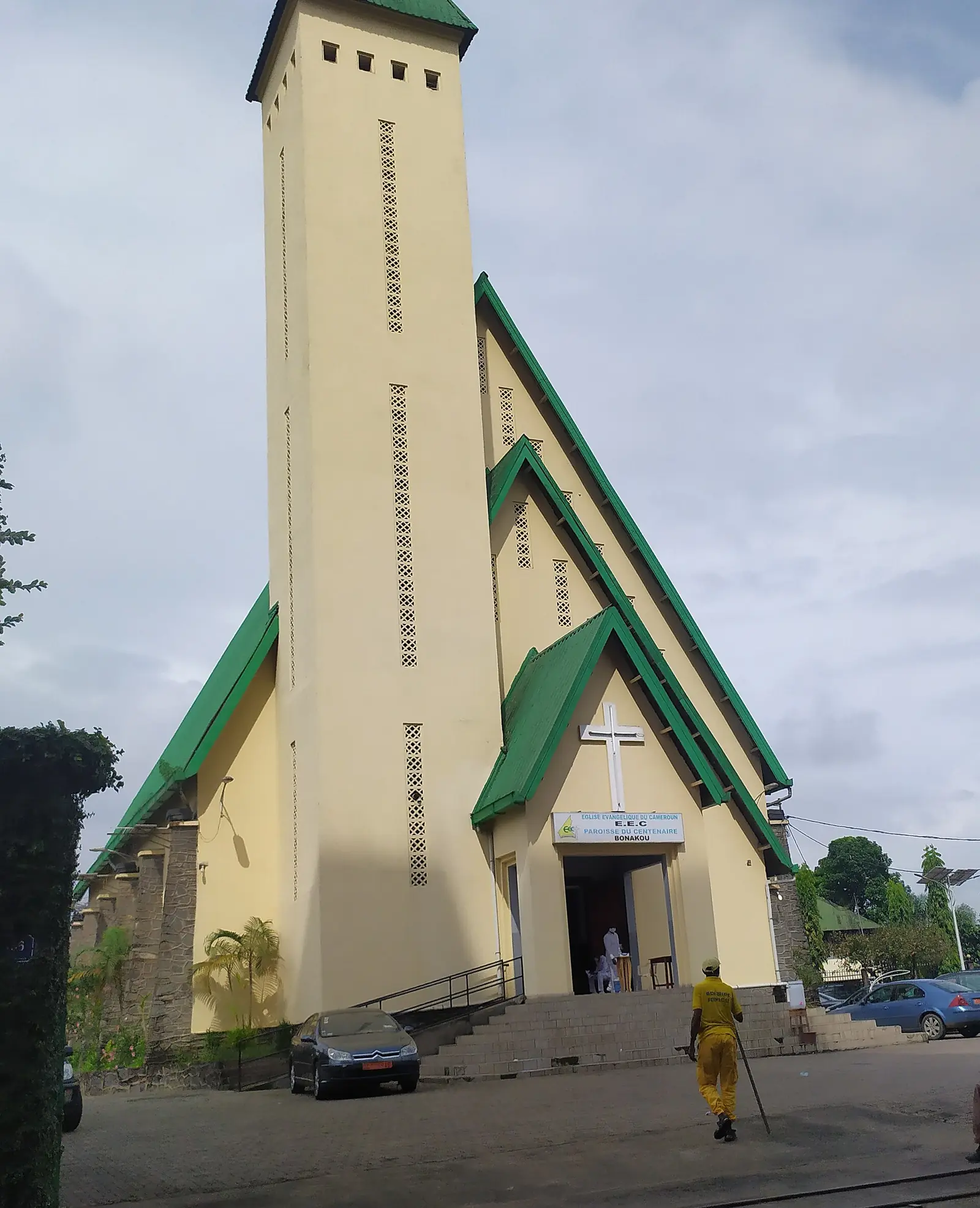
Centenary Temple
Akwa, Douala I
The Evangelical Church of Cameroon's mother church in Akwa, built in 1947 to mark a century since Bethel, Douala's first church.
Read the full guide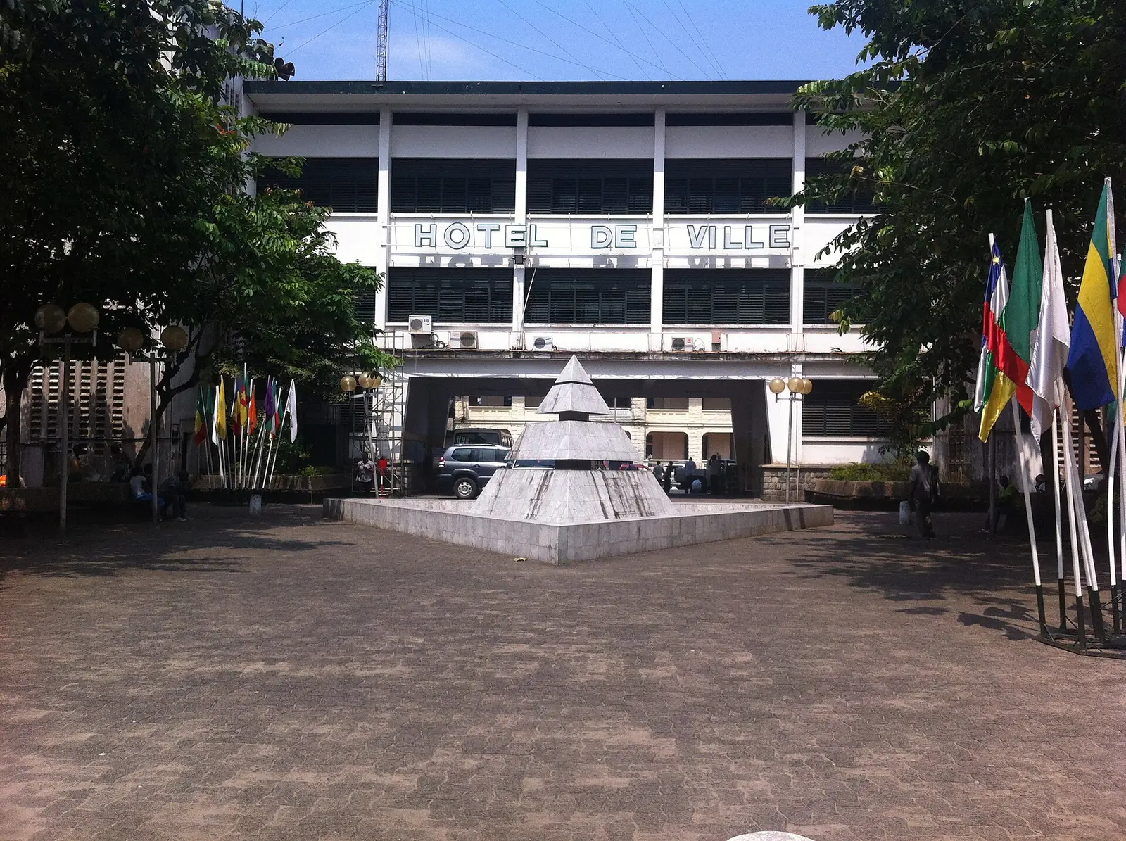
Bonanjo colonial quarter
Bonanjo, Douala I
Douala's administrative quarter on the Joss plateau, with German and French colonial buildings from 1891 to the 1930s around Place du Gouvernement.
Read the full guide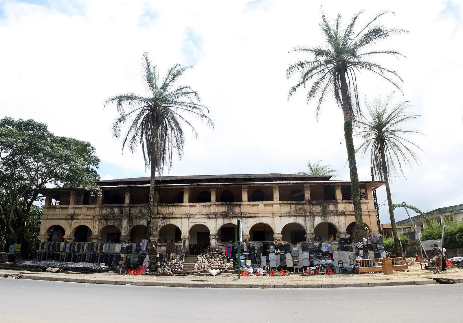
Villa Mandessi Bell
Bonanjo, Douala I
A brick house of the German period in Bonanjo, built from 1904 to 1910 for the planter David Mandessi Bell, and reported in ruins.
Read the full guide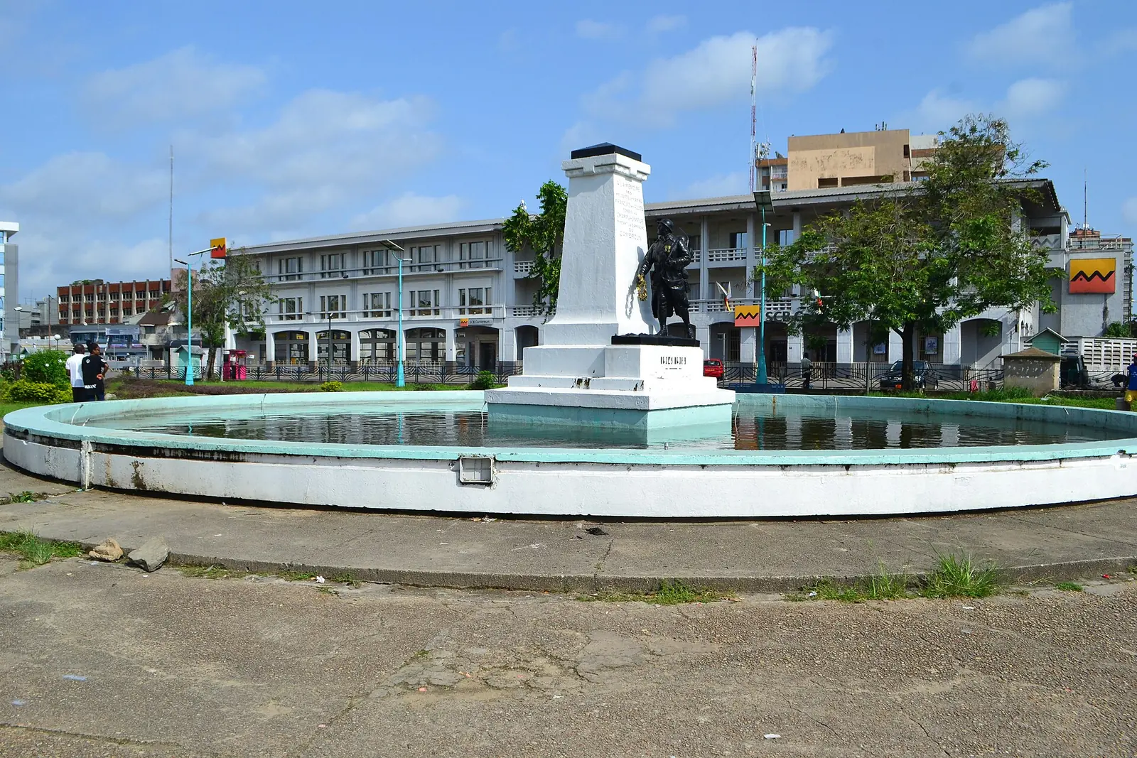
War memorial (Unknown Soldier)
Bonanjo, Douala I
A bronze French soldier in a fountain on Bonanjo's Place du Gouvernement, honouring those who died in the First World War Cameroon campaign.
Read the full guide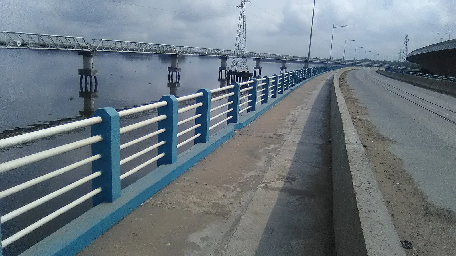
Wouri bridges
Deïdo to Bonabéri, Douala I
The 1,830 m concrete bridge of 1955 and the road and rail bridge of 2017 that link central Douala to Bonabéri across the Wouri.
Read the full guide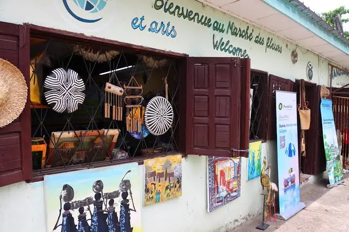
Marché des Fleurs
Bonapriso, Douala I
Florists' stalls by the Artisanat central in Bonapriso, selling bouquets, wedding flowers and funeral sprays, mostly grown in Cameroon.
Read the full guide- No openly licensed photo yet
Galerie MAM
Bonanjo (or Bali, per OpenStreetMap), Douala I
A 300 m² contemporary art gallery opened in 1995 by Marème Malong, showing African artists in Douala and taking them to international fairs.
Read the full guide 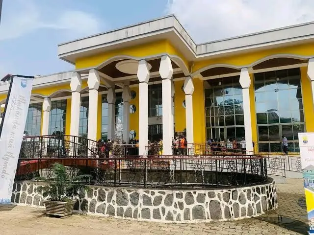
Maison des arts et de la culture Sawa
Besseké, Bonanjo (Bali, per OpenStreetMap), Douala I
The canoe-shaped museum and cultural centre of the coastal Sawa peoples and seat of the Ngondo, opened in the Bessèkè valley in December 2023.
Read the full guide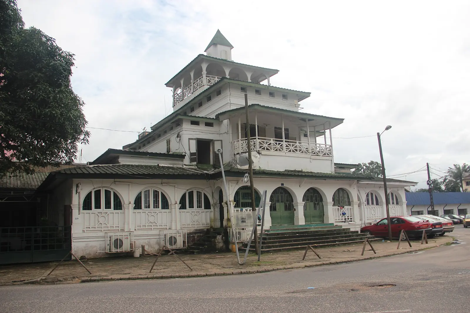
La Pagode (Palace of King Bell)
Bonanjo, Douala I
The former palace of the Bell kings in Bonanjo, Douala, built in 1905 and still owned by the Bell family. It was home to Rudolf Duala Manga Bell, hanged by the German authorities in 1914.
Read the full guide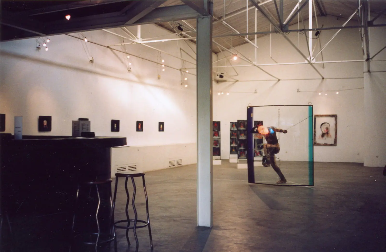
doual'art (Espace doual'art)
Bonanjo, Douala I
A non-profit contemporary art centre founded in Douala in 1991, with a gallery in Bonanjo and public artworks around the city. It organises SUD, the Salon Urbain de Douala.
Read the full guide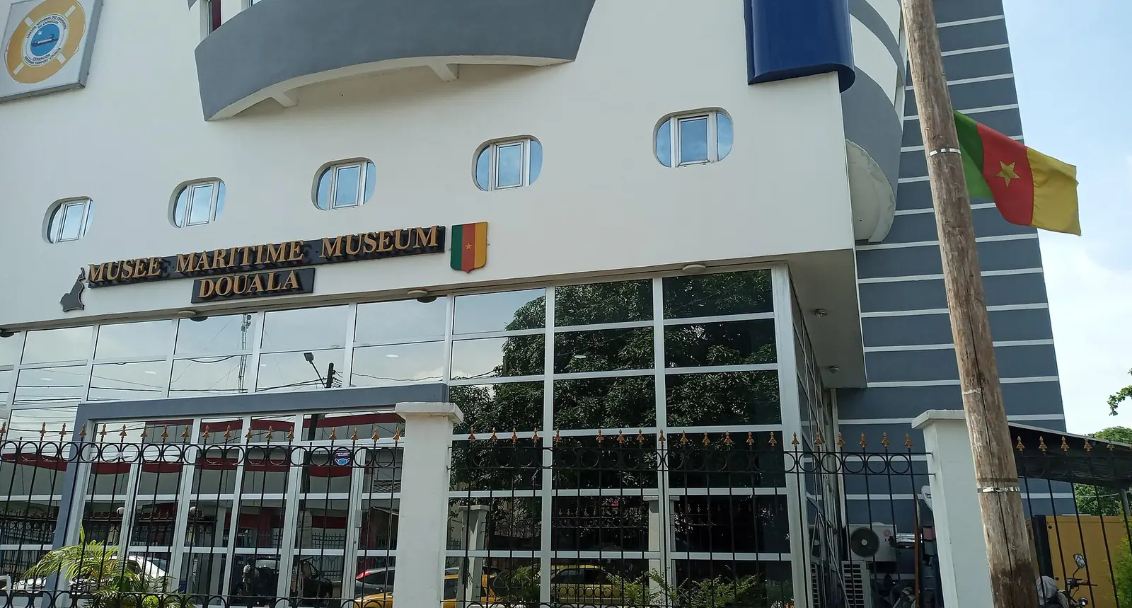
Douala Maritime Museum
Bonanjo, Douala I
A ship-shaped museum in Douala's Bonanjo district on Cameroon's coast, ports and ships, with a recreated ship's bridge and a navigation simulator.
Read the full guide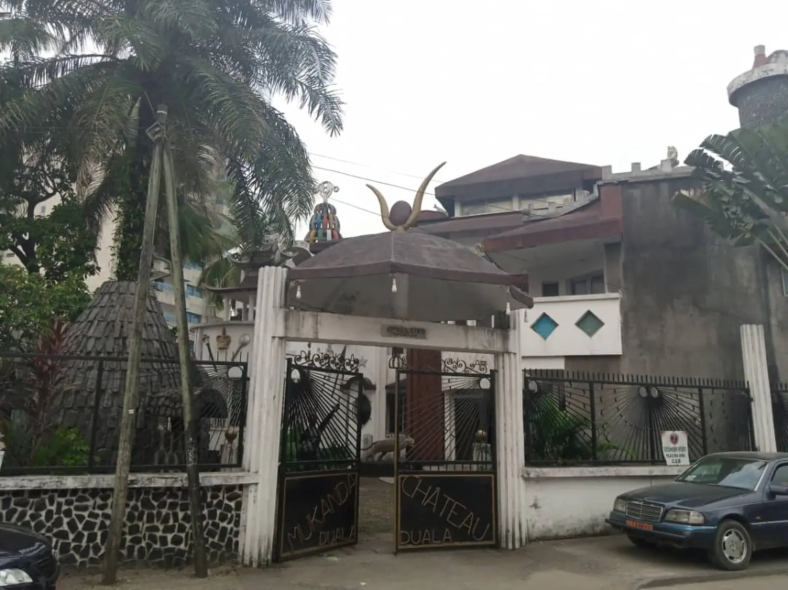
Dika Akwa palace
Akwa (Vallée Bessengué, per OpenStreetMap), Douala I
The white palace called Mukanda, built after independence by Prince Dika Akwa and long the seat of the Ngondo, the Sawa peoples' assembly.
Read the full guide
Douala's historic centre
Douala I covers the centre of the city on the left bank of the Wouri estuary. The Banya river separates it from Douala V to the north, and the Wouri bounds it to the south and west. The city's only expressway crosses it end to end, and most of the main boulevards are here. Its borough council, based in Bonanjo, was created by decree 87/1366 of 24 September 1987, which set up the Douala urban community.1,2
The 2005 census counted 223,214 people. The statistics office gives an area of 13 km², French Wikipedia 26.3 km². French Wikipedia notes that Douala I's share of the city's people fell from 20% in 1987 to 12% in 2005.4,1
Jean-Jacques Lengue Malapa has been mayor since 2007, according to French Wikipedia. Cameroon Tribune reported a council session he chaired on 28 October 2026, at which 2025 revenue was put at 3.265 billion CFA francs. Councils elected in February 2020 have had their mandate extended to 28 February 2027.1,2,6,7
Quarters
The council lists about 30 quarters and villages, among them Akwa, Bonanjo, Bali, Bonapriso, Deïdo, Joss, Koumassi, Ngodi and the newer zones of Akwa Nord and New-Deido. Akwa, named after King Akwa, was already densely settled in the early 19th century and is now the commercial heart, busy day and night. Bali, historically Bonamandone, became the second seat of the Bell royal family after the German expropriation of the Joss plateau. Bonapriso was founded by Priso a Doo la Makongo, who built villas on what were then swampy fields. Deïdo takes in Bessengué, Bonatéki, Grand Moulin and Bonamouti.2,1,8
Chiefdoms and history
Three of the Wouri division's six first-class traditional chiefdoms have their seat here: Akwa, Bell and Deïdo. Urban growth began under German rule. After 1910 the town plan separated European and African areas with a strip of unbuilt land: public services and European homes were to go in Joss, Bali and Akwa, and African quarters in New Deido, New Akwa and New Bell.1
Port, business and institutions
French Wikipedia lists the Port autonome de Douala among the subdivision's main economic sites, with Bonanjo's banks and head offices, the Central African stock exchange (BVMAC) on boulevard de la Liberté, the city's main shopping street, and Bessengué railway station. Laquintinie hospital at Ngodi Akwa and the Deïdo district hospital are the main public hospitals. The Stade de la Réunification, built in 1970 in the Bépanda hollow, holds 30,000, and the Mbappé Leppé stadium, formerly the Akwa stadium, dates from the 1950s.1,3
What to see
Most of the city's landmarks are in Douala I: the colonial buildings and monuments of Bonanjo, the cathedral and the Centenary Temple in Akwa, and doual'art's public artworks from Deïdo to Bonapriso. The regional tourism office's list adds the Dika Akwa palace, the Place de la douche municipale and the Dernier Comptoir Colonial.9
Getting around
Douala I is the hub of the city's traffic. The Deïdo roundabout leads to the Wouri bridges and Bonabéri, and the expressway runs through the subdivision. Trains to Yaoundé leave from Bessengué station.1
Map
What visitors say
We summarise accounts published elsewhere and link to the original. These aren't reviews collected by this site, and we don't show a rating.
We haven't yet found a published visitor account for this place.
Check before you go
Our sources can't yet confirm these points:
- Which of the two area figures is right: 13 km² (INS) or 26.3 km² (French Wikipedia)
- What the 'Dernier Comptoir Colonial' and the 'Place de la douche municipale' on the regional tourism office's list are, and where they stand
- Whether the Dika Akwa palace can be visited, and on what terms
- Whether Jean-Jacques Lengue Malapa served continuously from 2007: Osidimbea's table names him only from 2020
Sources for this page
Information checked on 18 November 2026. It may have changed since.
- Douala I, Wikipedia (French) (6 April 2026)
- Commune d'arrondissement de Douala 1er, Osidimbea, la mémoire du Cameroun (undated)
- OpenStreetMap Nominatim: searches and reverse lookups for Douala's town halls, quarters and sights, OpenStreetMap contributors / Nominatim (18 November 2026)
- Annuaire statistique de la région du Littoral, édition 2023: Tableau 2-1 (administrative map), Tableau 4-2 (area and population by arrondissement, 2005 census), Tableau 4-3 (projections 2017–2020) and chapter 1 (relief), Institut national de la statistique, Agence régionale du Littoral (undated)
- Cameroon: administrative division (2005 census by arrondissement, from BUCREP and INS), City Population (Thomas Brinkhoff) (undated)
- Douala I : les recettes s'améliorent, Cameroon Tribune (3 November 2026)
- Mandate of municipal councillors extended from June 1, 2026 to February 28, 2027, CRTV (4 May 2026)
- Quartiers de Douala, Wikipedia (French) (1 October 2026)
- Le Littoral en chiffres, édition 2023: Tableau 5-1, main tourist sites by arrondissement (source DRTOUR LT), Institut national de la statistique, Agence régionale du Littoral (undated)
Planning a trip to Douala I?
Tell us what you'd like to see, and Global Bush Travel will email you a quotation.