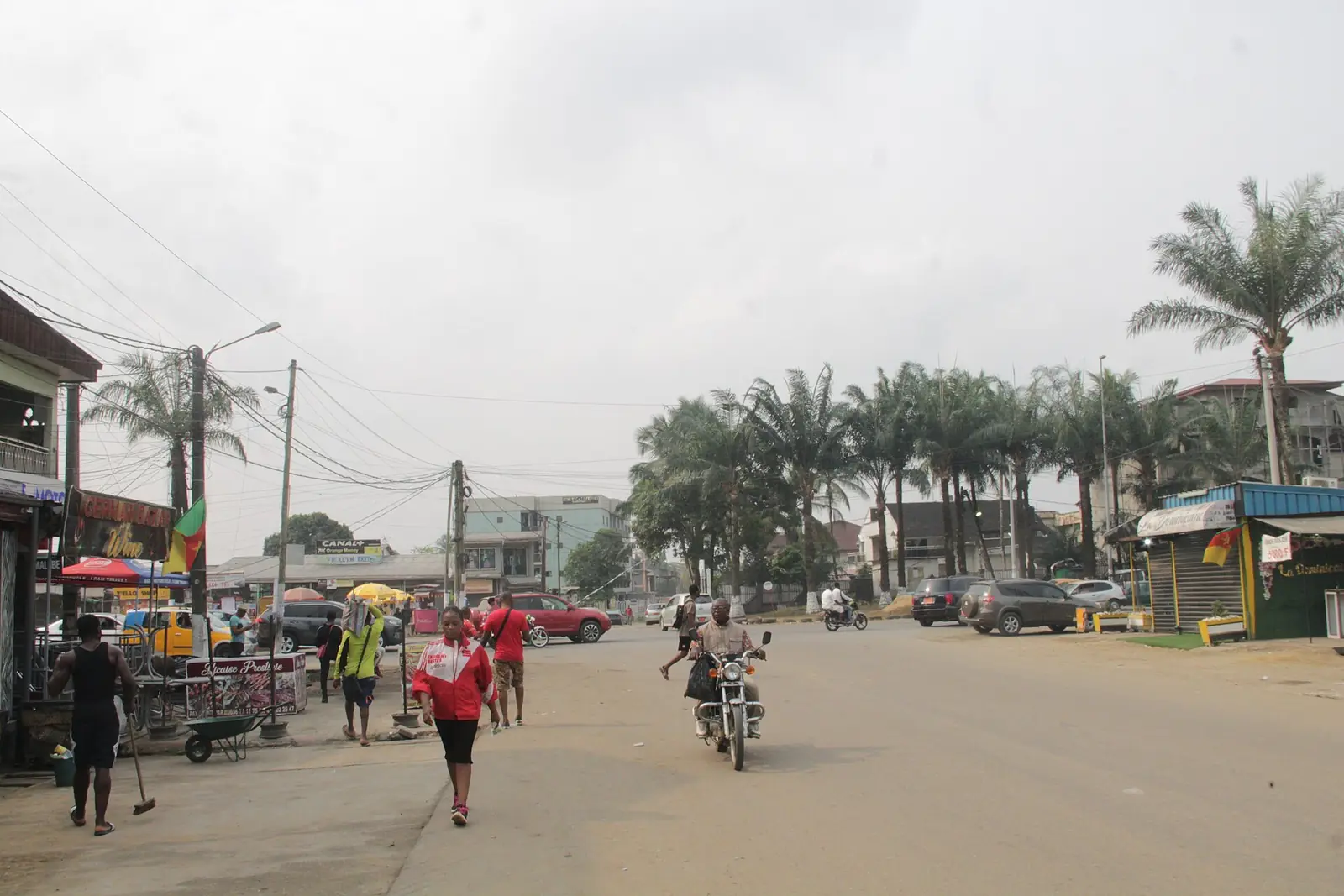
Douala V, the northern subdivision formed in 1993: Bonamoussadi, Kotto, Makèpè and Bépanda, home to more than half a million people in 2005.
Where it is
Douala V covers the north of the city, beyond the Banya river, which separates it from Douala I; Douala III lies to the south. French Wikipedia describes it as both urban and rural. It was created in 1993 by decree 93/321 of 25 November 1993, from part of Douala III; Osidimbea says the split took place in 1992. The 2005 census counted 544,919 people, second only to Douala III. Area figures differ widely: 62 km² from the statistics office, 50 km² from French Wikipedia and 210 km² from Osidimbea.1,8,2,5
The town hall is at Bonamoussadi, and the sub-prefecture at Kotto. Osidimbea records that the council's first three mayors died in office between 1996 and 2000, that the 2007 municipal elections were annulled by the Supreme Court, and that mayor Françoise Foning died in an accident in 2015. Richard Mfeungwang has been mayor since 2020. In October 2026 Cameroon Tribune reported the handover of a 1 km road in Denver-Bonamoussadi, paid for by the company MDC under an agreement he signed in February 2026. Councils elected in February 2020 have had their mandate extended to 28 February 2027.2,1,4,7,9
Quarters and villages
Douala V has 31 quarters and a set of older villages: the Ndogbong higher chiefdom, four villages of the Akwa canton (Bonamouang, Bonamoussadi, Bonangando and Bonangang) and ten of the Bassa canton, among them Kotto, Logbessou, Logpom, Makèpè and Ndogbatti. The newer quarters include the Bépanda neighbourhoods, Cité des Palmiers, Cité SIC, Makèpè, Kondi and the PK settlements on the roads north.1,2
Bonamoussadi, a contraction of the Duala 'Bona Mouangué nu sadi', the descendants of little Mouangué, grew from MAETUR and SIC housing estates and is known as a district of the new middle classes; in 2005 Bonamoussadi Cité had 34,767 people and Bonamoussadi village 10,614. Kotto, built by the SIC in the early 1980s, is a modern residential area. Denver and Santa Barbara are named after television series. Logbessou, a Bassa village shared with Douala III, grew from 167 people in 1968 to 4,752 in 2005.10,4,11,12
Markets and industry
The main markets are Bonamoussadi market and the Double-balle market in Bépanda. The SIC Cacaos factory, a subsidiary of Barry Callebaut, processes cocoa here, and French Wikipedia lists premises of the telecoms operator Camtel on rue de Deido Bassa.1
What to see
Map
What visitors say
We summarise accounts published elsewhere and link to the original. These aren't reviews collected by this site, and we don't show a rating.
We haven't yet found a published visitor account for this place.
Check before you go
Our sources can't yet confirm these points:
- The area of Douala V: 62 km² (INS), 50 km² (French Wikipedia) or 210 km² (Osidimbea)
- Whether Douala V was split from Douala III in 1992 or in 1993
- The main transport routes and public transport serving Bonamoussadi, Kotto and the PK settlements: no source found
- Which Bépanda neighbourhoods lie in Douala V and which in Douala I
- Any site of tourist interest in the subdivision
Sources for this page
Information checked on 18 November 2026. It may have changed since.
- Douala V, Wikipedia (French) (6 April 2026)
- Commune d'arrondissement de Douala 5ème, Osidimbea, la mémoire du Cameroun (undated)
- OpenStreetMap Nominatim: searches and reverse lookups for Douala's town halls, quarters and sights, OpenStreetMap contributors / Nominatim (18 November 2026)
- Quartiers de Douala, Wikipedia (French) (1 October 2026)
- Annuaire statistique de la région du Littoral, édition 2023: Tableau 2-1 (administrative map), Tableau 4-2 (area and population by arrondissement, 2005 census), Tableau 4-3 (projections 2017–2020) and chapter 1 (relief), Institut national de la statistique, Agence régionale du Littoral (undated)
- Cameroon: administrative division (2005 census by arrondissement, from BUCREP and INS), City Population (Thomas Brinkhoff) (undated)
- Douala V : une voie communale aménagée, Cameroon Tribune (26 October 2026)
- Douala I, Wikipedia (French) (6 April 2026)
- Mandate of municipal councillors extended from June 1, 2026 to February 28, 2027, CRTV (4 May 2026)
- Bonamoussadi (Douala), Wikipedia (French) (13 November 2026)
- Douala, Wikipedia (English) (11 November 2026)
- Logbessou, Wikipedia (French) (1 May 2025)
- Le Littoral en chiffres, édition 2023: Tableau 5-1, main tourist sites by arrondissement (source DRTOUR LT), Institut national de la statistique, Agence régionale du Littoral (undated)
Planning a trip to Douala V?
Tell us what you'd like to see, and Global Bush Travel will email you a quotation.