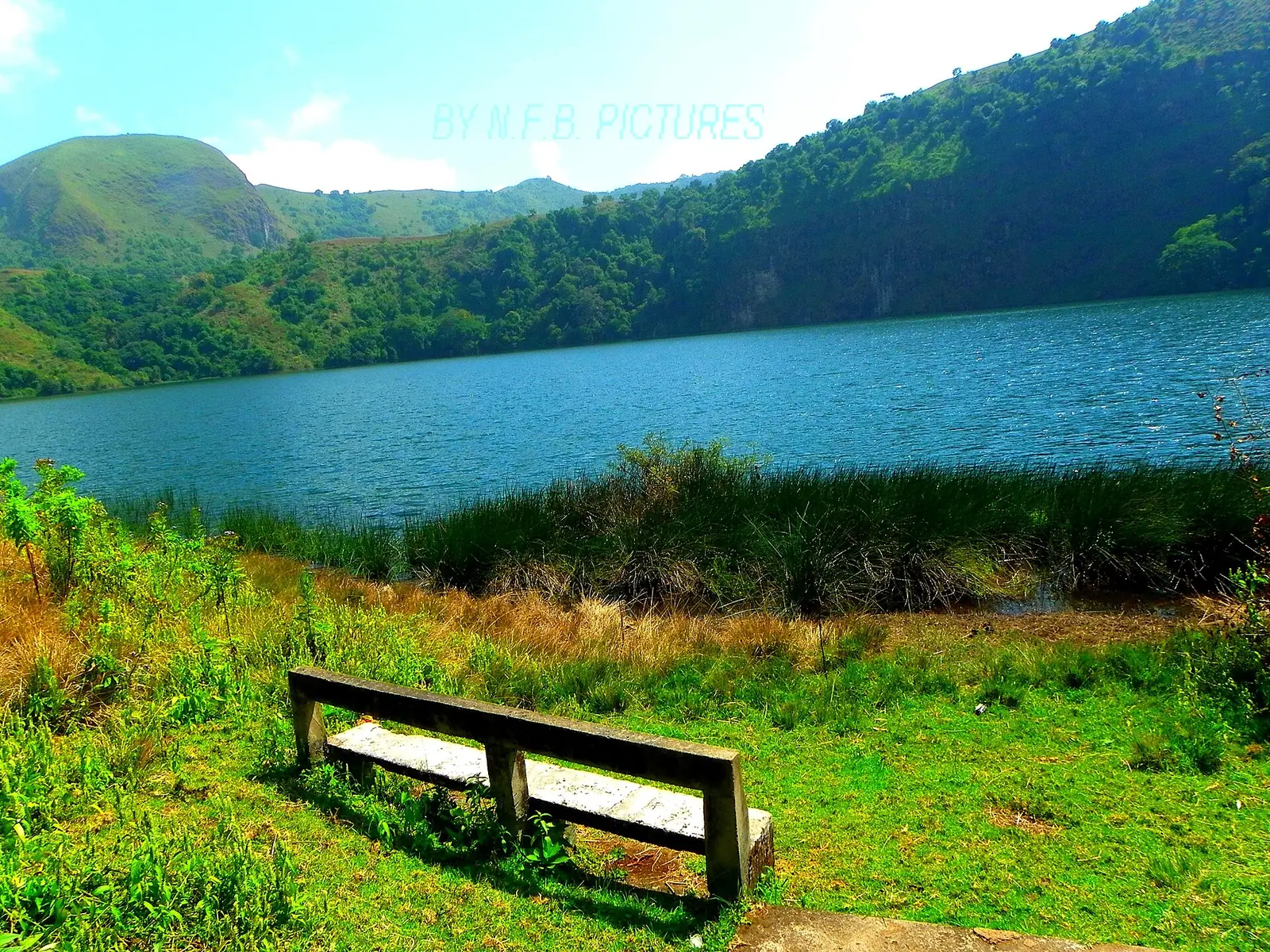
What they are
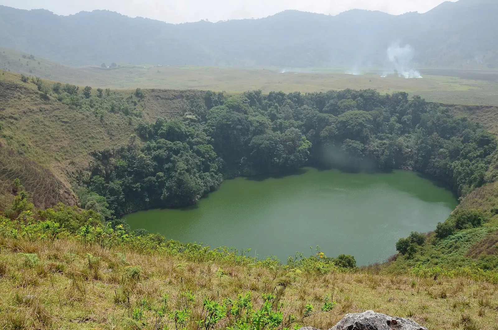
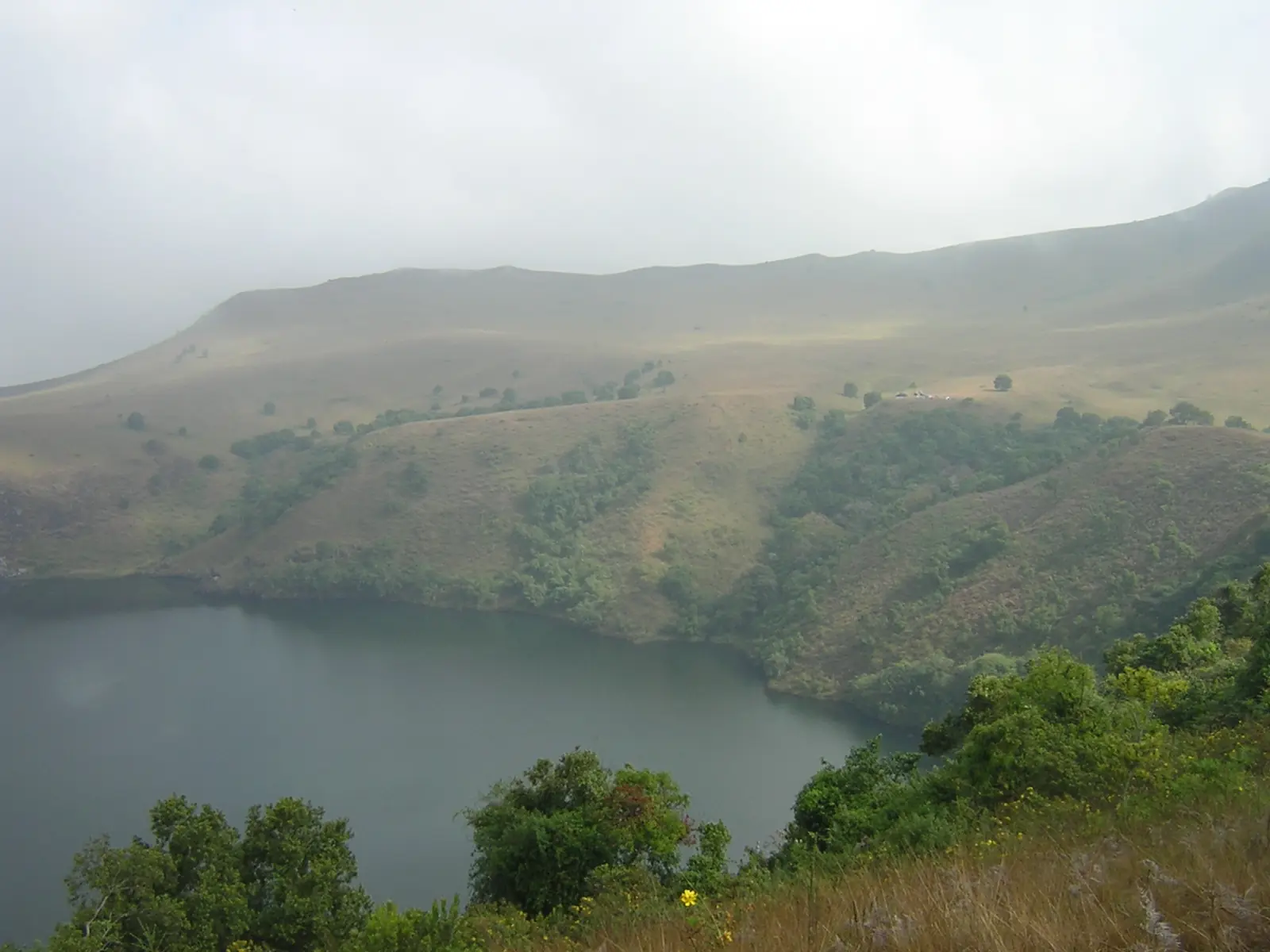
The Male and Female Lakes are two crater lakes in the Eboga caldera, at the top of Mount Manengouba, also spelled Muanenguba or Mwanenguba. A thin ridge separates them. The Key Biodiversity Areas factsheet describes them as small and deep, and puts the crater floor at about 1,950 m. Wikipedia gives a maximum depth of only 5 m without a clear source, so the depth remains unsettled.1,2,6,7
The lakes lie in Bangem Subdivision, Kupe-Muanenguba Division, in the Southwest Region. The massif as a whole is listed under both the Southwest and Littoral regions, and OpenStreetMap draws the boundary with Moungo Division, in the Littoral, a few kilometres east of the lakes.1,5,6,8
How the volcano formed
Manengouba is an extinct, many-staged volcano on the Cameroon Volcanic Line, between Mount Cameroon and the Bamboutos. An early Pleistocene shield volcano was followed by the Eboga stratovolcano, and then by the collapse that left a caldera about 4 km wide. Later eruptions built many small cones on the flanks and in the caldera, dated to between about 0.5 and 0.1 million years ago. Counts differ: about 70 in a 2022 geomorphology study and about one hundred in the Smithsonian's summary. The same 2022 study groups the twin lakes with cones formed by explosions of magma meeting water.1,3,4
Plants and animals
Cloud forest grows from about 1,200 m up to the caldera, whose floor is mostly montane grassland, regularly burnt and grazed. The mountain holds the entire known populations of five amphibians, including Cardioglossa manengouba and Phrynobatrachus manengoubensis. Royal Botanic Gardens, Kew, reports that elephants were hunted out by 1984 and names non-native fish as a major threat to the lakes. Kew describes the mountain as legally unprotected, and a strict nature reserve covering about half of the Key Biodiversity Area has been proposed.1,2
Beliefs and disagreements
DUNIA Magazine reported in 2015 that the lakes matter deeply to the Bakossi people, and that the Kupe-Muanenguba mountains hold their most sacred places. A local account in the same article calls the Female Lake the larger, with an outflow, and the Male Lake the smaller, landlocked and entered only by traditional priests of the Mbo people. These are reported beliefs, not studies. Sources also disagree on colour: DUNIA has a blue Female Lake and a green Male Lake, while the Routard guide has the reverse.5,7
In pictures
Map
Still to confirm
Our sources can't yet confirm these points:
- Maximum depth and surface area of each lake: no measured figure was found.
- Which lake is blue and which is green, and whether the colours change.
- The official boundary text between Kupe-Muanenguba (Southwest) and Moungo (Littoral); the placement here rests on sources and OpenStreetMap, not a government decree.
- Which non-native fish are in the lakes, and since when.
- The respective roles of the Bakossi and Mbo peoples at the lakes, from an ethnographic source.
- The current status of the proposed reserve.
Sources for this page
Information checked on 6 November 2026. It may have changed since.
- Mount Mwanenguba (CMNTIPA033), Tropical Important Plant Areas Explorer, Royal Botanic Gardens, Kew (B. Murphy, L. Usungo, M. Cheek) (Printed as accessed 16 June 2026)
- Mont Manengouba (KBA 6124), Key Biodiversity Areas Partnership (Last assessed 2024)
- Manengouba, Smithsonian Global Volcanism Program (undated)
- Investigation on the Manengouba Volcano's geomorphosites (Cameroon) (Zangmo Tefogoum et al., ICG2022-660), 10th International Conference on Geomorphology, Copernicus Meetings (2022)
- Female and Male Twin Lakes of Muanenguba, Cameroon, DUNIA Magazine (14 July 2015)
- Muanenguba Lakes, Wikipedia (undated)
- Guide du Routard, Cameroun: côte (Mbouassoum page; used only for the description of the lakes), Routard.com / Hachette tourisme (undated)
- Reverse lookup at the lakes (Bangem, Kupe-Muanenguba, Southwest); points at 9.88°E and beyond at latitude 5.03°N return Mélong, Moungo, Littoral, OpenStreetMap Nominatim (Queried 2026-11-06)
- Mount Manengouba, Wikipedia (undated)
Southwest Region
Capital: Buea
A region running from the Gulf of Guinea coast up Mount Cameroon, an active volcano, with Buea, the former German colonial capital, as its capital.
More places in the Southwest Region
Mount Cameroon
An active volcano rising from the Atlantic shore to the highest point of western and central Africa, with forests, grasslands and wildlife found nowhere else.
Limbe Botanic Garden
Founded in 1892 as a colonial trial garden between the ocean and Mount Cameroon, it now keeps about 1,500 kinds of plants and a herbarium of some 30,000 specimens.
Limbe Wildlife Centre
Set up in 1993 in the old Victoria Zoo, this sanctuary cares for gorillas, chimpanzees and drills rescued from the bushmeat and pet trades.
Black Sand Beaches of Limbe
Beaches of dark sand on the Atlantic at Limbe, formed mainly from the basalts of the Cameroon Volcanic Line, with Mount Cameroon behind the town.