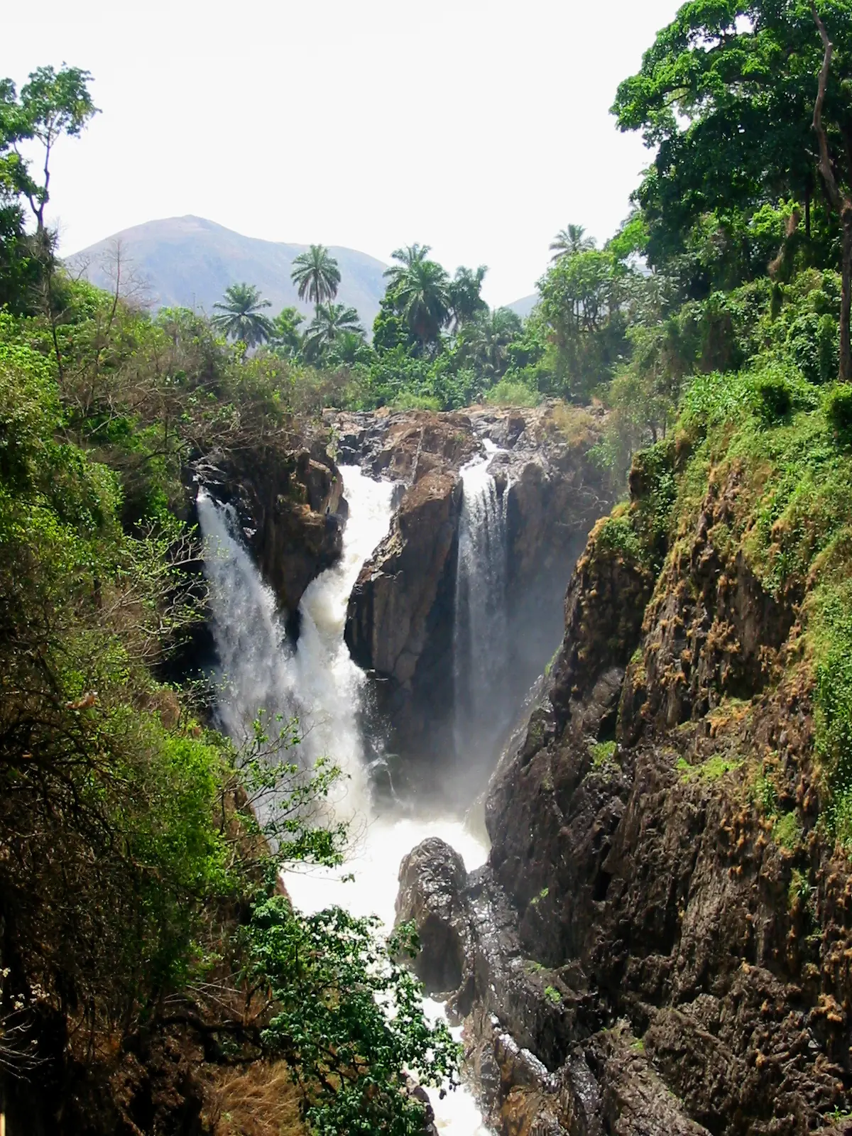
A waterfall on a river bound for Nigeria
Menchum Falls lies on the Menchum River, also written Metchum, along the road between Bamenda and Wum. The Bafut Council and Wikipedia place it about 20 km south of Wum and 30 km north of Bafut, in lush forest. Menchum Division takes its name from the falls, according to Cameroon Tribune, which says streams from Mezam, Boyo and Menchum divisions feed them.1,2,3,6
The river drains much of the region's highlands and flows west to join the Benue in Nigeria, as Phyllis Kaberry already noted in 1952. North of Bafut, the land drops abruptly to its valley. Wikipedia says the valley was once equatorial forest, and that timber cutting left open grassland prone to erosion on the slopes.2,5,6
How high is it?
A sacred site
A dam long planned
The falls have been the focus of hydroelectric plans for years, and the figures have shifted. Wikipedia records a 2009 memorandum for a 90 MW plant and a presidential announcement in December 2010. In October 2015, Business in Cameroon reported a contract for a 72 MW dam, with a 72 km line between Wum and Bamenda, while noting that a 2013 agreement had given the work to a Chinese group. Global Energy Monitor lists 72 MW at pre-construction. Power Technology's profile, updated in November 2024, gives 75 MW at the permitting stage, with construction expected to start in 2026.2,7,8,9
Map
Still to confirm
Our sources can't yet confirm these points:
- The measured height of the falls.
- Whether any work on the dam has begun as of 2026, and which company holds the contract.
- Whether 'about 20 km south of Wum' is a road distance: on OpenStreetMap's coordinates the two are about 11 km apart in a straight line.
Sources for this page
Information checked on 6 November 2026. It may have changed since.
- Wum: Menchum Waterfalls: Still Marvelling (Monica Nkodo; only the free part of the article could be read), Cameroon Tribune (1 February 2017)
- Menchum River, Wikipedia (undated)
- Menchum Falls page, Bafut Council (undated)
- Wonders of Cameroon, Wondermondo (undated)
- Women of the Grassfields, chapter II: Ecology (P. M. Kaberry), Colonial Research Publication No. 14, online at era.anthropology.ac.uk (1952)
- Setting (section of Mathias Niba, 'Bafut under colonial administration'), Paideuma, online edition at mambila.info (1995)
- Cameroon: CIMA International lands FCFA 7 billion contract for Menchum dam, Business in Cameroon (10 October 2015)
- Menchum hydroelectric plant, Global Energy Monitor (undated)
- Menchum hydroelectric project profile, Power Technology (updated 2024-11-11)
Northwest Region
Capital: Bamenda
A highland region of grassland, volcanic peaks and crater lakes, with Bamenda as its capital and Fons at the head of its many chiefdoms.
More places in the Northwest Region
Lake Oku
A crater lake on Mount Oku, ringed by montane forest and sacred to the Oku people. It is the only known home of the Lake Oku clawed frog.
Bafut Palace
The seat of the Fon of Bafut, a compound of about 50 buildings around a thatched shrine, beside a sacred forest, rebuilt after the German wars of the early 1900s and on UNESCO's Tentative List.
Big Babanki (Kejom Keku)
Big Babanki, or Kejom Keku, is a Kejom-speaking fondom in the Bamenda Highlands, near patches of montane forest rich in birds found only in the Cameroon mountains.
Lake Nyos
A deep crater lake in Cameroon's Grassfields, studied by scientists for its dissolved gas and the pipes built to draw it from the depths.