- Size
- 1,925 m long, 1,180 m wide1
- Age of the crater
- At most about 12,300 years, by a 2017 estimate3
- Gas release
- 21 August 1986; 1,746 deaths4
A deep lake in a young crater
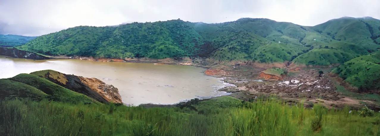
Lake Nyos fills a maar, a crater formed by a volcanic explosion, in the Oku volcanic field of Menchum Division. A 1987 survey in Science measured it at 1,925 m long and 1,180 m wide. It is shallow at its southern end, then drops steeply to a flat bed of silt and mud at 208 m. Wikipedia gives its surface altitude as 1,091 m. The 1987 survey gave a mean depth of 112 m, while Wikipedia lists 94.9 m.1,3,5,7
The crater's age has been hard to pin down. Earlier dating methods gave results from 400 years to more than 350,000 years, and the 1987 survey thought it might be only a few centuries old. A 2017 thermoluminescence study of quartz thrown out in the eruption calculated an average maximum age of 12,300 years, give or take 1,500.1,3
The night of 21 August 1986
At about 21:30, people near the lake heard rumbling for 15 to 20 seconds. One witness saw a white cloud rise and a surge of water, which washed about 25 m up the southern shore. Carbon dioxide denser than air filled the basin, spilled over the rim and ran down the valleys. Many people lost consciousness at once, and survivors woke 6 to 36 hours later. The lake's clear blue water turned rusty red.1
The usual count is 1,746 deaths, the figure given in Eos in 2016. The 1987 survey says at least 1,700, and a 2022 press article says nearly 2,000. Livestock losses are given as about 3,000 cattle, more than 3,000 livestock or 3,500 animals. Reports of the cloud's reach also differ, from up to 10 km in the 1987 survey to 25 km on Wikipedia, which names Nyos, Kam, Cha and Subum among the villages affected.1,4,6,8
What caused it
Scientists first disagreed on whether this was a volcanic eruption or a limnic one, in which gas dissolved in a lake comes suddenly out of solution. The 1987 survey concluded that carbon dioxide of magmatic origin had built up in the lake's deep water, that victims died of asphyxiation, and that there was no significant direct volcanic activity. By 2016 Eos reported agreement around the limnic explanation. The trigger itself was unknown to the survey's authors, who noted that a small disturbance could be enough in nearly saturated water. Lake Monoun had a smaller gas release in 1984, which killed 37 people.1,4
Estimates of the gas released also vary. The survey suggests about 1.2 km³ if the lake had been saturated, and Wikipedia reports 100,000 to 300,000 tonnes, with some sources up to 1.6 million tonnes.1,7
Drawing off the gas
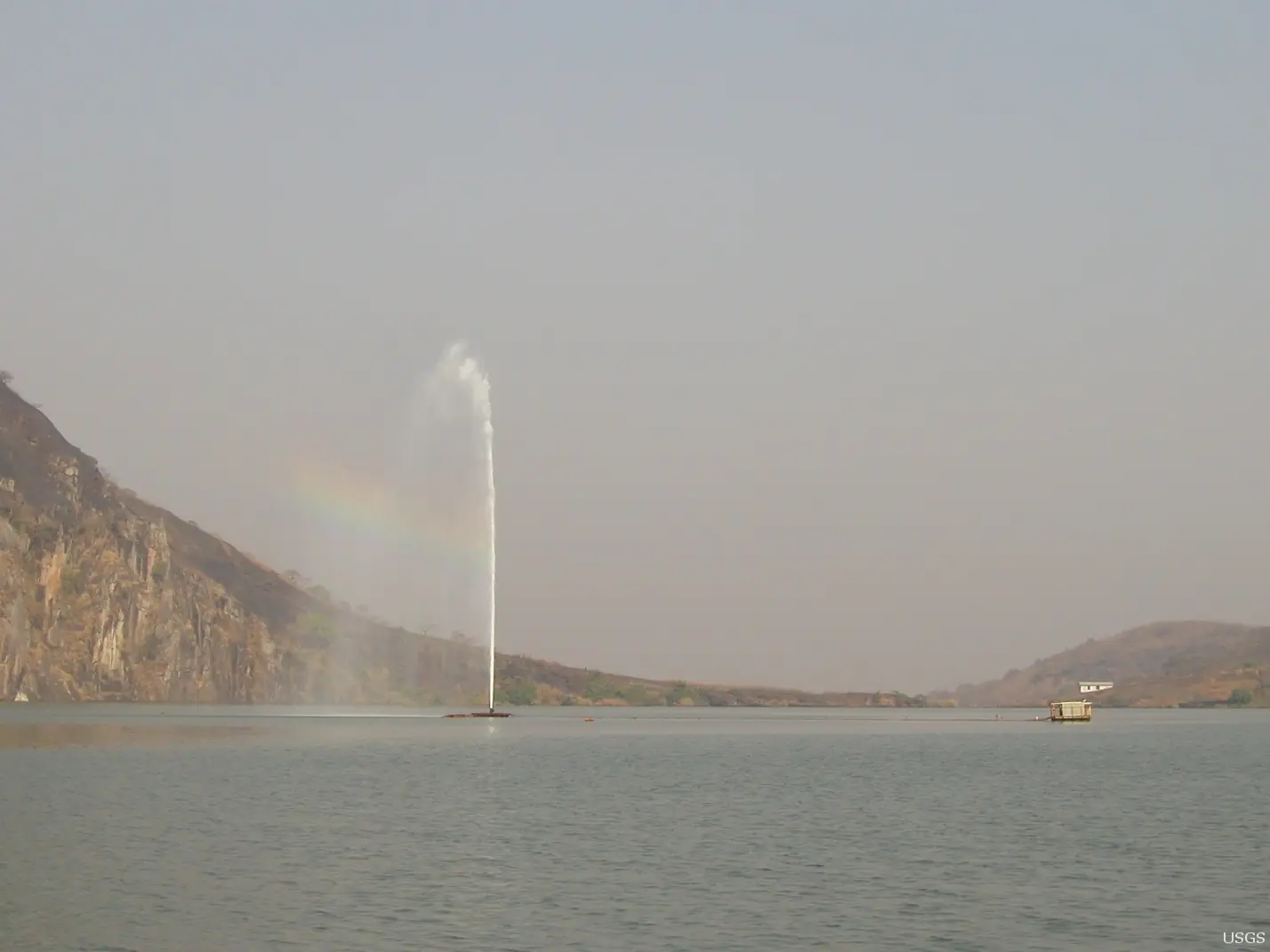
Gas began to build up again after 1986. A French team installed a first permanent pipe in 2001, which lifts deep water to the surface so that the gas escapes in a controlled way, visible as a jet of water. A 2005 paper in PNAS found that gas content had fallen by 12 to 14%, but that one pipe would remove only about a quarter of the remainder by 2015, and it called for more. Two further pipes followed in 2011, according to Wikipedia.2,4,5,7
Later accounts of the work don't fully match. A 2022 press article says degassing was completed in 2019; Wikipedia says researchers found that year that one pipe could keep running without outside power; and Cameroon Tribune described a system still at work in 2026. The 1987 survey also called the natural dam at the lake's outlet weak, a 40 m wide strip of volcanic deposits above a 35 to 40 m waterfall, and Wikipedia reports a 2005 UN assessment of the same dam.1,5,6,7,8
The survivors
Survivors were moved to resettlement camps, usually counted as seven, in Menchum and Boyo divisions. Cameroon Tribune's 2026 report names Yemge, Esu, Upkwa, Ipalim, Kumfutu, Kimbi, Subum and Buabua. A 2022 press article puts the number at over 12,000 people. Forty years on, the Tribune describes a generation born in the camps, several of which have become permanent settlements, while older survivors still long for their home villages. Full resettlement of the lake basin remains restricted, it says, though farmers return to Nyos in the rainy season and Fulani herders graze cattle there.5,6
In pictures
Map
Still to confirm
Our sources can't yet confirm these points:
- The exact death toll and livestock losses, since sources give different figures.
- The surface area (1.58 km²) and mean depth: Wikipedia's figures were not checked against a primary survey, and the 1987 survey gives a different mean depth.
- How many degassing pipes are working now, how much gas remains, and whether the 2019 'completion' is accurate. The Halbwachs paper of 2020 could not be read.
- The present condition of the natural dam. The 2005 UN assessment itself could not be opened.
- The number of resettlement camps: the 2026 report says seven but names eight, and its full text is behind a paywall.
Sources for this page
Information checked on 6 November 2026. It may have changed since.
- The 1986 Lake Nyos Gas Disaster in Cameroon, West Africa (Kling et al.), Science 236: 169-175, Science, via Zenodo (10 April 1987)
- Degassing Lakes Nyos and Monoun: defusing certain disaster (Kling et al.), PNAS 102(40); abstract read, PNAS, via Europe PMC (2005-10)
- New thermoluminescence age estimates for the Nyos maar eruption (Cameroon Volcanic Line) (Schmidt et al.), PLOS ONE 12(5), PLOS ONE, via Europe PMC (2017)
- Cameroon's Lake Nyos Gas Burst: 30 Years Later (Rouwet, Tanyileke and Costa), Eos, American Geophysical Union (12 July 2016)
- Echoes Of Lake Nyos: Safety, Nostalgic Memories 40 Years After Deadly Gas Leak (Kimeng Hilton; free portion read), Cameroon Tribune (21 August 2026)
- Glimmer of hope for Lake Nyos disaster survivors (Isaac Genna Forchie), FairPlanet (23 August 2022)
- Lake Nyos, Wikipedia (undated)
- Lake Nyos disaster, Wikipedia (undated)
Northwest Region
Capital: Bamenda
A highland region of grassland, volcanic peaks and crater lakes, with Bamenda as its capital and Fons at the head of its many chiefdoms.
More places in the Northwest Region
Lake Oku
A crater lake on Mount Oku, ringed by montane forest and sacred to the Oku people. It is the only known home of the Lake Oku clawed frog.
Bafut Palace
The seat of the Fon of Bafut, a compound of about 50 buildings around a thatched shrine, beside a sacred forest, rebuilt after the German wars of the early 1900s and on UNESCO's Tentative List.
Big Babanki (Kejom Keku)
Big Babanki, or Kejom Keku, is a Kejom-speaking fondom in the Bamenda Highlands, near patches of montane forest rich in birds found only in the Cameroon mountains.
Mankon Museum
A palace museum at the gate of Mankon Palace in Bamenda, showing objects of kingship, belief and daily life, some of which still leave for ceremonies.