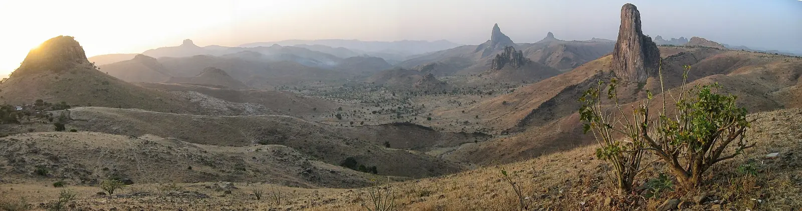
A Kapsiki village among volcanic peaks
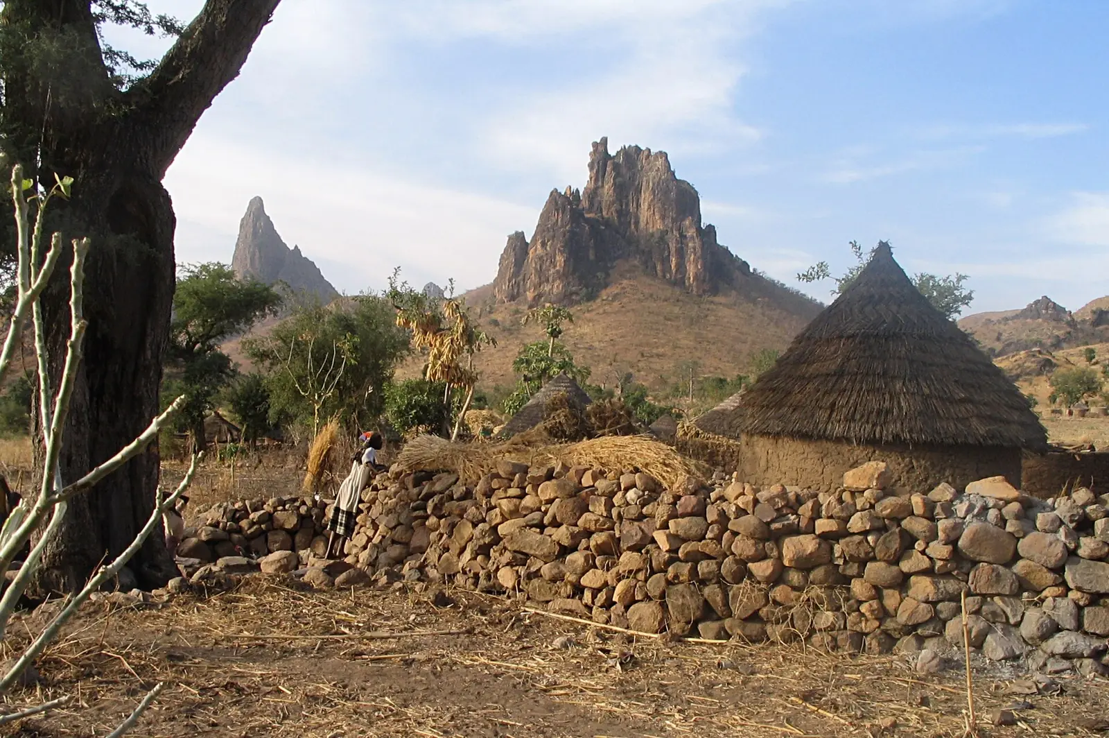
Rhumsiki, also spelled Rumsiki or Roumsiki, is a village in the Mandara Mountains, in Mogodé commune in Mayo-Tsanaga department. Both Wikipedia editions place it about 55 km from Mokolo and about 3 km from the Nigerian border. Its small houses are built of local stone with thatched roofs, and they are scattered through the village and the valley around it.1,2
French Wikipedia, citing the national census office's 2005 list of villages, gives Rhumsiki 5,388 inhabitants. It also cites a 1972 village dictionary from ORSTOM that counted 1,150 people in 1966-67, when the village already held a weekly Sunday market and a peanut market. A 1980 Michigan State University survey of the area's markets still lists a Sunday market at Rhumsiki among the smaller ones.2,8
Peaks from an old volcanic field
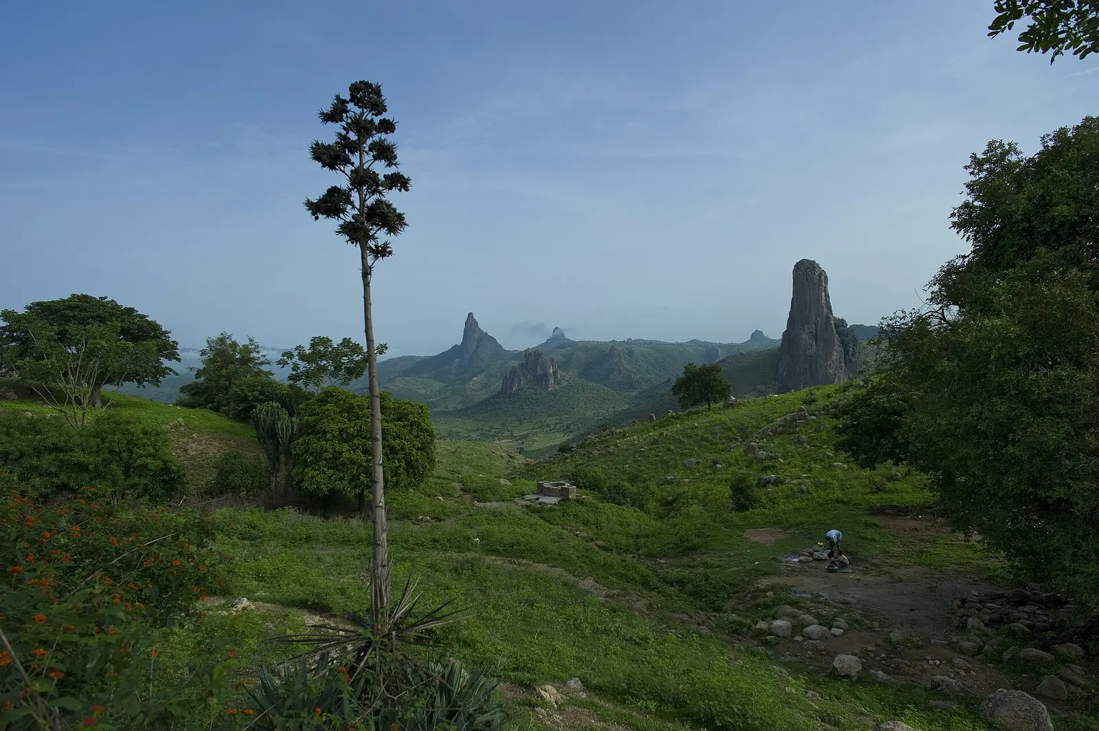
Volcanic plugs, the hardened cores of long-extinct volcanoes, and basalt outcrops surround the village. The largest plug, Kapsiki Peak, is given as 1,224 m tall; both Wikipedia editions take that figure from a 1983 school geography of Cameroon. The peak has appeared on stamps, in 1947-52 under French rule and again in 1962 and 1980.1,2
Geologists list the Kapsiki plateau among the volcanic areas of the Cameroon Line, though a 2007 review notes that whether its volcanism truly belongs to that line is still debated. A 2004 dating study says that lava began to pour out around 40 million years ago in the northern part of the line, including the Kapsiki plateau.6,7
Gerhard Müller-Kosack's specialist site on the northern Mandaras describes the Kapsiki homeland as a central plateau about 900 m high, south of Mokolo, marked by volcanic remains visible from far away. It names Mogodé and Kamale as the main Kapsiki settlements in Cameroon, followed by Roumsiki, Sir, Roumzou, Ourya and Amas.3
The Kapsiki
Anthropologist Walter van Beek, who has published on the Kapsiki since 1975, treats the Kapsiki of Cameroon and the Higi of Nigeria as one people. He explains the name as referring to sprouting sorghum grain to brew beer. Autonomous villages are the backbone of Kapsiki territorial organisation, and by their traditions of origin they fall into two groups: 16 villages say they came from the west, and 18 from the east, from Gudur.3
Van Beek has also written on Kapsiki crab divination, in a 2013 book chapter. English Wikipedia, drawing on guidebooks from 1999 to 2004, describes a diviner in Rhumsiki who reads the future from the way a crab moves pieces of wood, shown to visitors along with blacksmiths, potters, spinners, weavers and dancers.1,5
Those guidebooks described Rhumsiki as one of the country's most popular attractions, and the Rough Guide and Lonely Planet both criticised how organised tourism had shaped it. Van Beek's 2003 article in the journal Africa compares the effects of tourism on the Dogon of Mali and the Kapsiki. He found that the Kapsiki tend to read tourists' search for authenticity as a sign that they are seen as remote and backward, while the Dogon draw cultural pride from it.1,4
In pictures
Map
Still to confirm
Our sources can't yet confirm these points:
- The height of Kapsiki Peak from a survey or map, rather than a 1983 school textbook.
- Whether the 5,388 people counted in 2005 refer to the village alone or to a wider area.
- The rock type of Kapsiki Peak itself; the geology papers read cover the plateau as a whole.
- Where André Gide's often-quoted praise of the landscape first appeared; only a guidebook citation was found.
Sources for this page
Information checked on 9 November 2026. It may have changed since.
- Rhumsiki, Wikipedia (citing the Bradt 2004, Rough Guide 1999 and Lonely Planet 2002 guides, and Gwanfogbe et al., Geography of Cameroon, 1983) (undated)
- Rhumsiki, Wikipédia (citing the BUCREP 2005 village list and ORSTOM's 1972 Dictionnaire des villages du Margui-Wandala) (undated)
- The Kapsiki-Higi (Nigeria and Cameroon), mandaras.info, Gerhard Müller-Kosack (draws on van Beek, Barreteau and others) (undated)
- African tourist encounters: effects of tourism on two West African societies (W. E. A. van Beek; abstract page), Africa 73(2), International African Institute / Cambridge University Press (2003-05)
- Crab divination among the Kapsiki/Higi of North Cameroon and Northeastern Nigeria (W. E. A. van Beek; record page), Tilburg University research portal (chapter in Reviewing reality: dynamics of African divination, LIT Verlag) (2013)
- Âges K-Ar des roches magmatiques du fossé de Garoua (Cameroun) : leur place dans le cadre de la « Ligne du Cameroun » (R. Montigny, I. Ngounouno, B. Déruelle), Comptes Rendus Géoscience 336 (2004)
- The 'Cameroon Hot Line' (CHL): a unique example of active alkaline intraplate structure in both oceanic and continental lithospheres (B. Déruelle, I. Ngounouno, D. Demaiffe), Comptes Rendus Géoscience 339 (2007)
- An assessment of the supply and marketing situation for agricultural commodities in the Mandara Mountains Integrated Development Project region (J. Holtzman and M. Weber, Mandara Mountain Research Report no. 6), Michigan State University (August 1980)
Far North Region
Capital: Maroua
Cameroon's northernmost region, where the Chad Plain meets the Mandara Mountains and more than 50 ethnic groups live. It holds the Diy-Gid-Biy World Heritage sites, Waza National Park and the craft traditions of Maroua, its capital.
More places in the Far North Region
Waza National Park
A national park and UNESCO biosphere reserve between Sahel and savanna, home to elephants, one of the last Kordofan giraffe populations and about 379 recorded bird species.
Marché central de Maroua
Maroua's central market, home to tanners, weavers, tailors, potters and blacksmiths, with a craft centre at its entrance since 1955.
Mandara Mountains
A volcanic range of terraced slopes and eroded peaks on the Cameroon-Nigeria border, home to the Diy-Gid-Biy cultural landscape, a World Heritage site since 2025.
Lake Maga
A shallow reservoir created in 1979 on the Logone plain, home to hippopotamuses, large gatherings of waterbirds and Musgum and Massa fishing communities.