- Waterbirds
- More than 20,000 for much of the year (2001 assessment)1
What it is
Lake Maga is an artificial reservoir in the Logone plain, immediately south of the town of Maga in Mayo-Danay, in the Far North Region. The Logone, which forms the border with Chad, bounds it to the east. Seasonal watercourses from the Mandara Mountains and the Maroua plain feed it, along with the Logone upstream. It averages no more than 3 m deep and its capacity is given as 625 million m³.1,2,6,7
Its area changes with the seasons and sources disagree widely: 149 km² for the Key Biodiversity Area, 180 to 250 km² in a 2004 Pachyderm article, 240 km² on average and 240 to 360 km² in a 2015 master's thesis, and 360 km² in both a Food and Agriculture Organization table and a Dutch regional history.1,3,5,6,7,10
History and effects of the dam
The dam was built in 1979 under the second SEMRY rice project, to supply and protect irrigated rice fields; the 2015 thesis also gives 1978 in one table, and a Dutch account gives 1979 to 1981. Its length is given as 27 km, from Pouss to Guirvidig, or as 30 km. The rice area is 7,000 ha in a 2002 appraisal for the World Bank and about 15,000 ha in the Dutch account.2,4,5,6
Together with an embankment along the Logone, the dam changed the flooding of the plain downstream, more than climate did, and large areas including Waza National Park stopped flooding. Elephants there spent more time in woodland until flooding returned. Two openings in the embankment, in 1994 and 1997, reflooded about 600 km². The Waza Logone Ramsar site lies between Lake Maga and Lake Chad.2,3,11,12
Wildlife
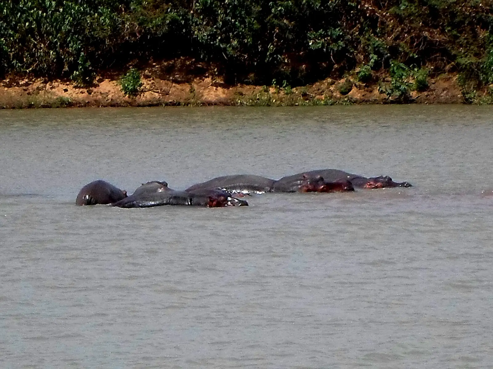
The 2001 Key Biodiversity Area assessment calls the lake an important dry-season refuge, with more than 20,000 waterbirds for much of the year and over 4,000 long-tailed cormorants on record. Pale harriers were common winter visitors. It also records 30 to 50 hippopotamuses, which regularly come into conflict with fishers. The site has no protected area coverage, and the factsheet has not been reassessed since.1
People and the fishery
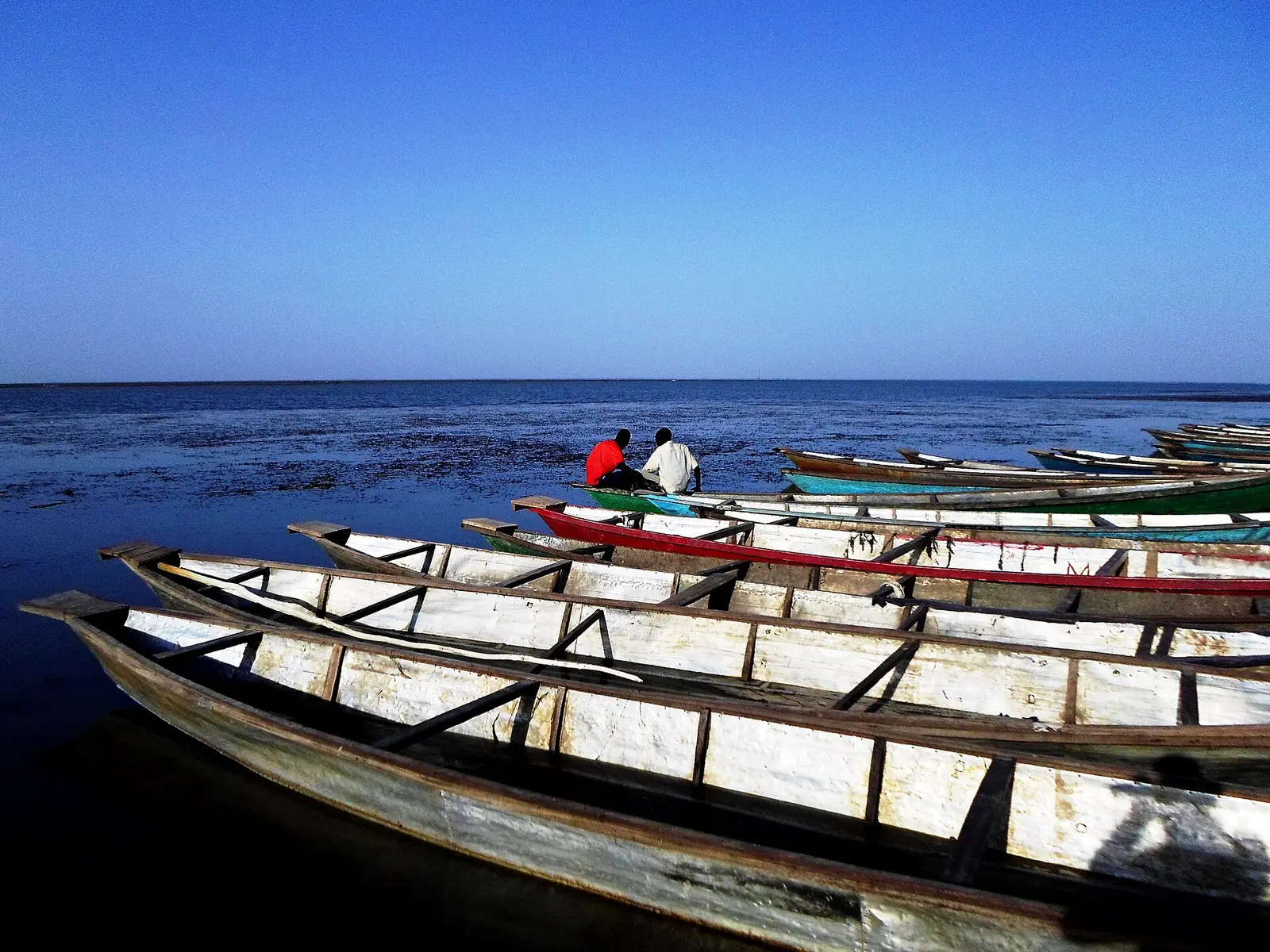
The Musgum, Massa and Kotoko are long-standing lakeside fishing communities, and the Musgum and Massa are described as the reservoir's principal original inhabitants. Sirata, Tupuri, Fulani, Moundang, Shoa Arab and Hausa people also live around it. According to the 2015 thesis, a 2011 survey by the livestock and fisheries ministry, funded by the FAO, found 53 villages and camps, 2,567 pirogues and 6,174 fishers. The thesis puts the catch at about 2,000 tonnes a year, above a sustainable limit of 1,500 tonnes, though an FAO table gives a potential yield of 1,870 tonnes, and it warns that recorded landings may understate real catches. Tilapia made up 48% of its 2015 landings data.7,8,9,10,13
In pictures
Map
Still to confirm
Our sources can't yet confirm these points:
- The lake's current area and depth.
- Bird and hippopotamus numbers since the 2001 assessment.
- The exact dam dates and length, and the area of rice served.
- Current numbers of fishers and catch; the latest figures read date from 2011 and 2015, and come from a master's thesis.
- Whether any part of the lake lies inside the Waza Logone Ramsar site; the Ramsar summary places the site between Lake Maga and Lake Chad.
Sources for this page
Information checked on 6 November 2026. It may have changed since.
- Lake Maga (KBA 6107), Key Biodiversity Areas Partnership (Last assessed 2001)
- Reflooding the coupled human and natural system of the Waza-Logone Floodplain, Cameroon (Moritz, Hunter and Scholte), Frontiers in Conservation Science (24 September 2024)
- Impact of dam construction on two elephant populations in northern Cameroon (de Iongh, Tchamba, Aarhaug and Verhage), Pachyderm 36 (January-June 2004)
- Appraisal of the Safety of Maga Dam, Cameroon (L. J. S. Attewill, Jacobs GIBB, for the World Bank), GEF IW:LEARN (March 2002)
- The SEMRY rice polders in Cameroon, Flevolands geheugen (16 September 2024)
- Gestion durable des ressources halieutiques dans la retenue d'eau de Maga, reservoir description (E. Toussoumna, Master 2 thesis, Université de Ngaoundéré), Mémoire Online (2015)
- Same thesis, introductory summary of the fishery, Mémoire Online (2015)
- Same thesis, villages and peoples, citing the 2011 MINEPIA survey, Mémoire Online (2015)
- Same thesis, lakeside communities, Mémoire Online (2015)
- Status of fish stocks and fisheries of thirteen medium-sized African reservoirs, Table 1.1 (after Crul, 1992), Food and Agriculture Organization (undated)
- Annotated List of Wetlands of International Importance: Cameroon, Ramsar Convention (undated)
- Logone flood-plain (KBA 6105), Key Biodiversity Areas Partnership (Last assessed 2001)
- Same thesis, landings data and their limits, Mémoire Online (2015)
Far North Region
Capital: Maroua
Cameroon's northernmost region, where the Chad Plain meets the Mandara Mountains and more than 50 ethnic groups live. It holds the Diy-Gid-Biy World Heritage sites, Waza National Park and the craft traditions of Maroua, its capital.
More places in the Far North Region
Rhumsiki
A Kapsiki village of stone and thatch houses in the Mandara Mountains, set among volcanic peaks that include 1,224 m Kapsiki Peak.
Waza National Park
A national park and UNESCO biosphere reserve between Sahel and savanna, home to elephants, one of the last Kordofan giraffe populations and about 379 recorded bird species.
Marché central de Maroua
Maroua's central market, home to tanners, weavers, tailors, potters and blacksmiths, with a craft centre at its entrance since 1955.
Mandara Mountains
A volcanic range of terraced slopes and eroded peaks on the Cameroon-Nigeria border, home to the Diy-Gid-Biy cultural landscape, a World Heritage site since 2025.