- From Garoua
- About 100 km to the south1
A horseshoe of granite
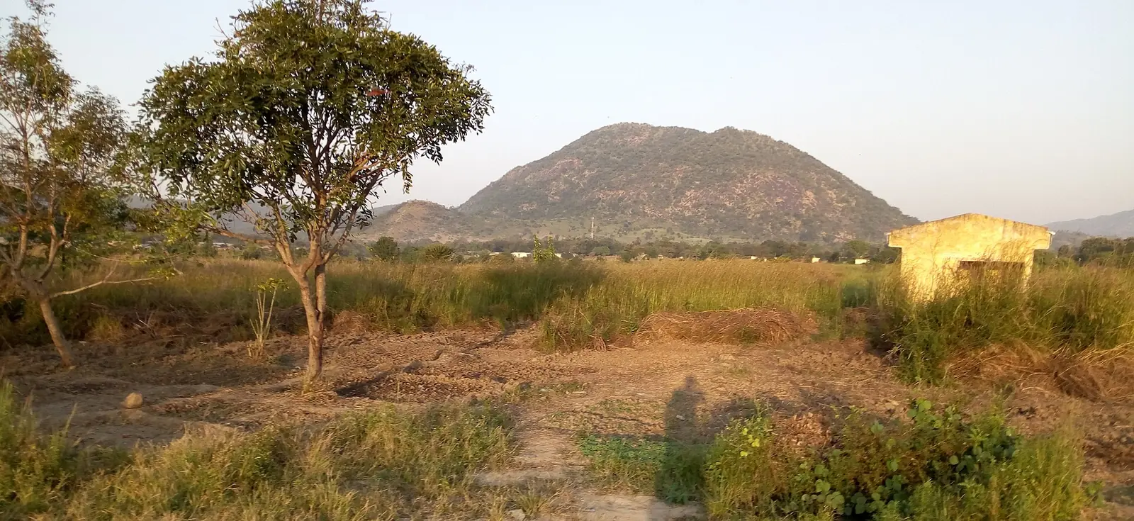
The Poli mountains, or Monts de Poli, are also known as Mount Vokré or Hosséré Vokré. This horseshoe-shaped ridge lies about 100 km south of Garoua and just south of the town of Poli, between Faro and Bénoué national parks. Its height is given as nearly 2,000 m by Kew and 2,049 m by Wikipedia, and an ethnographic study gives 2,040 m for the large relief above Poli. Poli itself sits at about 478 m.1,2,3
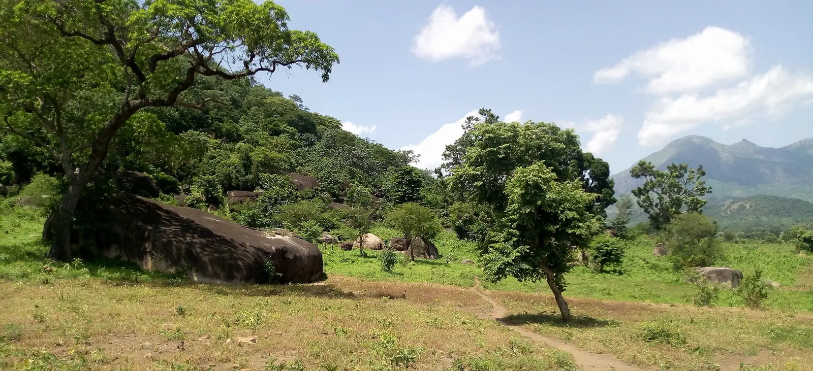
The range is made of ancient granite, with large boulders around the summit. Lower slopes carry wooded savanna, and forest survives mostly as narrow strips in valleys and gorges. The summit area appears largely bare, and grazing is thought to be the main cause of the loss of forest. Poli's rains run from mid-March to the end of October, peaking in August, with very little from November to February.1
Plants and animals
Kew lists the range as an Important Plant Area for threatened species such as Antherotoma clandestina and Ledermanniella raynaliorum, a plant of waterfalls and rapids, though the main records date from the 1960s to the 1980s. Wikipedia reports 92 bird species and mammals including olive baboon and rock hyrax. None of the massif lies in a protected area, according to Wikipedia.1,2
The Dowayo and the Duupa
The Dowayo, also called Namchi, live in five cantons around Poli. Nigel Barley, who did fieldwork among them, gave about 15,000 people in 1983 and described mountain and plains groups. Christian Seignobos gave about 18,000 in 1998. Barley records that they saw themselves largely in opposition to the Fulani, who raided the area for slaves and levied tribute.3,4
Their small, humpless cattle are central to social life, used for bride-wealth, rituals and above all funerals, and tied to the symbolism of circumcision. They are rarely sold. Seignobos counted 853 head in 1990 and 1991 and questioned the breed's future.3
The Duupa, also written Dupa, live on the massif and the plains next to it. Their farming centres on sorghum, with several varieties mixed in one field. Researchers worked for years around Wantè, a village about 10 km east of Poli on the unpaved road to Garoua, where sowing starts in April or May and the harvest comes in December or January.2,5
Getting there
Poli is the capital of the Faro department and, according to Wikipedia, has an airstrip. A 2018 travel article describes the overland route: about 18 hours by train from Yaoundé to Ngaoundéré, then about seven hours by van on poor dirt roads to Poli. It was a guided group tour, and it mentions Bukaru Lodge in Poli, a group of mud huts. We found no independent trekking route, guide contact or price.6,7
In pictures
Map
What visitors say
We summarise accounts published elsewhere and link to the original. These aren't reviews collected by this site, and we don't show a rating.
On a 13-day organised tour, the writer stayed at a lodge in Poli and met Dowayo and Mbororo people nearby. A local guide and camp staff then took the group on foot, through bush and across streams, to a Duupa settlement in the foothills. She describes the chief's healing work, daily grain distribution, a visit to a sacred forest, and an evening of singing and dancing.
Lies Ouwerkerk, Transitions Abroad, Published March 2018
Check before you go
Our sources can't yet confirm these points:
- The exact summit height and its name.
- Current Dowayo and Duupa population figures; those read are decades old.
- Whether Bukaru Lodge still operates, and its prices.
- Trekking routes, guides, permits and road conditions.
- Whether the Poli airstrip is in use.
Also nearby
Sources for this page
Information checked on 6 November 2026. It may have changed since.
- Mount Vokré (Hoséré Vokré, Monts de Poli) (Tropical Important Plant Areas factsheet), Royal Botanic Gardens, Kew (factsheet copy dated 2026-06-16)
- Hosséré Vokré, Wikipedia (undated)
- Les Dowayo et leurs taurins (Christian Seignobos), in Des taurins et des hommes, IRD Éditions (1998)
- Symbolic Structures: An Exploration of the Culture of the Dowayos, ch. 1 'The ethnographic background' (Nigel Barley; excerpt read), Cambridge University Press (1983)
- High outcrossing rates in fields with mixed sorghum landraces: how are landraces maintained? (A. Barnaud, G. Trigueros, D. McKey, H. I. Joly), Heredity (6 August 2008)
- Time travel in Cameroon: the Dupa tribe (Lies Ouwerkerk; travel article about an organised tour), Transitions Abroad (19 March 2018)
- North Region (Cameroon), Wikipedia (undated)
Enquire about Poli Mountains
Visit Poli Mountains
Plan your trip to Poli Mountains in the North Region. Send us an enquiry about guided tours, accommodation and transport, and we'll reply by email.
Send an enquiryNorth Region
Capital: Garoua
A savanna region built around the Bénoué River, with Garoua as its capital, Fulbe lamidates such as Rey Bouba, and the Bénoué, Faro and Bouba Ndjida national parks.
More places in the North Region
Bénoué National Park
A savanna national park of about 1,800 km² on the Bénoué River, and part of a UNESCO biosphere reserve. It has hippos, antelopes and more than 300 bird species, though recent surveys show large mammals in decline.
Grande Mosquée de Poumpoumré (Garoua Grand Mosque)
Garoua's grand mosque in the Poumpoumré district, a Saudi royal gift inaugurated in 1981. It reopened to worshippers in March 2024 after about 18 months of restoration.
Faro National Park
A large savanna park in the west of the North Region, near the Nigerian border. The Faro River holds a major hippo population, and a 2025 survey recorded 34 large and medium-sized mammal species, including Derby eland and roan antelope.
Lagdo Reservoir
A large man-made lake on the Bénoué, about 60 to 70 km from Garoua, formed by a dam completed in the early 1980s. It supports a fishery and the region's hydropower, with a fishing village, a market and the Île aux Damans along its shores.