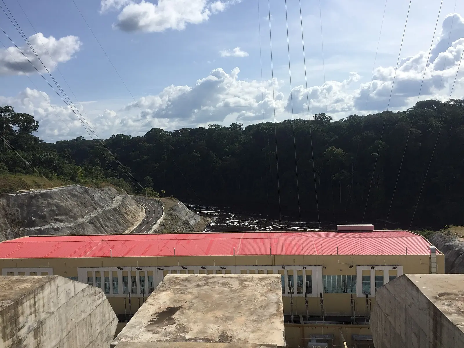
A hydropower station on the Ntem
The Memve'ele station stands on the Ntem River at Nyabissan, also spelt Nyabizan or Nyabessan, in the Vallée-du-Ntem department. It is about 140 km by road southwest of Ebolowa and 296 km southwest of Yaoundé. An earth-fill dam 20 m high holds a reservoir of about 19 million m³. Sinohydro built it under a contract signed in 2012, and the first 80 MW were produced in April 2019. Wikipedia puts the total cost at US$831.6 million as of 2021, about 64% of it lent by China's Exim Bank, 23% by the African Development Bank, and the rest paid by the government.1
Full commercial output had to wait for the 225 kV line to Yaoundé. Cameroon Tribune reported that the transmission line was switched on in November 2022, so the full output could flow to the Ahala substation near Yaoundé. Output still depends on the river. In January 2023, during the low-water season, Eneo said the plant was giving 30 MW only in the evening peak and nothing at other times, causing rolling power cuts. Xinhua reported in 2025 that Cameroonian authorities took over running the station in October 2024.1,2,3,4
The Memve'ele falls
The site takes its name from falls on the Ntem. A 2012 tourism degree report from the University of Yaoundé I describes a series of four falls where the river turns sharply to follow a fault line, the highest about 35 m. Their local names are Assok Asseng, Assok Dùm, Assok Anguielè and Mba'yènè. It says three local guides were trained in 2006 with WWF support, and quotes the village chief giving a guide fee of 3,000 FCFA. Written as dam work began, it warned that the dam could reduce the falls' flow and scenic value. OpenStreetMap still maps a waterfall, 'Chutes Memvé élé', near the dam. We found no recent account of how the falls look today.5,7
People and the river
The area is home mainly to the Ntumu and Mvae, both Fang peoples, according to the 2012 report. Since the dam opened, fishing communities from northern and western Cameroon and from West Africa have come to fish the reservoir. In March 2022, after a fisherman's death led to clashes between communities, the prefect of Vallée-du-Ntem suspended all fishing around the dam.5,6
Visiting
Map
What visitors say
We summarise accounts published elsewhere and link to the original. These aren't reviews collected by this site, and we don't show a rating.
We haven't yet found a published visitor account for this place.
Check before you go
Our sources can't yet confirm these points:
- Whether visitors may enter the station or view the dam, and who to contact (Electricity Development Corporation or the operator)
- Current state of the Memve'ele falls since the dam was built
- Whether local guides still work at Ebianemeyong or Nyabizan, and current fees (3,000 FCFA was quoted around 2012)
- Whether the March 2022 fishing ban around the dam is still in force
- Road condition from Ebolowa and from Kribi or Campo
Also nearby
Sources for this page
Information checked on 9 November 2026. It may have changed since.
- Memve'ele Hydroelectric Power Station, Wikipedia (undated)
- Cameroon: Memve'ele dam's low production leads to rolling blackouts (Eneo), Business in Cameroon (26 January 2023)
- Barrage de Memve'ele : à plein régime, Cameroon Tribune (21 November 2022)
- A glimpse of Memve'ele hydro station in Cameroon (Xinhua), The Star (Kenya) (18 September 2025)
- Développement du tourisme durable autour des chutes de Memve'ele à travers l'aménagement d'un écovillage (Adonis Dorgelet Edane Edane, Licence professionnelle, Université de Yaoundé I), Memoire Online (2012)
- Nyabizan : le calme après la tempête, Cameroon Tribune (11 March 2022)
- Nominatim search: Memve'ele, OpenStreetMap (9 November 2026)
Enquire about Memve'ele Hydroelectric Power Station
Visit Memve'ele Hydroelectric Power Station
Plan your trip to Memve'ele Hydroelectric Power Station in the South Region. Send us an enquiry about guided tours, accommodation and transport, and we'll reply by email.
Send an enquirySouth Region
Capital: Ebolowa
Rainforest and Atlantic coast, from the beaches of Kribi and the Lobé Falls to Campo Ma'an National Park and the cocoa country around Ebolowa.
More places in the South Region
Nkolandom
In a forested hollow 18 km from Ebolowa, Nkolandom is a village with a tourist centre, an artificial lake with canoe rides, caves in the surrounding hills and a museum of African art.
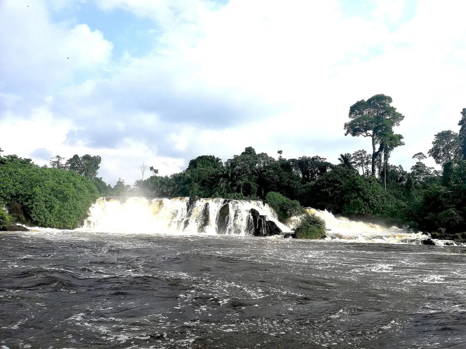
Kribi Beach and Lobé Falls
A beach town on the Gulf of Guinea, where the Lobé River reaches the Atlantic through a series of cascades, a rare sight and a place of ritual for local peoples.
Campo Ma'an National Park
A national park of about 264,000 hectares between the Atlantic and the Equatorial Guinea border, with forest elephants, western lowland gorillas, chimpanzees and mandrills. Visitor facilities are limited and access is by rough road.
Grand Batanga
A coastal village just south of Kribi, the former capital of the Batanga people, with palm-lined beaches.